Baranduda Regional Park
(www.northeastvictoria.online)
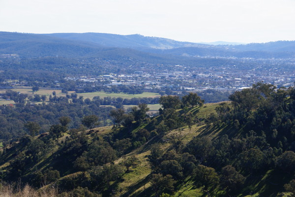
Baranduda Regional Park forms the main part of a ridge system to the south-east of the Wodonga urban area.
For bushwalkers, the main attractions here include great bushland scenery, vistas of the high country, and proximity to the environs of the city.
Popular access points include Ridge Lane (from the east, this leads off from the Wodonga-Yackandandah Road), and Burgess Lane (shown as Edneys Lane on some maps) from the western side.
In either case, walking at Baranduda involves a climb, and the most popular route usually involves the Baranduda Range Track, which follows the ridge system north-east to south-west.
An interesting loop combination consists of Range Track, followed by a descent along Cobbs Track and an ascent of Trig Point Track, as well as variations of this theme.
Given its proximity to the urban area, Baranduda is best enjoyed on weekdays, and (given the climb involved) cooler days are preferred.
There are several sketch maps of Baranduda available on-line, and the 1:50 000 scale topographic sheets are ‘Albury’ and ‘Yackandandah’; however, most of the detail is shown on ‘Albury’.
Overall, the Park has a AWTGS-3 rating, and many walkers will find a set of trekking poles a useful asset.
See also the Albury-Wodonga Parklands website (link below).
Intro Screen on a fresh browser page
COPYRIGHT © 1995-2024, Chris McLaughlin.