BIKE PATHS, RAIL TRAILS and CYCLE ROUTES
(www.northeastvictoria.online)
BRIGHT to WANDILIGONG
Bright, a major tourist centre of the North-east, was named after the nineteenth century political and social reformer John Bright. It was originally settled in the late 1830s, and at that time was called Morses Creek. The name change, and many other significant changes, came in the 1860s, with the discovery of gold.
Amongst Bright's attractions are its beautiful tree-lined streets. Most of the trees were planted in the 1920s and 1930s and provide a very pleasing and colourful streetscape to much of the town. Delaney Avenue is particularly attractive in autumn when the alternating species of trees are a blaze of colour.
The town has a good range of shops and services, as well as a wide range of accommodation options.
The ride described here leads from Bright to the nearby village of Wandiligong, an easy five kilometres away.
Wandiligong grew up as a gold mining settlement, and although much rehabilitation has taken place, there is still widespread evidence of the gold mining era around the township.
The area was first mined in about 1856, and was known as Growlers Creek until about 1875, when the present name was adopted. The permanent population today is about 250, and services on-hand include the Wandiligong Hotel, a nice caravan park/camping ground and some neat B&Bs.
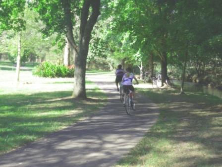
The five kilometre ride described here links the townships of Bright and Wandiligong, using a newly developed bike path.
Starting off from the corner of Railway Avenue and Bakers Gully Road (this is near Bright Railway Station), turn south into Bakers Gully Road (that is, away from the town centre), keeping to the right of the bitumen so as to use the bike path - pedestrian pavement.
Turn left into Park Street, once again staying to the right of the bitumen, and follow this roadway through to where it becomes Coronation Avenue, one of several routes out of Bright that lead to Wandiligong.
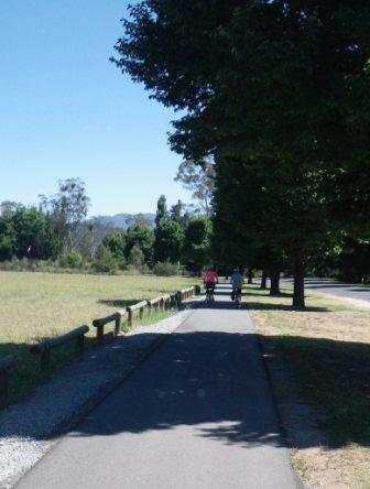
Following Coronation Avenue, the bike path continues to follow the bitumen quite closely, crossing over to the opposite side of the bitumen on several occasions, with care being required at each of these crossings.
Coronation Avenue now leads up the valley to Doughertys Bridge (over Morses Creek), where there is a separation of vehicle and bike traffic for safety reasons.
From Doughertys Bridge the bike path follows the scenic Morses Creek Valley, before swinging in towards Morses Creek itself for the final run into Wandiligong.
The bike path now meanders around as it follows the sparkling water of the creek, and terminates at Stephens Bridge, a short distance from the town centre. Just prior to Stephens Bridge, there is small bridge to the right, and this leads to Alpine Park, a great place for a picnic.
If you turn left at Stevens Bridge it is a short ride to the town centre, albeit slightly upslope; whilst turning right at the Bridge leads to the Wandiligong Maze and Cafe (details at www.wandimaze.com.au).
Having had a drink and a snack, the return to Bright is by the same route, completing a very pleasant (and easy) morning or afternoon ride.
Intro Screen on a fresh browser page
COPYRIGHT © 1995-2020, Chris McLaughlin.