BIKE PATHS, RAIL TRAILS and CYCLE ROUTES
(www.northeastvictoria.online)
MOUNT BEAUTY MOUNTAIN BIKE AREA
(Big Hill Mountain Bike Park)
Mount Beauty (population about 1300) is located on the Kiewa River, and is set in a beautiful valley, with excellent views of Mount Bogong.
The township has a good array of shops and services, centred around Hollands Street, as well as motels and some small restaurants. The township, like many others in and around the high country was purpose built as part of a hydro-electric scheme, the Kiewa Scheme in the case of Mount Beauty.
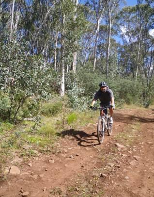
Mount Beauty’s Mountain Bike Area (which is more formally known as Big Hill Mountain Bike Park) is concentrated in the hill country overlooking the township, with most trails being located between the Bogong High Plains Road, Big Hill, Mount Beauty (the actual mountain, 633m) and the West Kiewa River.
The trails are mostly of the ‘single track’ variety, although some are on forest roads. There are twenty plus trails to choose from, and most of these are detailed on a colourful sketch map available from Rocky Valley Bikes, and Snow Sports (03 5754 1118).
The same shop also sells the Mountain Biking Guide : Mount Beauty and Falls Creek that gives a detailed description of these trails, and many others in this part of the Kiewa Valley.
The VicMap 1:50 000 topographic maps covering the trails area are Mitta Mitta and Falls Creek; these are available in print, and GPS (digital), format.
If you mostly want a downhill run, then you will need to get a lift to Cranky Charlie, a prominent u-bend on the Bogong High Plains Road, not far out of town. A turn-off on the Falls Creek side of the bend is signposted to the West Kiewa Power Station (which you cannot access) and Big Hill.
There is a shuttle service operating out of Mount Beauty - see the township entry for details.
The downhill side of most of the other trails can be accessed from the Bogong High Plains Road just out of Mount Beauty township, as well as from Simmons Creek Road. This latter access is a turning off the Kiewa Valley Highway, just on the Tawonga side of the township, and leads over a ridge system to the diversion weir on the West Kiewa River. The township access point is not far out of town, and has a formal information centre and toilets, close to where all those great trails disappear into the bush.
Intro Screen on a fresh browser page
COPYRIGHT © 1995-2020, Chris McLaughlin.