BIKE PATHS, RAIL TRAILS and CYCLE ROUTES
(www.northeastvictoria.online)
RUTHERGLEN - WAHGUNYAH RAIL TRAIL
The railway tracks have long since gone (the line was opened in 1879, and remained in service until 1962) but this rail trail certainly provides some enjoyment. The rail trail is about nine kilometres long, and is one of the shortest bike pathways in the North-east.
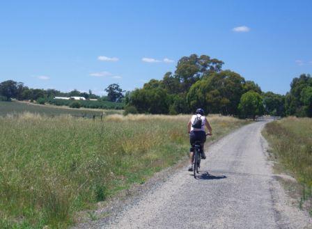
The path taken by the Rail Trail is through fairly open country, so you will need plenty of water on a hot day; however there are no steep gradients, so this is a nice trip for all bikers.
The surface of the Trail is bitumenised, albeit gritty for most of its length. The Trail starts at the former Rutherglen Railway Station (in Douglas Street, just near the VIC) not far from the main commercial street of the town, and some nice coffee shops.
Riding from Rutherglen to Wahgunyah:
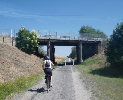
As you pull away from the former station, there are wheat silos to the right, and straight-ahead there is the only bridge on this route, and underpass of High Street.
Once clear of the urban area, vineyards soon appear, and the Trail passes around the back of Chambers Winery, with the ruins of the nearby Vidal Winery being clearly visible to the right.
Soon after this, the winery buildings of Calico Town Winery appear on the ridgeline to the right, with the nearby poppet head being clearly visible (see Winery Listing below).
On the way past these features, there are several relics from the gold mining era, with some stopes being visible to the left.
O’Donoghues Road is the next landmark on the Trail; this is an unsealed road, with a barrier system to ensure that riders slow down for this intersection. If you swing right (east) at this intersection, then it is a short up-hill ride to Calico Town Winery (see below).
Continuing towards Wahgunyah, there is another unsealed road to cross, again with a barrier system to ensure that riders slow down at this point.
As you approach Wahgunyah, Uncle Tobys Plant comes into view, and soon after this you need to cross over the C376 (Federation Way), where the road traffic will be travelling quite rapidly, and you need to allow plenty of room to get over safely. There is a length of railway track embedded in the bitumen at this point, and riders should take care to avoid getting narrow rims caught in this obstacle.
Passing around the rear of Uncle Tobys, the former Wahgunyah Railway Station site is encountered, and veering right in the midst of the site now leads to a t-junction at Sarah Street. Turn right here, and head down towards Barkly Street, where you need to turn left to get to the centre of town and the John Foord Bridge; this is where the action finishes.
For a continuation of the enjoyment, you can keep straight-ahead at Barkly Street, and pick up the Tommy McCrae Walking Track.
This riverside track (which caters for bikes, as well as walkers) leads upstream from Wahgunyah, and follows the Murray River to Federation Bridge; more details from an information board at this point, and in the Wahgunyah description.
Riding from Wahgunyah to Rutherglen:
In the reverse direction to the description given above, all of the landmarks obviously appear in the reverse order. But wait - there’s more . . .
On the final approach to Rutherglen, there are many excellent views of the vineyards that cluster around the town, as well as some really nice glimpses of some of Rutherglen’s historic buildings. For example, the original town watertower (with its wine glass top) is clearly visible on the hill behind the township, as is the Mount Carmel Convent.
Intro Screen on a fresh browser page
COPYRIGHT © 1995-2020, Chris McLaughlin.