
MOUNT BULLER
(includes Klingsporn Track)
(www.northeastvictoria.online)
As mentioned in the Mansfield description, the Taungurung People were the first adventurers to explore what is now the Mount Buller area.
Much later than this (during and after the gold rush) mountain cattleman started using the high country, droving cattle up to Mount Buller, and Mount Stirling, for the summer grazing season.
Many of these cattle droving families built huts in the high country, and following the style of this tradition, the first chalet was built at Mount Buller in 1929.
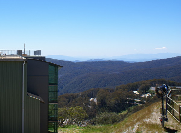
In the late 1940s the modern day resort of Mount Buller began to take shape, with the construction of alpine style buildings, and several ski lifts.
In the modern era the resort has international class facilities, and although primarily a ski resort, Buller is also a very popular venue in the warmer months, with mountain biking, and bushwalking, being the main activities.
Popular walks include . . .
Delatite River Trail
This is a 12km descent from the village, down to the valley floor at the Mirimbah parklands, with multiple water crossings on the way.
There are 21 actual bridges across the Delatite River, as well as a wet crossing of the River, and numerous minor watercourses to step over.
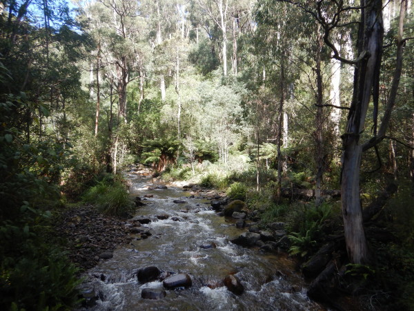
Most of the bridges are log bridges that are quite narrow, and require great care.
The main features of this walk are its alpine riverine scenery, tall timber, ferns, and subtle changes in the vegetation on the descent to Mirimbah.
Most walkers (and bikers) make use of the Mount Buller shuttle service to get from Mirimbah to Mount Buller, and then enjoy the descent - see the Mount Buller website for details of the shuttle.
The start of this walk is from just east of the village, at the picnic area on the Corn Hill Track; alternatively, start off from Box Corner, a well known corner on the drive up to the village.
In either case, the descent is clearly marked, and heads north, and then north-west, tracking the Delatite River quite closely.
The finish is at the Mirimbah Reserve, a great place to spend some time, and to relax.
This walk is rated as AWTGS-3, and takes about four hours to complete from Box Corner, plus the time on the shuttle service to Box Corner, or the village.
Add another hour if you are starting off from Corn Hill Road.
Trekking poles are a useful asset on the descent, both for safety, and for the stress that poles take away from your knees.
See the Mount Buller - Mount Stirling Walk Guide for more details.
Klingsporn Bridle Track
Klingsporn's Bridle Track was originally constructed to allow cattle a direct route to the high country for summer-time grazing.
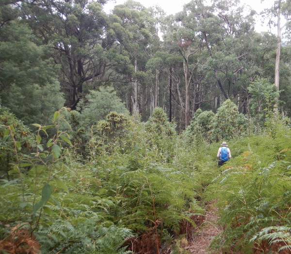
For bushwalkers, it is an ideal descent from Buller, with amazing scenery, in particular the transition through different vegetation communities is completely fascinating.
As with the Delatite River trail, most walkers make use of the Mount Buller shuttle service to get from Mirimbah to Mount Buller, and then enjoy the descent - see the Mount Buller website for details of the shuttle.
The descent starts at the base station of the Burnt Hut ski-lift, and this is accessible (by a vehicular track) from the Arlberg Hotel.
From the ski-lift, the Trail winds its way around the alpine terrain, and the relentless descent starts quite quickly.
The distance (from the ski-lift) down to Mirimbah is about nine kilometres, and this AWTGS-3 rated walk takes about three hours, plus the time on the shuttle service to the village.
Trekking poles are a useful asset on the descent, both for safety, and for the stress that poles take away from your knees.
Little Mount Buller
This is an alpine walk of about three kilometres (each way, total of about six kilometres) that leads from the Clock Tower to the summit of Little Mount Buller (1558m).
The action starts from the centre of the village (that is, the Clock Tower), and leads along The Avenue, and then continues to the south, so as to intersect the Whiskey Creek Trail.
Turn right here, and follow this trail on its looping path towards the Litte Mount Buller Spur.
On the way, the base stations of the Bull Run, and Federation chair lifts will have been passed.
This now leads to a t-junction, where you need to swing left, and prepare for the rocky ascent to the Little Buller summit.
The return is by retracing the outgoing route, but with reference to the Mount Buller - Mount Stirling Walk Guide, it is feasible to choose another route.
In either case, this walk is rated AWTGS-3, and takes about three hours to complete.
MOUNT BULLER (official website, summer)
MOUNT BULLER (official website, winter)
Intro Screen on a fresh browser page
COPYRIGHT © 1995-2021, Chris McLaughlin.