MOUNT STIRLING
(www.northeastvictoria.online)
Mount Stirling (1749m) is a popular alpine destination, and is located about 30km east of Mansfield. Stirling is best known as a cross-country ski area, but apart from this wintertime activity, other things to do include . . .
Intitial access is by taking the scenic Mount Buller Road (C320) east from Mansfield, and then the sign-posted road to Mount Stirling at Mirimbah.
There are several riverside rest areas (some of which permit short-term camping) on the way to Mirimbah, so this is a drive that is begging to be taken slowly.
Once at Mirimbah, the turn-off to Mount Stirling is to the left, alongside an extensive array of parklands.
Leaving the bitumen behind, it is about nine kilometres to the well-known Telephone Box Junction (TBJ), where there is a car parking area, with toilets nearby.
The Circuit Road
This is a 55km loop around the environs of Mount Stirling, and is a popular route for 4wd vehicles, soft-roaders, and Mountain Bikers.
In either case, tradition holds that the loop is completed in a clockwise direction, so as to minimise the risks from oncoming traffic.
The recommended map (essential equipment) is Sheepyard Flat - Craigs Hut Forest Activities Map, produced by Rooftop Maps.
Heading off from TBJ, it is a little over 3.5km to the turn-off that leads to Razorback Hut.
Getting to the hut (which was built by the Klingsporn Family) involves a small detour that is 4wd-ish, however it is only a short distance from the Circuit Road, and this is a pleasant walk.
There is plenty of cleared ground here, making this a popular camping area.
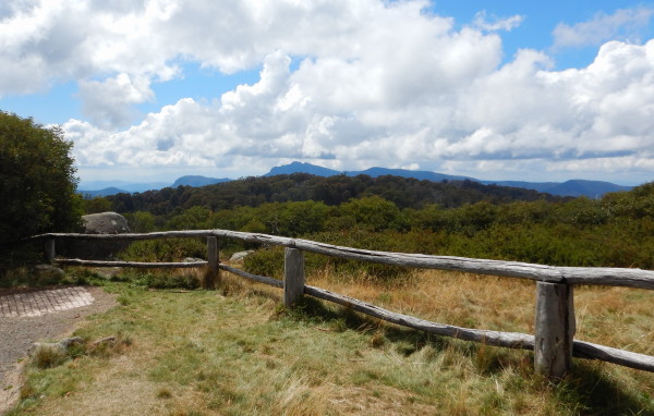
Continuing along Circuit Road, there are many great views through the trees, and King Saddle is encountered at the 5.5km mark.
The road off to the left at this point leads down to the King River at Pineapple Flat (nice camping), and is 4wd only.
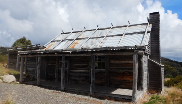
The road now winds its way around the the pedestrian access track to Craig's Hut, where there is a reasonable amount of car parking, on the left.
The Hut is anout 1.7km from here, and involves a gradual climb up to the environs of the Hut. However, it is well worth the effort, not only to see the Hut, but to take in the ambience and views.
Craig's Hut was originally built (in 1983) as part of the backdrop for the movie The Man from Snowy River but was destroyed by bushfire, the current one being a rebuild of the original.
Back at Circuit Road, the route continues its path back to TBJ, with Howqua Gap Hut appearing on the right at about 20.5km from the Craig's Hut parking area.
On the way, there are many amazing forest views to absorb, and it is well worth taking it slowly through here.
A further seven kilometres now takes you back to TBJ, where you need to turn left to get back to Mirimbah.
Pineapple Flat
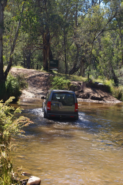
As mentioned above, the Circuit Road provides 4wd access to the King River at Pineapple Flat.
This is a 12km detour (each way), and it takes about 30 minutes to make the descent down to the river.
The actual water crossing is normally about 50cm deep, and leads to a popular camping area within the Alpine National Park.
The King River rises around Mount Howitt, and Mount Speculation, and is one of Victoria's most scenic rivers.
This makes Pineapple Flat a popular area in summertime holiday periods, and it is well worth spending a few relaxing days here.
There is a good measure of flat-ish ground here, and tents of all sizes are popular.
The route to/from the river is not practical for non-4wd vehicles, nor camper-trailers, nor caravans, nor motorhomes.
From Pineapple Flat, the King heads north towards Lake William Hovell, and then via a beautiful river valley to join the Ovens River at Wangaratta.
The recommended map (essential equipment) is Sheepyard Flat - Craigs Hut Forest Activities Map, produced by Rooftop Maps.
Mount Stirling Loop [AWTGS-3]
This is a loop, of about 14km, from TBJ towards the environs of Mount Stirling, and then back, via a different route, to the start. The recommended map (essential equipment) is Sheepyard Flat - Craigs Hut Forest Activities Map, produced by Rooftop Maps.
There is also a map in the Mount Buller and Mount Stirling Walk Guide, available from the Mansfield Visitor Information Centre.
As with the Circuit Road, the adventure (which requires formal walking shoes/boots, and a set of trekking poles) starts at TBJ by taking the final part of Circuit Road for about 500m (take care to look out for traffic).
This leads to a signposted track (Bluff Spur Trail), off to the left. This then leads to another junction (after about 250m) to Bluff Spur Trail.
Turn right here, and follow this excellent route for about 3.5km to Bluff Spur Hut, built in 1987 in memory of two skiers who died near here in 1985 (see www.MonumentAustralia.org.au for more details).
The hut is unlocked, and can be used for overnight accommodation; as well, there is a toilet here, and some flat ground for a tent or two.
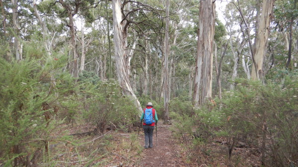
Continuing on, take the West Summit Trail, which winds around the west side of Mount Stirling.
The next manoeuvre is to veer left onto Stirling Trail, with the Geelong Grammar School Hut coming up on the left very quickly.
Stay with Stirling Trail to just beyond the King Spur Hut, and then veer left, and left again, taking the Wombat Drop Loop.
This now heads south-west to meet up with Upper Baldy Trail, which marks the final descent back towards TBJ.
Turn left at Circuit Road (look out for traffic once more), and the car park of TBJ is not far away.
Overall time taken will have been 6-7 hours, making a very enjoyable day's walking.
Bluff Spur Hut [AWTGS-3]
This is a shortened version of the above loop walk, covering about eight kilometres, and taking about four hours. Some of the text from the above description is repeated here.
The recommended map (essential equipment) is Sheepyard Flat - Craigs Hut Forest Activities Map, produced by Rooftop Maps.
There is also a map in the Mount Buller and Mount Stirling Walk Guide, available from the Mansfield Visitor Information Centre.
As with the Mount Stirling Loop, this walk requires formal walking shoes/boots, and a set of trekking poles.
The action starts at TBJ by taking the final part of Circuit Road for about 500m (take care to look out for traffic). This leads to a signposted track (Bluff Spur Trail), off to the left. This then leads to another junction (after about 250m) to Bluff Spur Trail.
Turn right here, and follow this excellent route for about 3.5km to Bluff Spur Hut, built in 1987 in memory of two skiers who died near here in 1985.
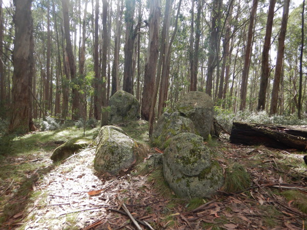
Items of interest along the way include a vegetation change from tall timber to snowgums, lots of moist fern covered glades, and many moss covered rocks - all very interesting.
Just opposite the Memorial Hut there is a circle of hand-cut bush seats - a great place for lunch before retracing your steps back to TBJ.
Intro Screen on a fresh browser page
Mount Stirling (official website)
COPYRIGHT © 1995-2021, Chris McLaughlin.