MOUNT BEAUTY WALKS
(www.northeastvictoria.online)
West Kiewa Gorge
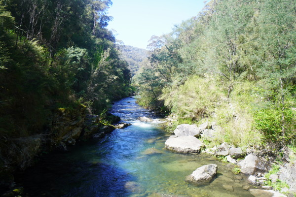
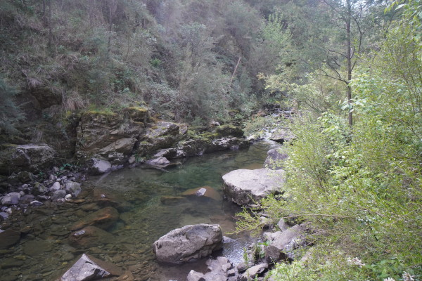
The West Kiewa River rises in the high country around Mount Hotham, and the Bogong High Plains, and this short walk provides an opportunity to sample its great scenery, as well as some snippetts from the Kiewa Hydro-electric Scheme.
Take care on all sections of the walk as there are many loose surfaces en route.
Also, take care on the narrow sections as there is a steep drop off to the side.
There are two options for this walk, either start from the Visitor Information Centre, or from the Mount Beauty Mountain Bike Park.
Option A : This three kilometre walk starts from the Visitor Information Centre, and is rated AWTGS-3.
From the Visitor Information Centre, take the roadway directly opposite (watch out for traffic on the Kiewa Valley Highway) and follow this roadway up to the concrete formwork of the tail-race channel (this is used for outflows from the West Kiewa Power Station).
The narrow track now starts a gentle climb as it winds around the hillslope, and then at a small t-junction you need to head off to the right, so as to follow the river upstream.
This now leads to a swing bridge over the Kiewa (great views) and then follow the river upstream.
Items of interest on the way include ‘The Adit’ (a legacy of the hydro works, where a storyboard reveals its history), as well as perfect riverine scenery.
The end of the walk is reached at a sign that indicates that the canyon is about 150m away. Continuing on from here involves some tricky river crossings, and most people turn around at this point.
Option B : This three kilometre walk option starts from the Mountain Bike Park, easily accessible via the Bogong High Plains Road out of Mount Beauty, and is rated AWTGS-3. The Park is sign-posted to the right, not far from the roundabout as you enter Mount Beauty from the Kiewa Valley Highway.
From the car park, take the metal stairway, and then veer over to the roadway leading west, and follow this to a four way intersection.
Keep straight ahead at this point, and follow this route to a set of steps (take care) that lead down towards the river.
Swing left at the bottom of the steps, and this now leads to a swing bridge over the Kiewa (great views) and then follow the river upstream.
Items of interest on the way include ‘The Adit’ (a legacy of the hydro works, where a storyboard reveals its history), as well as perfect riverine scenery.
The end of the walk is reached at a sign that indicates that the canyon is about 150m away. Continuing on from here involves some tricky river crossings, and most people turn around at this point.
COPYRIGHT © 1995-2023, Chris McLaughlin.