MURMUNGEE SCENIC RESERVE
(www.northeastvictoria.online)
The Murmungee Basin lies to the south-west of Beechworth, and is overlooked by several mountain range systems. One of these forms the basis of the Murmungee Scenic Reserve, an interesting venue for a vigourous bushwalk, rated as AWTGS-3.
Note that this walk (which has an ascent of 300m), requires a pair of formal walking shoes/boots, as well as a set of trekking poles.
Initial access is via Fergusson Road/Lane (from the Great Alpine Road, east of Everton), and then Zig Zag Road, as shown on the VicMap 1:50 000 sheet Yackandandah, available in print, and GPS (digital), format.
Taking Zig Zag Road, drive to the Pine Plantation gate, and keep right once through the gate. Continuing onwards, there is a small parking area with a Zig Zag Trail signpost on a tree.
This footpad, to the summit area of the Reserve, dates from the gold rush days, and it takes 2-3 hours to complete the walk (that is, the ascent, and descent).
The footpad is marked at intervals with red reflective indicators, and makes an alpine style ascent to the summit.
On the way there are many great views to enjoy, but take care with safety, don’t walk and gawk at the same time.
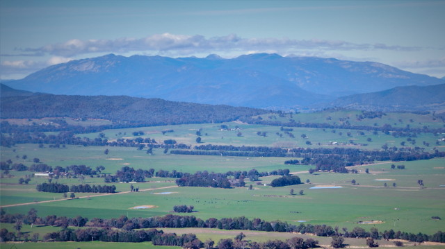
The views include the Mount Buffalo massif, the Murmungee Basin, and a very interesting terraced ridge system to the west.
On at the summit area, there are many great places to sit and enjoy the views, and to have lunch.
Expectedly, the return route is by carefully retracing your steps, 300m down to the floor of the Basin.
See the Local History link (below) for some fascinating detail on this area.
Intro Screen on a fresh browser page
COPYRIGHT © 1995-2020, Chris McLaughlin.