MANSFIELD - SHEEPYARD FLAT
(www.northeastvictoria.online)
TRAVELLING TIME: About 90 minutes.
DISTANCE COVERED: 50km.
OVERVIEW – TRIP PLANNING MAPS: Spatial Vision, Buller - Howitt Area.
DETAILED MAPS: Rooftop’s Mansfield - Mount Howitt Adventure Map.
SUPPLIES/FUEL: Mansfield has a full range of shopping, services and accommodation as well as some great eateries.
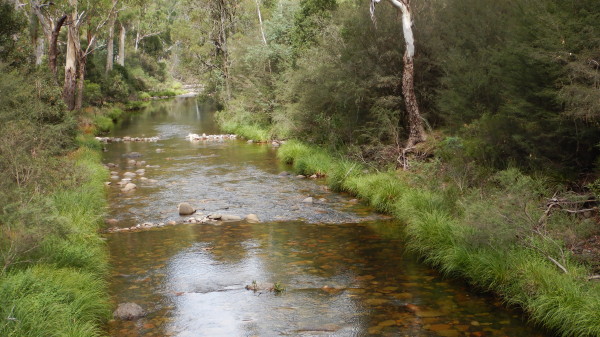
CAMPING: Very good at Sheepyard Flat, and at other places upstream, alongside the Howqua River.
WHEN TO GO: Avoid wet, and super-hot conditions.
TRACK DETAILS: Generally good surface of gravel and packed earth, with some slippery sections after rain or snow; not recommended for large caravans under any conditions.
OTHER INFORMATION: A very scenic route, with plenty of interest along the way.
This gravel tour leads to the Howqua Valley, and begins by taking the Mount Buller Road (C320) east from Mansfield, and then Howqua Track, off to the right after about 20km. This intersection is quite well signposted, and is encountered soon after passing through the small settlement of Merrijig, on the Delatite River.
Timbertop Saddle is then encountered after a further seven kilometres. There is a walk to Mount Timbertop from the Saddle, and this is an enjoyabale adventure of about 5.5km (in total). This walk involves a predictable climb, and it is wise to allow at least three hours for this two-foot detour.

There is a map of the route at the Saddle, and this AWTGS-3 walk requires formal walking shoes/boots, and a set of trekking poles.
Once in the environs of the summit, there is a loop around this 1275m peak, and this has some narrow, rocky sections that will not suit everyone; if in doubt make a u-turn at this point.
Continuing along Howqua Track, a few holiday cabins are now passed (on the right), and then it's the final approach to Sheepyard Flat, a popular camping area alongside the Howqua River.
Having parked your vehicle (or set up camp), relics from the old days can be found by walking or driving downstream.
Fry’s Hut (built by legendary bushman Fred Fry) is an interesting landmark, and about a kilometre downstream from the Hut, there is a brick chimney, part of a smelting furnace, completed in 1884 for the Mountain Chief Gold Company.
A detailed history of this area can be found in the excellent book The Howqua Hills Story by Graeme and Chris Stoney.
There several interesting walking tracks emanating out from the camping area at Sheepyard Flat, and these are detailed on the Parks Victoria website (link below).
Having enjoyed the drive, and the destination, it is now time to make a u-turn, and return to Mansfield by retracing the incoming route.
Mansfield - Mount Buller website
Intro Screen on a fresh browser page
COPYRIGHT © 1995-2021, Chris McLaughlin.