TUNGAMAH and Boosey Creek
(www.northeastvictoria.online)
Tungamah is located about 30km south-west of Yarrawonga, 42km north of Benalla, with Boosey Creek (a minor tributary of the Broken Creek drainage system) passing through the township.
Tungamah was named after an Aboriginal word thought to mean wild brush turkey, and was gazetted in 1875, when pastoral runs were made available for selection in the wider area (that is, St James, Wilby and Tungamah).
As rural land was taken up, the town grew rapidly, and many public buildings were soon erected - a school, a post office, five stores, five hotels and two banks.
In 1886 the railway line connected Tungamah to Benalla and Yarrawonga, and the town became the administrative centre of the newly formed Yarrawonga Shire until 1891, when the Yarrawonga area was legislated as a separate shire.
For several years the separate entities were called Yarrawonga and North Yarrawonga, until 1893 when Tungamah Shire was created, and many historic buildings still survive.
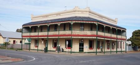
Examples include the three churches on the hill north of the town (Presbyterian 1885, Catholic 1886 and Anglican 1889), the former Colonial Bank (1880), Masonic Hall (1890), Phillips and Costigans general stores (1883 and 1889), the Hotel (1891), Mechanics Institute, the Court House (1890), the Post Office and the Water Tower (1909).
In the modern era, Tungamah is an interesting place to visit, with a well documented Heritage Walk to explore (see link below), a general store, a museum and a hotel.
Tungamah is also home to a set of wheat silos, all with excellent artwork; two have a brolga spread across them, whilst the one on the left has a kookaburra.
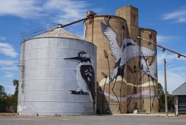
The art was commissioned in 2018, and was completed by Sobrane Simcock, with the help of a cherry picker.
Rural activities centre around sheep, dairy cattle, meat cattle, cereals and canola.
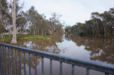
There is a small weir on Boosey Creek, and this provides a nice water frontage parkland for the town, as well as being a pleasing area for an overnight camp.
If you have your canoe with you, the Creek is a nice, quiet, venue for some paddling and/or bird watching etc, but mind your head on the road bridge.
The adjoining Tungamah Lions camping area is run by volunteers, and is situated on the banks of Boosey Creek, with good amenities on-site.
Tungamah is easily accessible via the signposted turn-off on the Benalla - Yarrawonga Road, and from the signposted turn-off on the Wangaratta - Yarrawonga Road (C326) at Peechelba.
In both cases, this is a very scenic drive.
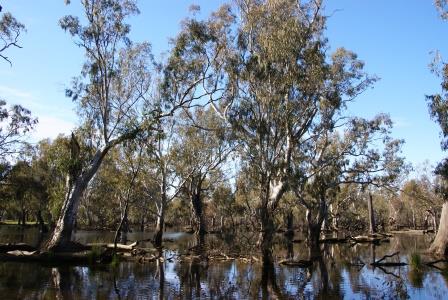
The nearby Tungamah Swamp (about three kilometres east) is part of an 880 hectare conservation area that provides habitat for many threatened species.
These include the Red-chested Button Quail, Grey-crowned Babbler, Plains Leek Orchid, Bluish Raspwart, Buloke, Small Scurf Pea and Spurred Spear-grass.
The Swamp gets a reasonable in-fill of water most winters, at which time it is a great place for bird watching, particularly water birds.
Yarrawonga Visitor Information Centre
Intro Screen on a fresh browser page
COPYRIGHT © 1995-2026, Chris McLaughlin.