WARBY - OVENS NATIONAL PARK
(www.northeastvictoria.online)
Friends Walking Track [AWTGS-4]
This pleasant five kilometre walk starts and finishes at ’Wenhams’, one of only two official camping areas in the National Park, quite close to the summit of Mount Warby.
The easiest vehicular access to this area is via Gerrett Lane, which is a left turn just near Ryans Lookout; this leads to a cross-roads, where you need to take Booths Road off to the left, then look for a small track off to the left.
This then leads to a small car parking area adjoining Wenhams Camp, where there is a picnic area, a camping area, and a toilet block.
From the picnic area ’Friends Walking Track’ (named for The Friends of the Warby Ranges) leads off on a nice loop through woodlands, with some great views, particularly from Kwat Kwat Lookout (optional detour).
Note that this walk requires a pair of formal walking shoes/boots, as well as a set of trekking poles.
The Parks Victoria info PDF and/or the 1:50 000 scale topographic map Wangaratta is also required; a download of the topographic data is available from the internet, and can be printed off and/or loaded into a GPS device.
The basic loop takes about two hours to complete, add about 20 minutes extra to include Kwat Kwat.
Setting off to the north from the picnic area, the first landmark is a y-junction after about 200m; keep right here, and continue to follow the trail (and its intermittent red triangle markers) to another y-junction (after a total of 800m).
Keep right here, and head downslope to a picturesque creek, and a timber bridge.
Cross over the bridge, and turn left so as to follow the creek as it curves around a hillslope.
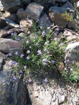
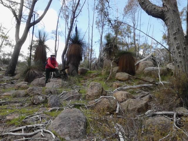
This is a very pretty section of the walk, with excellent rocky scenery, plenty of wattles and plenty of grass trees.
A cross roads are encountered at 1.4km, and you need to keep straight-ahead at this point.
Another cross roads are encountered at 2.1km, and at this point you can either turn left for a detour to Kwat Kwat Lookout (400m each way) or keep straight-ahead for the main trail.
If you take the detour to Kwat Kwat, just follow the roadway to where it starts to make a sharp dip, and then look for the footpad off to the left, after about 100m.
Back at the cross roads referred to above (at 2.1km), the turn off to the Alpine Views Track (on the left) is encountered at 3.7km, and Mount Warby is at 4.35km.
Keep right at the summit of the Mount, and this then leads generally downhill to a road junction at 5.2km; from here it is another 250m to get back to the picnic area.
The distances given here are based on the assumption that Kwat Kwat Lookout is visited; deduct about 800m if this is not so.
| Friends Track | Section km | GPS |
| 1st y-junction | 200m | 36/20/24.5 : 146/12/12.8 |
| 2nd y-junction | 800m | 36/20/05.5 : 146/12/18.9 |
| 1st cross roads | 1.4km | 36/20/12.2 : 146/12/34.5 |
| 2nd cross roads | 2.1km | 36/20/26.1 : 146/12/52.7 |
| Kwat Kwat Lookout | 2.5km | 36/20/17.4 : 146/12/56.4 |
| return to 2nd cross roads | 2.85km | 36/20/26.1 : 146/12/52.7 |
| Alpine Views Track | 3.7km | 36/20/41.7 : 146/12/46.7 |
| Mount Warby | 4.35km | 36/20/54.1 : 146/12/30.6 |
| road junction (Wenhams Track to right) | 5.2km | 36/20/35.1 : 146/12/15.4 |
| Picnic Area | 5.45km | 36/20/27.4 : 146/12/14.3 |
COPYRIGHT © 1995-2020, Chris McLaughlin.