WARBY - OVENS NATIONAL PARK
(www.northeastvictoria.online - smartphone site)
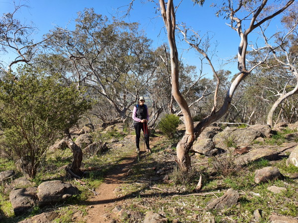
Loggers Lane [AWTGS-3]
Well, this is Loggers Lane, not Lovers Lane, but it’s still a very popular route, with a variety of terrain, and vegetation.
The Parks Victoria info PDF and/or the 1:50 000 scale topographic map Wangaratta is also required. Note that this walk requires a pair of formal walking shoes/boots, as well as a set of trekking poles.
The action starts at the small car parking area at the junction of Wangandery Road and Gerritts Road, not too far out of Wangaratta via the Wangandery/Thoona Road.
The adventure itself kicks off by wandering down to a locked gate across Loggers Lane, and side-stepping this structure so as to pick up a little used vehicular track (Management Vehicles Only).
Ignore the narrow track going off to the right at about 100m; that is, stick with Loggers Lane.
The Lane then leads, for a little over two kilometres, to an area of flattish ground, a popular place for morning tea, or an early lunch.
There is a disused, and rather vague, track junction here, but it is no longer shown on the topographic map of the area.
Continuing onwards, and upwards, there is a single file track going off to the right, about 100m before the route meets up with Taylors Track (this turn-off is about 2.90km from the start : see also the comment below).
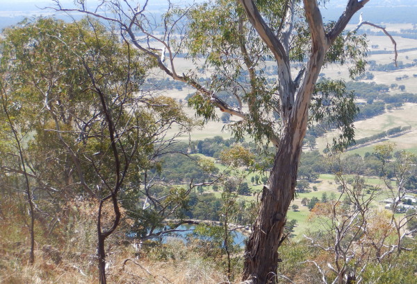
All along the way to this point, there are several great views to the left, some nice rocky scenery and lots of grass-trees to admire.
Take the single file track, as mentioned above, and follow this scenic track through to a steady descent that meets up with Loggers Lane.
On this section ignore all left options, but take care to swing right at a significant tree on a wide section of track (GPS data, 36/19/14 : 146/11/58.9; this is about 4.12km from the start).
Not only is the vista really excellent in this section (including amazing views of the flood plain down towards Thoona, and beyond) but so too is the vegetation; lots of grass-trees, nodding lily, and spur wing wattles.
Turning left at Loggers Lane, it is about 300m to the start.
Just prior to the single file track going off to the right there is an un-marked track to the left. This leads to some amazing granite studded country, with great views of the Ovens-King flood plains, as well as Mount Buffalo.
The track is all single-file, and joins up with Taylors Track a few hundred metres south-east of the Loggers Lane/Taylors Track junction.
If you take this option then it will add about two kilometres to the overall distance.
Once at Taylors Track, turn right, follow this old roadway through to Loggers Lane, then turn right to pick up the original route, as described above.
An alternative starting point for the walk is from Ryans Lookout. This offers spacious car parking, picnic tables, a toilet and great views.
So, instead of turning to the left off the bitumen (into Gerritts Road), turn right into the Ryans Lookout car park. Take care with this turn, and in crossing the bitumen on foot to get to the actual start of the walk.
Access to the start is by taking the narrow footpad leading uphill from the picnic area. This leads to the bitumen, where (as mentioned) great care is required.
COPYRIGHT © 1995-2021, Chris McLaughlin.