WARBY - OVENS NATIONAL PARK
(www.northeastvictoria.online)
Alpine Views Track [AWTGS-4]
This is an 8.5km loop that starts and finishes at ’Wenhams’, one of only two official camping areas in the National Park.
Note that this walk requires a pair of formal walking shoes/boots, as well as a set of trekking poles.
The Parks Victoria info PDF and/or the 1:50 000 scale topographic map Wangaratta is also required; a download of the topographic data is available from the internet, and can be printed off and/or loaded into a GPS device.
Vehicular access to this area is via Wangandery Road out of Wangaratta, and then Gerrett Lane, which is a left turn just near Ryans Lookout; this leads to a cross-roads, where you need to take Booths Road off to the left, then look for a small sign-posted track off to the left.
This then leads to a small car parking area adjoining Wenhams Camp, where there is a picnic area, a camping area, and a toilet block.
The basic loop takes about 3.5 hours to complete, add about 20 minutes extra to include Kwat Kwat Lookout.
From Wenhams picnic area you need to make a u-turn, so as to pick up a Management Vehicles Only (MVO) gated track that leads to the south; this is sign-posted Kwat Kwat Lookout, 1.7km.
About one kilometre, on a nice wide track, leads to a t-junction where Peregrine Track is the straight-ahead option.
Peregrine Track then leads, after about 300m, to a cross-roads where you need to turn right (straight-ahead leads to Kwat Kwat Lookout; add about 800m to the walk if you want to include this option).
We are now on part of the Friends Loop, and a further 800m leads to the sign-posted left turn onto the Alpine Views Track.
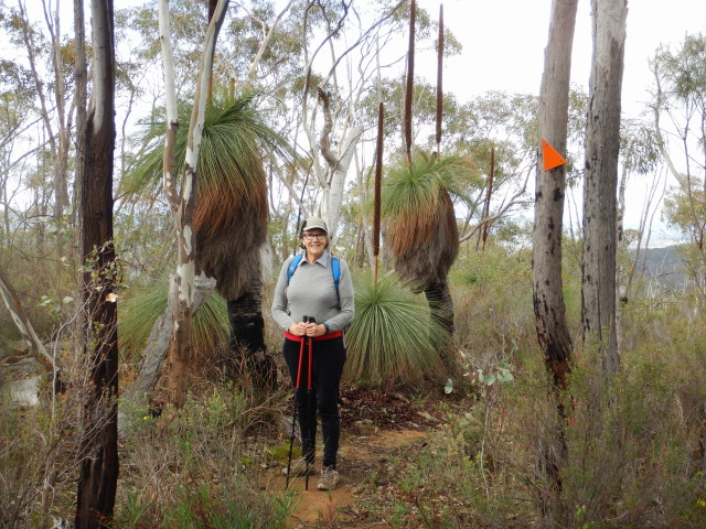
This is a very pretty section of the Warby Ranges, and one of the best walking tracks in the Park, with excellent views, and plenty of interest.
Following the orange triangles, at the 4.25km mark, the track merges with a wider track (sign-posted Alpine Views, to the right; see note below), and from here it is a further 0.75km to where Salisbury Track goes off to the left.
Ignore this, and proceed a further few hundred metres, where a slip track off to the right is sign-posted Salisbury Walk.
This is a single file track (with orange triangles) that leads to the top of Mount Warby. It is a steady climb to the Mount, and once there you can say that it is mostly downhill all the way home.
Keep straight-ahead from the Mount, and this then leads generally downhill to a road junction at 8km; from here it is another 500m to get back to the picnic area.
Many walkers add this walk to the basic Friends Loop; just turn left at the Alpine Views turn-off for an additional five kilometres on the Loop.
| Alpine Views Track | Section km | GPS |
| Peregrine Track | 1km | 36/20/30.1 : 146/12/44.9 |
| Friends Track intersection | 1.3km | 36/20/26.1 : 146/12/52.5 |
| start of Alpine Views Track | 2.1km | 36/20/41.7 : 146/12/46.6 |
| continuation of Alpine Views Track | 4.26km | 36/20/11.6 : 146/12/30.9 |
| Salisbury Falls Track (to left) | 5.00km | 36/21/24.8 : 146/13/11.3 |
| y-junction to Mount Warby | 5.19km | 36/21/25.5 : 146/13/10.1 |
| Mount Warby | 7.5km | 36/20/54.4 : 146/12/29.9 |
| Picnic Area | 8.5km | 36/20/27.4 : 146/12/14.3 |
[Note : An optional “extra” on this beautiful walk is to turn left at this intersection (as mentioned in the description), and follow this dis-used vehicular track for about 750m. This will take you to an un-named waterfall, visible on the right (that is, east side) of the track.
The cascade here is very scenic, particularly at wattle time, and well worth the additional 1.5km on your adventure. After enjoying the view at this “secret” location, make a u-turn and return to the Alpine Views Track.]
COPYRIGHT © 1995-2020, Chris McLaughlin.