WARBY - OVENS NATIONAL PARK
(www.northeastvictoria.online)
Salisbury Walk [4.6km version, AWTGS-3]
Access to this very scenic walk is by taking a turn to the west at the off-set cross-roads at the Warby Range Road - Shanley Street intersection.
This leads to a narrow roadway that finishes at a very small car park, providing foot access to the scenic Salisbury Falls, and the walk described here.
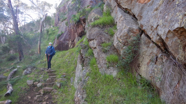
Having parked your vehicle, the signposted walking track leads north, passing a Warby-Ovens National Park sign, and a gateway.
Keeping right at the subsequent y-intersection, the narrow footpath leads steadily upslope for about 2.3km to intersect Boilerwood Track (part of the Alpine Views route - see separate description).
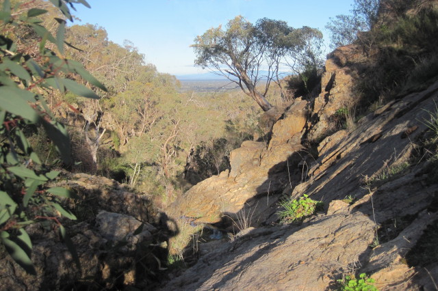
En route, there are many very pretty sections of waterway to admire, as well as some excellent rocky scenery. Take care to only admire the views when you are stationary, there are many obstacles underfoot, and it is not wise to walk and gawk at the same time.
Returning to the car park, by the same route, there are several great views of the distant high country, notably Mount Buffalo and the Wabonga Plateau.
Note that this walk requires a pair of formal walking shoes/boots, as well as a set of trekking poles.
Distance covered is about 4.6km, the overall time taken is about three hours, and the change in altitude (from the start to Boilerwood Track) is about 150m.
Salisbury Walk [12km version, AWTGS-3]
Access to this very scenic walk is by taking a turn to the west at the off-set cross-roads at the Warby Range Road - Shanley Street intersection.
This leads to a narrow roadway that finishes at a very small car park, providing foot access to the scenic Salisbury Falls, and the walk described here.
Having parked your vehicle, the signposted walking track leads north, passing a Warby-Ovens National Park sign, and a gateway.
Keeping right at the subsequent y-intersection, the narrow footpath leads steadily upslope for about 2.3km to intersect Boilerwood Track.
En route, there are many very pretty sections of waterway to admire, as well as some excellent rocky scenery. Take care to only admire the views when you are stationary, there are many obstacles underfoot, and it is not wise to walk and gawk at the same time.
Turn left at Boilerwood Track, and follow this for a few hundred metres to an un-signposted single file track to the right. This meanders around, and leads (for a few kilometres) to the summit of Mount Warby. Once at Mount Warby, there are some interesting views, and plenty of rocks to sit on and enjoy morning tea/lunch.
Leaving Mount Warby, take the short descent to the right (not the straight-ahead option), and follow this through to a disused roadway that leads to the signposted Alpine Views Track.
Taking this beautiful track leads to a meander down to another disused roadway. This is signposted "Alpine Views Track" off to the right, and leads back to Boilerwood Track.
Follow this through to where the descent back down to Salisbury Falls leads off to the left; this provides the return to the car park, with several great views of the distant high country, notably Mount Buffalo and the Wabonga Plateau.
Note that this walk requires a pair of formal walking shoes/boots, as well as a set of trekking poles.
Distance covered is about 12km, the overall time taken is about five hours.
COPYRIGHT © 1995-2020, Chris McLaughlin.