WARBY - OVENS NATIONAL PARK
(www.northeastvictoria.online - smartphone site)
Loggers Lane-Wenhams Loop [AWTGS-4]
This is a variation on the Loggers Lane Loop, and leads to Wenhams, and then back to the start via a different route, giving a total distance of about 12km, and a walking time of about four hours.
The Parks Victoria info PDF and/or the 1:50 000 scale topographic map Wangaratta will be a valuable asset. Note that this walk requires a pair of formal walking shoes/boots, as well as a set of trekking poles.
The action starts at the small car parking area at the junction of Wangandery Road and Gerritts Road, not too far out of Wangaratta via the Wangandery/Thoona Road.
The adventure itself kicks off by wandering down to a locked gate across Loggers Lane, and side-stepping this structure so as to pick up a little used vehicular track (Management Vehicles Only).
Ignore the narrow track going off to the right at about 100m; that is, stick with Loggers Lane.
The Lane then leads, for about 2.2km, to an area of flattish ground, a popular place for morning tea, or an early lunch.
There is a disused, and rather vague, track junction here, but it is no longer shown on the topographic map of the area.
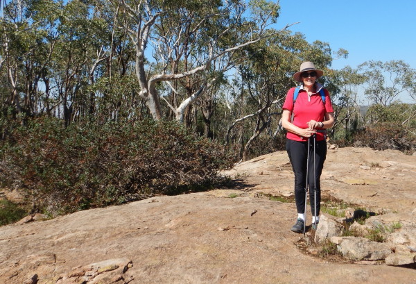
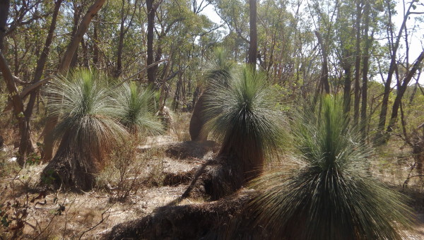
All along the way to this point, there are several great views to the left, some nice rocky scenery and lots of grass-trees to admire.
Continuing onwards, and upwards, take the un-marked track to the left, not long before the Taylor's Track interesction (that is, about 2.9km from the start).
This leads to some amazing granite studded country, with great views of the Ovens-King flood plains, as well as Mount Buffalo.
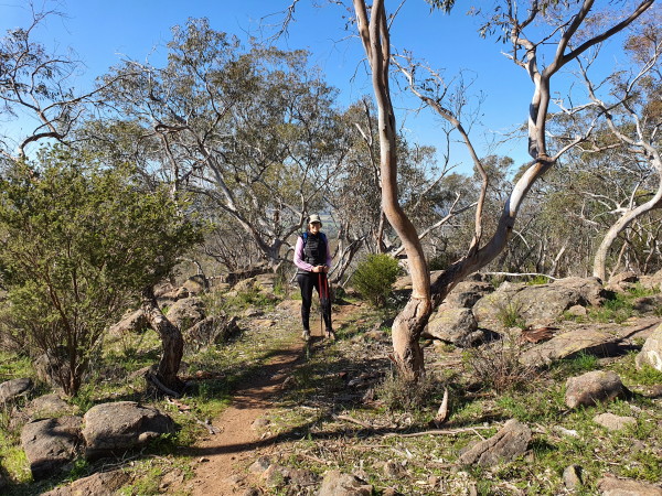
This track is all single-file, and after about 1.7km joins up with Taylors Track.
Turn left here, and after about 100m, take another single-file track off to the right for a few metres, and then turn left onto another narrow track.
This now leads over the hill, and then down towards an area of cleared land, with a creek off to the left (distance at this point is about 5.2km).
Keep basically straight-ahead at this point, and carefully follow the footpad through to Wenhams, about 800m away at this point.
On the way there are some "bush shelters" to admire, as well as a short section of boardwalk to enjoy.
There are picnic facilities, as well as toilets at Wenhams, and this is good place to have morning tea/lunch before tackling the next stage of the walk.
The return part of the loop involves retracing your steps for about 100m.
That is, setting off to the north from the picnic area, the first landmark is a y-junction after about 200m; keep left here, and continue to follow this meandering trail to a left turn at about 600m. Ignore this and continue through to another y-junction at about 1.3km.
Keep left-ish here, and follow the path through for another 120m to an isolated intrusion of granite.
This is a very scenic locality, with views of Mount Buffalo, and the surrounding countryside, and makes a great place for morning tea.
The granite here shows the onion skin weathering that is typical of granite, as well as bands of quartz. The surrounding vegetation includes grass-trees, and the spur-wing wattle.
Moving on from here, you need to take a faint footpad towards the south, and then swing around to the north, ignoring any side tracks. As you leave the environs of the granitic outcrop, you need to have Mount Buffalo to your right.
Staying on the narrow footpad, ignore all of the minor tracks going off to the right, and note that the route is now following a disused vehicular track.
Follow this track, as it heads basically westwards, and then make a sharp turn to the right, just in front of a notable cluster of grass-trees.
Continue to follow this footpad, again ignoring all of the tracks going off to the right.
This now leads to Taylors Track, where a left turn is required.
Not long after this, take the single file track curving off to the right.
This quickly leads (after a few metres) to an inverted y-junction, where you need to keep basically straight-ahead.
The track now meanders around for a few hundred metres, and gradually morphs in to a former vehicular track.
Swing right at a significant tree on a wide section of track (GPS data, 36/19/14 : 146/11/58.9), taking a clearly marked track.
This now quickly meets up with another footpad going off to the left, and you need to keep right at this point.
The track now meanders around the hillside, basically heading north.
Not only is the vista really excellent in this section (including amazing views of the flood plain down towards Thoona, and beyond) but so too is the vegetation; lots of grass-trees, nodding lily, and spur wing wattles.
Turning left at Loggers Lane, it is about 300m to the start.
An alternative starting point for the walk is from Ryans Lookout. This offers spacious car parking, picnic tables, a toilet and great views.
So, instead of turning to the left off the bitumen (into Gerritts Road), turn right into the Ryans Lookout car park. Take care with this turn, and in crossing the bitumen on foot to get to the actual start of the walk.
Access to the start is by taking the narrow footpad leading uphill from the picnic area. This leads to the bitumen, where (as mentioned) great care is required.
COPYRIGHT © 1995-2021, Chris McLaughlin.