WARBY - OVENS NATIONAL PARK
(www.northeastvictoria.online)
Ryans Lookout to Kwat Kwat Lookout [AWTGS-3]
A route to Kwat Kwat Lookout is described in the Friends Track description, however this variation leads to Kwat Kwat from Ryans Lookout, via Loggers Lane and Taylor's Track.
The Parks Victoria info PDF and/or the 1:50 000 scale topographic map Wangaratta will be a valuable asset.
Note that this walk requires a pair of formal walking shoes/boots, as well as a set of trekking poles (some of the undulating sections have quite loose surfaces).
The starting point for the walk is from Ryans Lookout. This offers spacious car parking, picnic tables, a toilet and great views.
Ryans is accessible by carefully turning north off the bitumen of Wangandery Road, not too far out of Wangaratta via the Wangandery/Thoona Road.
The action starts by taking the narrow footpad leading uphill from the picnic area. This leads to the bitumen, where great care is required - look and listen for traffic.
The adventure itself kicks off by wandering down to a locked gate across Loggers Lane, and side-stepping this structure so as to pick up a little used vehicular track (Management Vehicles Only).
Ignore the narrow track going off to the right at about 100m; that is, stick with Loggers Lane.
The Lane then leads, for about 2.2km, to an area of flattish ground, a popular place for morning tea, or an early lunch.
There is a disused, and rather vague, track junction here, but it is no longer shown on the topographic map of the area.
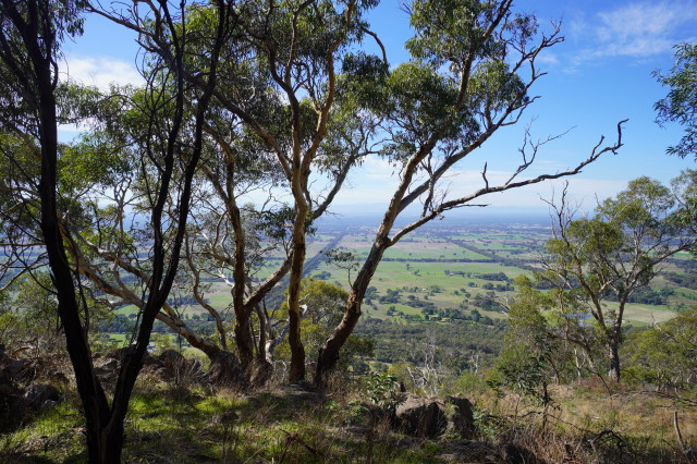
All along the way to this point, there are several great views to the left, some nice rocky scenery and lots of grass-trees to admire.
Continuing onwards, and upwards, the route leads to Taylor's Track, about three kilometres from the start, where a left turn is required.
Taylor's Track (like Loggers Lane) is quite undulating, but very enjoyable, with a good showing of wildflowers and grass-trees.
A signposted intersection is encountered after about 1.4km on Taylor's Track (this is the Friends Track loop from Wenhams Camp) and you need to turn left at this point.
Another intersection appears after about 700m, and at this point you need to turn left for Kwat Kwat Lookout (now about 400m away).
Heading towards Kwat Kwat, just follow the roadway to where it starts to make a sharp dip, then veer right, and then look for the footpad off to the left, after about 100m.
There are great views from the Lookout, and this is a popular place for lunch.
Expectedly, the return route involves retracing your steps back to Ryans Lookout, and the overall distance covered is about 12km.
COPYRIGHT © 1995-2023, Chris McLaughlin.