BIKE PATHS, RAIL TRAILS and CYCLE ROUTES
(www.northeastvictoria.online)
WANGARATTA TOWN LOOP
(One Mile Creek Bike Path)
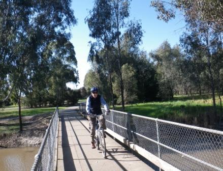
This is the main dedicated cycling route in Wangaratta, and basically follows One Mile Creek, a waterway that has its catchment area to the south-west of the city. From end-to-end, this bike path starts at Cribbes Road (on the south-west side) and finishes at the Yarrawonga Road (on the northern side of the city). In between these two end points there are many different ride combinations, with the end-to-end ride covering about 5.3km.
A continuation of this ride leads over to the Ovens River, and then (via two narrow bridges) to the city centre, APEX Park and the start of the Murray to Mountains Rail Trail.
Assuming that you start from Cribbes Road, intermediate access-egress points include,
White Street (800m from the start)
Vincent Road (1.65km)
Perry Street (2.3km)
Greta Road (2.6km)
Tone Road (Old Hume Highway, 2.8km)
Wareena Park (3.0km)
Roy Street (3.5km)
Swan Street (4km)
Rowan Street (4.4km)
Turner Street Bridge (4.7km)
Phillipson Street (4.9km)
Edwards Street (Yarrawonga Road, 5.3km)
[Between Phillipson Street and Edwards Street (the Yarrawonga Road) the bike path passes alongside the northern terminus of Appin Street. Just beyond Appin Street, there is a spur track going off to the left which basically follows Three Mile Creek, upstream to Williams Road. This provides excellent access to the Collyndale Estate, and to Williams Road and Lindner Road (where an informal bike path continues west). As well, a few hundred metres from the main bike path (that is, the One Mile Creek Bike Path) there is another spur track, which leads in to the Waldara Estate via a new-ish bridge.]
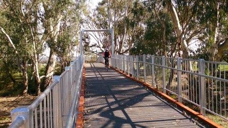
No matter which sections you ride, or in which order/direction, this is very enjoyable cycling terrain, with the Creek having a well preserved corridor of native vegetation along its full length. Obviously, there are many contact points with the urban world, but this is still a great place to unwind.
Having reached the Yarrawonga Road, there are three options,
Make a u-turn and enjoy the great scenery of One Mile Creek once more.
Heading away from town, there is the opportunity of following the Yarrawonga Road for about seven kilometres, finishing abruptly just before the small settlement of Killawarra.
The surface along here is initially quite good, but soon changes to a mostly earthen surface that is not too functional in wet conditions.
To complete a loop you can head back towards the urban area. As mentioned above, this leads to a ride alongside the Ovens River, and then (via two suspension bridges) to the city centre, and/or APEX Park and/or the start of the Murray to Mountains Rail Trail.
Taking the signposted bike path from the Yarrawonga Road Bridge, you need to follow the Yarrawonga Road for a short distance south (that is, towards the city centre) and then keep left so as to pick up College Street. Here, the bike path signage will guide you past a couple of new residential areas, over the northern section of Phillipson Street, past Galen College, and then alongside the northern edge of the Barr Reserve.
This then brings you alongside the Ovens River, with many nice riverine views to enjoy. A further couple of kilometres of bike path now leads to a roadway (Evans/Grey Street) where you need to make an abrupt left turn, so as to keep alongside the Ovens River.
A steep-ish descent leads to the environs of the Melbourne - Sydney Rail Bridge (which you pass under) and then to one of two new suspension bridges over the River. Once over the Ovens, there is another bridge which now brings you back to the city side of the water, and a small picnic area.
From here, head upslope towards the city centre, and then either swing right (for the CBD) or left for yet another bridge - this one leading to APEX Park and the start of the Murray to Mountains Rail Trail [see note below].
If you want to get back to the southside of the urban area (where the One Mile Creek pathway originates) then you can head for Faithfull Street, Chisholm Street and the flood levee that defines Merriwa Park. This short section leads to the Murdoch Road - Meldrum Street area where it is easy to pick up One Mile Creek once more, via Harper and Roger Street.
[If you want to head directly to the Murray to Mountains Rail Trail, then instead of taking the second bridge over the Ovens River, stay on the formed bike path on the north side of the river, and follow this pathway straight through to Apex Park.]
Intro Screen on a fresh browser page
COPYRIGHT © 1995-2020, Chris McLaughlin.