BIKE PATHS, RAIL TRAILS and CYCLE ROUTES
(www.northeastvictoria.online)
YACKANDANDAH MTB Trails
MTB enthusiasts from Yackandandah, and surrounds, have documented a series of MTB trails in the hill country to the west of this historic township, and this page presents an overview of those trails.
The action begins by riding (or driving) to the Trail Head; this involves taking Bells Flat Road (just west of the township) and then swing on to Service Basin Road.
These are both forestry roads, with a mix of earthen and gravel surfaces, a mix that pervades all of the MTB Trails.
The 50km of trails emanate out from the Trail Head, with most of them being loops, ranging from 3.5km to 18.5km, and most being of an intermediate standard.
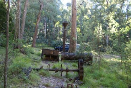
The terrain covered is quite hilly, and was extensively mined in the mid-1800s, with many points of interest.
An overview map, with some fine detail, is available from Visitor Information Centres in the region; more detailed maps, and descriptions, can be found via the Yack Tracks link shown below.
Yackandandah Visitor Information Centre
Intro Screen on a fresh browser page
COPYRIGHT © 1995-2020, Chris McLaughlin.