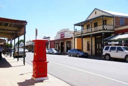
CHILTERN - MOUNT PILOT NATIONAL PARK
SCENIC DRIVE
(www.northeastvictoria.online)
TRAVELLING TIME: About three hours, depending on your interests.
DISTANCE COVERED: About 35km.
OVERVIEW MAPS: Rooftop, Beechworth - Albury - Wangaratta Adventure Map.
DETAILED MAPS: Rooftop, Beechworth - Albury - Wangaratta Adventure Map. A detailed map, cum brochure is also available from a downloadable PDF on the Parks Victoria website (see the link below). This shows the principal road network of the National Park, as well as the approximate location of the landmark features referred to in the description. Neither of these maps are 100% comprehensive, and the tour description should be followed closely to avoid making a wrong turn.
SHOPS and SERVICES: Chiltern has a small range of shopping and services.
ACCOMMODATION: Caravan Park at Chiltern (nicely located, close to the town centre and Lake Anderson); the township also has two motels and several B&Bs.
WHEN TO GO: Avoid any sustained wet weather, and any super-hot days.
ROADWAY DETAILS: A mix of bitumen, and generally good bush roads (albeit unsealed, and quite narrow in places). No problems in the dry for any vehicle with reasonable ground clearance.
OTHER INFO: An interesting part of the North-east, with a nice mix of history and scenery. As well as the Scenic Drive described here, there is an ’official’ forest drive promoted by the Shire, however the tour described here deviates slightly from the Shire’s. A brochure called Chiltern Forest Drive (the official tour) is available from Visitor Information Centres in the North-east. Distances quoted may vary by several kilometres from one vehicle to another.
With the tripmeter set to 0.00, the action starts by heading westwards away from the town centre, swinging left onto High Street, where it parts company with Conness Street at a y-junction.
The signpost at this point indicates that you are taking Chiltern Valley Road, and this leads past a story board detailing the history of the Black Dog Goldfields (Chiltern was formerly called Black Dog Township - see the Chiltern description for more details).
Once clear of the urban area, there are several groups of wetland areas to the left and right, these were all created by gold mining activities, and are a haven for waterbirds in an otherwise dry part of Victoria.
After about 2.7km, swing right at a t-junction, where Chiltern Valley Road makes an abrupt right turn. Immediately on the right at this point, Chiltern Valley No1 Dam is another relic from the gold mining era, and has a small picnic area alongside the waterfrontage.
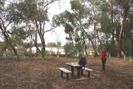
Continuing along Chiltern Valley Road, the five kilometre mark sees Chiltern Valley No2 Dam come up on the left, with a memorial to the 1836 expedition of Major Thomas Mitchell being straight-ahead at this point. The Dam has a short walking track, and is a popular area for bird watching.
Initial access is by pulling into the car parking area, just near the National Park sign. Leaving the hardware safely parked, Nankeen Track leads off into a box-ironbark woodland, and curves around the back of one of many mullock heaps to be found in the Chiltern area (a legacy of the gold mining).
After about 10 minutes, a small picnic area comes into view, and this is located alongside the dam waterfrontage, with a picnic table setting, as well as a nice bird hide.
After admiring the birdlife etc, you can return to the car park by retracing your steps, or by following a faint walking pad that leads off along the waterside from just near the bird hide.
Continuing on, with the Mitchell Memorial on your right, it is a further kilometre to where Marengo Road goes off to the right.
On the left at this junction there is a story board detailing the history of Chiltern Valley, a separate (and rival) township to that of Chiltern.
Marengo Road is unsealed, but like other bush roads on this tour, quite well graded - no problems unless you go too fast (if there is a dust cloud in the rear vision mirror, then you are going too fast).
Ignore all of the side roads, and follow Marengo Road through to a five way intersection at Durham Road, where you need to swing right onto the bitumen of the C377 (the Rutherglen - Chiltern Road).
Follow the C377 for a little over two kilometres, taking Donchi Hill Road (shown on some maps as Donkey Hill Road) into the open woodlands of the National Park.
Donchi Hill Road is very scenic, with great bushland views in every direction, and expectedly soon begins to climb up towards the said Donchi Hill. This leads to even nicer views, views of the distant high country, as well as the pastoral lands on the valley floor.
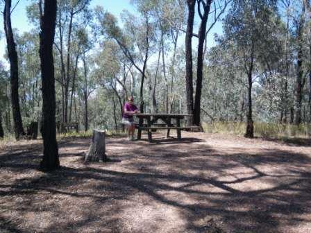
At about the 14.5km mark, there is a really nice picnic area (on the right) with expansive views all the way across the valley, and this is the perfect place to stop for morning tea or lunch.
Donchi Hill Road has now made a substantial swing around to the north-east, and meets up with the C377 at about the 16km mark.
Almost directly opposite this intersection, Depot Road leads off into the National Park once more; Depot Road is, in fact, a continuation of Donchi Hill Road, and is the route for today.
Swing left as soon as you leave the C377, and then veer right at a y-junction, following Depot Road upslope.
At a little over 19km, veer right at an un-signposted junction onto Mount Pleasant Road, following this through to the C381 (the Chiltern - Howlong Road). A very short distance on the bitumen then leads to the un-signposted Rileys Road going off to the left.
At about 22km, the Indigo Cemetery Road goes off to the left, and this leads to a small car parking area, with the Cemetery, and an associated story board, being a stone's throw away.
Return to Rileys Road, and continue in the same direction as before, veering right onto Greenhill Road after a few hundred metres.
At about 24.5km, veer right onto Magenta Road and follow this through to where Battery Hill Road goes off to the left. Keep right at this intersection, as well as at the y-junction that follows almost immediately.
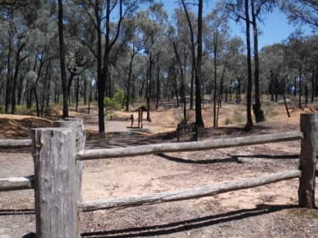
This now leads (after a few hundred metres) to the Magenta Mine Site, and a spacious car park.
The Mine Site has an excellent information shelter, and this details almost everything you always wanted to know about gold mining in the Chiltern area, and the Magenta Mine in particular.
Return to the Battery Hill Road intersection by retracing your steps (wheel tracks), and then follow Battery Hill Road for about a kilometre to where the access track to the State Battery is signposted off to the left.
The State Battery was constructed during the mid-1930s, and was intended to encourage gold mining during the Great Depression of that period. The Battery was abandoned in 1940, when more urgent tasks faced the nation.
It is now only a few hundred metres to the Chiltern - Barnawartha Road, with Chiltern being about three kilometres to the right, and the Frog Hollow Picnic Area being a short distance to the left.
If you are heading north after having completed the tour, then the Barnawartha Road leads to the small village of Barnawartha, with easy access from the village to a full interchange on the Hume Freeway.
Intro Screen on a fresh browser page
COPYRIGHT © 1995-2020, Chris McLaughlin.