DARGO HIGH PLAINS ROAD
(Dargo to the Great Alpine Road)
(www.northeastvictoria.online)
TRAVELLING TIME: Allow about three hours.
DISTANCE COVERED: 75km (Dargo to the Great Alpine Road); Dargo is about 70km north of the Princes Highway, about 90km from Bairnsdale and about 130km from Sale.
OVERVIEW MAPS: Spatial Vision, Touring the Victorian Alps.
DETAILED MAPS: Rooftop Maps, Bairnsdale - Dargo - Omeo Adventure Map. The VicMap 1:50 000 topographic maps for this tour are Cobungra and Steve; these are available in print, and GPS (digital), format.
SHOPS and SERVICES: Bairnsdale and Sale have a full range of shops and services, and there are plenty of fuel outlets in these towns, and on the Princes Highway. Waterford (on the Wonnangatta River, just before Dargo) has a general store (at the caravan park) and a fuel outlet. Dargo has a general store, and a fuel outlet. Once at the Great Alpine Road, turn right (south) for fuel and/or supplies at Mount Hotham, Dinner Plain and Omeo; turn left (north) for Harrietville and Bright.
ACCOMMODATION: Dargo has a range of accommodation options, including a motel and cabins (book at the Dargo Hotel for the cabins). There are several bush campsites on the Dargo High Plains, and some of these are detailed in the text. In general, the best camps are within the last 30km of the journey.
Water may be a problem in summer and autumn, and it is worth taking some extra supplies with you if you intend camping.
WHEN TO GO: Subject to seasonal road closure (notionally early June to late October); in any case avoid any super-hot days, and/or sustained wet conditions.
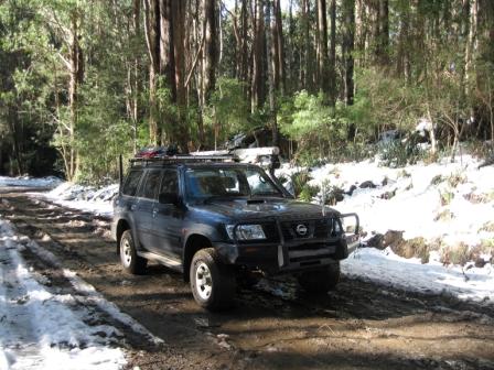
ROADWAY DETAILS: Mostly unsealed gravel road, with some steep climbs which are slippery in the wet. 4wd rated camper-trailers should have no problems, but take care on those tight bends. Note that the road is officially closed to caravans at all times of the year (however, the sign that says this does not have an owner; that is, it is not certain which authority placed these signs).
The roadway is sealed for about 27km from the southern end, then there is about 47km of gravel/cobble, then bitumen for the last kilometre to the Great Alpine Road.
OTHER INFO: A very scenic tour that leads from tall timber country to snowgums, alpine meadows and snow-capped peaks (in the spring). Distances are measured from Dargo township, and may vary by several kilometres from one vehicle to another.
If you are completing this drive in the opposite direction to that given here, take care at the junction of the Great Alpine Road, and the High Plains Road; it is poorly signposted, and it is an awkward turn.
This tour is one of several touring routes that can be used to access the North-east, and is a popular entree to the area for travellers from Gippsland.
The start of this great trip first involves getting to the small community of Dargo, accessible via Fernbank (that is, the Dargo turn-off on the Princes Highway) 38km east of Sale.
This joins up with the sinuous, but well surfaced, Dargo Road (C601).
Alternatively, take the C601 (the Lindenow Road) directly from just west of Bairnsdale, or Stockdale Road, and then Beverley Road from Stratford.
Dargo
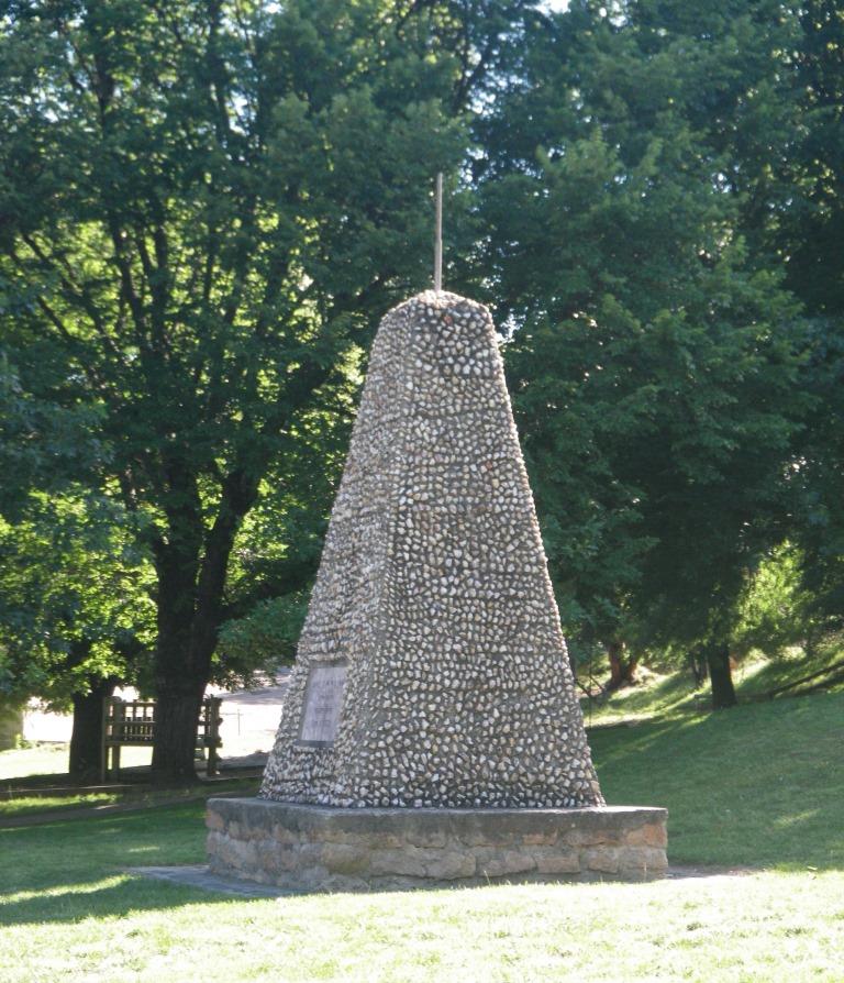
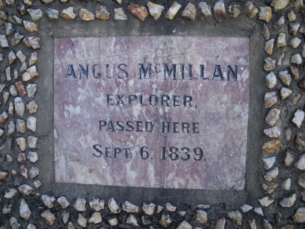
In 1839, explorer Angus McMillan became one of the first Europeans to enter what is now the Dargo the area and, on behalf of his employer, Lachlan Macalister, claimed a 16,000 acre pastoral run that was christened Dargo Hill. See the cameo of McMillan at the end of the main description.
A gold rush in the 1860s paved the way for the establishment of Dargo township (in 1864), and the town became a significant stop-over and supply base for the Crooked River, Grant and Talbotville Goldfields. When the gold petered out Dargo was the only settlement in the area to survive, a benefit of its mixed economy (gold mining, pastoral activities and timber getting).
One of the long term residents of the Dargo area, the Treasure Family, came to Dargo in 1878, and has been involved in local grazing enterprises since then.
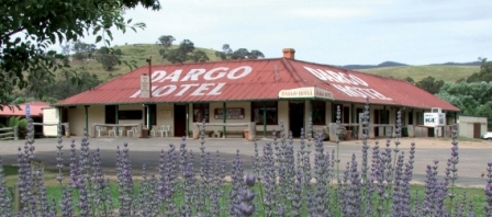
Present day Dargo has a general store, a fuel outlet, a winery, a hotel and a motel (the nearest caravan park is at Waterford, about 10km south of town). It makes a great base camp for touring in the area.
Leaving Dargo township, the road to the Dargo High Plains, and Mount St Bernard, leads north from town, firstly to Grant Junction (154km from town), and then begins a climb up to the Dargo High Plains, and snowgum country, via Mount Ewen.
Mount Ewen and the Dargo High Plains
Mount Ewen is one of the high points on this route, and often marks the impassable barrier of snow in wintertime. Just north of here there is a collection of huts known as Treasures Huts, and these were erected by the Treasure Family referred to above.
Assuming that you pass the barrier imposed by Mount Ewen, the Dargo High Plains are encountered on the northern side of the slopes.
There is a nice camping area (on the right) at about 19km from Dargo, and this is followed by the reliable natural spring known as Mount Owen Springs, with this feature also to be found to the right of the roadway.
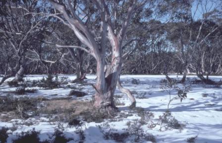
Continuing on, the Dargo High Plains have snowgum woodlands with many open meadows and provide a typical high country ambience.
A good campsite (on the right, with basic amenities and great views) comes into view about 29km from Dargo, and this is followed by another good place to camp, Gows Hotel Site (this is on the right, near the junction of the Dargo High Plains Road and Ritchies Road).
There is a well equipped picnic area (on the right) at about 53km, and this is quickly followed by a scenic lookout (also on the right); this area also has some handy flat ground that makes quite a popular camping area.
The High Plains Road then continues past Mount Freezeout (65km from Dargo, small picnic area on the right - great views) to its junction with the Great Alpine Road (B500) at Mount St Bernard (70km).
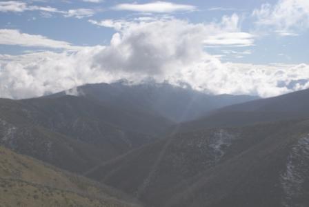
On the lead up to this junction there are many great views of the alpine ranges to the right; snow cover usually remains here well into November.
Once on the Great Alpine Road, turn carefully right (south) for Mount Hotham, Dinner Plain and Omeo; turn left (north) for Harrietville and Bright. More details in the description of the Great Alpine Road.
ANGUS McMILLAN
Angus McMillan (1810-1865) was born in Scotland, and migrated to Australia in 1838. Amongst his luggage, he had letters of introduction to the wealthy Captain Lachlan Macalister, who subsequently employed him on one of his properties, just west of Sydney.
However, McMillan was appalled at the treatment of convict labourers on this property, and moved to another location (also owned by Macalister), this time in the Monaro District of southern NSW. It was here that McMillan learnt much of his bush skills, and developed a keen interest of the geography of the known, and unknown, parts of his new surroundings.
On one of his forays, he glimpsed, and then visited parts of what we now call Gippsland, and wrote enthusiastically to Macalister about what he had seen. There was a significant drought in much of NSW at the time, so Macalister agreed to finance an expedition to explore the unknown areas of eastern Victoria, and to (hopefully) find a stock route to a southern port.
So, with a group of convicts, McMillan travelled from the Monaro, into the Omeo area in August 1839, continuing down into the Tambo Valley early in 1840. McMillan then found, and documented, the Nicholson, Mitchell, Perry, Avon, Macalister and Thomson Rivers, establishing two pastoral properties near the mouth of the Avon, one for Macalister, the other for himself.
The other notable explorer of Gippsland, Strzelecki, mostly followed McMillan’s footsteps, and was the first to use the word Gippsland after the current Governor of Victoria (McMillan wanted to call the area Caledonia Australis).
After this initial exploration, McMillan settled at Bushy Park, and was a prosperous man for many years, but fell victim to unwise speculation and bushfires.
In 1864, McMillan was offered the leadership of the State Government’s Alpine Expedition, the object of which was to open up tracks in the gold mining areas of Dargo, Matlock and Omeo. McMillan, and his party, set out from Stratford, and pioneered over 350km of new tracks, covering much of the catchment of the Avon, Mitchell and Thomson Rivers. However, towards the end of this arduous trek, a pack horse fell on McMillan, and he set out for home, only reaching Iguana Creek, where he died on May 18, 1865.
He was buried in the Sale Cemetery (on the east side of town), and was survived by his wife Christina (they were married in 1857) and their two sons, Ewan and Angus. The family were quite destitute at this time, and were to depend on the State Government for ongoing support.
McMillan pioneered much of what we now call Gippsland, and spent the latter part of his life as a popular member of society, making a significant contribution to his new found homeland, and its welfare. Although he accrued very little wealth from his farming endeavours, and resented the credit given to Strzelecki as an explorer of the area, his memoirs show that, like many migrants of that era, he had a great love for his adopted country.
There are many monuments to the achievements of McMillan throughout Gippsland - see the MonumentAustralia website (link below) for a full listing.
If you can locate a copy, more details of McMillan’s life can be found in "Angus McMillan : Pathfinder" by Kenneth Cox, 1973 and 1984.
Intro Screen on a fresh browser page
COPYRIGHT © 1995-2020, Chris McLaughlin.