THE GREAT ALPINE ROAD
WANGARATTA * BRIGHT * OMEO * BAIRNSDALE
(www.northeastvictoria.online)
WANGARATTA * BRIGHT * OMEO * BAIRNSDALE
TRAVELLING TIME: At least an hour to Bright, 3.5 hours to Omeo, 5 hours to Bairnsdale.
DISTANCE COVERED: 75km to Bright, 185km to Omeo, 305km to Bairnsdale.
BAIRNSDALE * OMEO * BRIGHT * WANGARATTA
TRAVELLING TIME: At least 90 minutes to Omeo, four hours to Bright, five hours to Wangaratta.
DISTANCE COVERED: 115km to Omeo, 225km to Bright, 305km to Wangaratta.
OVERVIEW MAPS: Touring map of Victoria.
DETAILED MAPS: non required, unless you are completing any of the longer bushwalks.

SHOPS and SERVICES: Wangaratta, Myrtleford and Bright are the main commercial centres of this tour north of the ranges. Wangaratta has a full range of shops and services, as does Myrtleford; Bright has a good range of shops and services; both Porepunkah and Harrietville have cafes, a general store, and a fuel outlet. See also the separate description of Mount Hotham and Dinner Plain.
On the south side; Omeo has fuel outlets, a small supermarket and some nice eateries; Swifts Creek has a mini-mart, a bakery, a cafe and a fuel outlet; Bruthen has a small range of shops and services, including a bakery, several cafes, a brewery (with cafe), a small supermarket and several fuel outlets; Bairnsdale has a full range of shops and services.
ACCOMMODATION: Wangaratta has a wide range of accommodation options, including a nice riverside caravan park. Myrtleford and Bright also have a wide range of accommodation options, including caravan parks. Porepunkah and Harrietville have very enjoyable riverside caravan parks, as well as motels and cabin accommodation. Freeburgh also has a riverside caravan park, as well as some holiday cottages.
Mount Hotham has a number of summertime accommodation options, but nearby Dinner Plain is a more popular place to stay in the warmer months. The Village has hotels, lodges and many neat and rustic cottages to stay in (all very reminiscent of the mountain cattlemen they are named after) with plenty of room to park vehicles nearby.
On the south side; Omeo has hotels, motels and the Omeo Caravan Park alongside Livingstone Creek.
Swifts Creek has a small caravan park, and some holiday cottages; Bruthen also has a small caravan park and a motel; Bairnsdale has a full range of accommodation options, including a nice riverside caravan park.
WHEN TO GO: Can be heavy going during the winter months due to snow cover; non-winter months are best.
ROADWAY DETAILS: Sealed road all the way, with some steep gradients between Harrietville and Mount Hotham; vehicles towing caravans, or trailers, may need to engage low range and/or a low gear.
OTHER INFO: A great road trip, and one that is not to be missed.
More details on the wineries referred to in the description can be found in the Winery Listing on the HomePage.
There are many walks described in this section - walks that can be completed as part of your journey along the GAR.
See also More bushwalks from the Great Alpine Road at the end of this description.
| Great Alpine Road | Section km | Total km |
| Wangaratta - Tarrawingee | 11km | 11km |
| Tarrawingee - Everton | 11km | 22km |
| Everton - Myrtleford | 23km | 45km |
| Myrtleford - Porepunkah | 26km | 71km |
| Porepunkah - Bright | 5km | 76km |
| Bright - Harriteville | 25km | 101km |
| Harrietville - Mount Hotham | 31km | 132km |
| Mount Hotham - Dinner Plain | 11km | 143km |
| Dinner Plain - Omeo | 42km | 185km |
| Omeo - Swifts Creek | 27km | 212km |
| Swifts Creek - Bruthen | 69km | 281km |
| Bruthen - Bairnsdale | 24km | 305km |
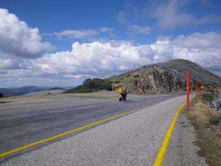
The Great Alpine Road (also known as the GAR) is one of the most popular tourist routes in the Alpine area, with a wide range of things to see and do, accompanied by some of the best alpine scenery in Australia. The GAR is quite steep, exposed and twisty on the Bright side of Mount Hotham, but is sealed all the way, and generally has a good surface.
The road is often closed by snow from late autumn through to early spring, and chains should always be carried at this time of year. During the official snow season, chains are compulsory for all vehicles, and they may be hired on a one-way basis from either side of the high country.
Distances quoted may vary by several kilometres from one vehicle to another. The description given here covers the route from north to south, but the drive is equally popular in either the north-south or south-north direction. See also the optional detours, and side-trips, shown after the main description.
Wangaratta
One of the first settlements in North-east Victoria was at Ovens Crossing, at the confluence of the King and Ovens Rivers. This was in the mid-late 1830s, and the township (re-named Wangaratta) has since grown into a very pleasing riverside town of 18,000 people; more details in the separate description of the township (see the Homepage).
The GAR starts on the northern edge of the Wangaratta CBD, turning east on to what used to be called the Ovens Highway, shortly after crossing the Ovens River at the Thomas Mitchell Bridge.
On the way out of town the Road passes through a small remnant section of red gum, floodplain, forest and the Hume Freeway interchange is then encountered about five kilometres out of Wangaratta.
This is quickly followed by the Firefighters Monument (on the right, near the Petticoat Lane intersection); the Monument commemorates the service and sacrifice of the ten volunteer firefighters who lost their lives in this area during the 1943 Bushfires.
This was one of several events that lead to the creation of the present day firefighting service, the Country Fire Authority (CFA) in 1945.
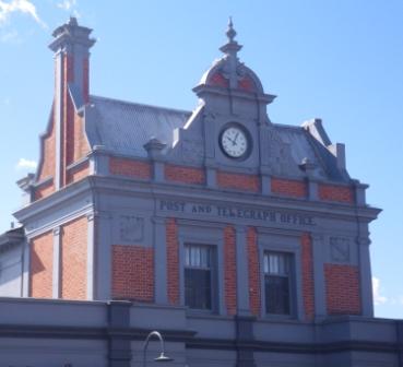
A plaque on the front of the former Post and Telegraph Office in Wangaratta remembers the three postal workers who died during this event.
There is very little dedicated parking near the monument, so take care with passing traffic if you want to stop at this point.
Tarrawingee
From the Monument It is then a further five kilometres to the small scattered settlement of Tarrawingee, and the turn-off to Beechworth and Yackandandah (the C315; see the Wangaratta - Beechworth Loop for more details). Just around the corner, the Plough Inn (National Trust classified) serves an excellent meal, but not every day of the week.
Adjoining the Hotel, Ladsons Store (also known as Carinya) is a two-storey brick building built in 1860 by Thomas Ladson. Ladson ran the store until 1880, and then sold the property to Hopton Nolan. Nolan passed the store on to his son Thomas, and since then the property has been home to four generations of Nolans. The buildings were classified by the National Trust in 1984, and in 1986, after a long period of neglect, the Nolan family decided to restore the landmark building to its original glory.
On the Myrtleford side of Tarrawingee, River Road leads down to the Ovens River, where River Road Reserve has good access to a nice beach area, making for a fairly popular riverside camping area. Access to the Reserve is by crossing over the bridge, and then swinging off to the left.
Also, not far out of Tarrawingee, there is a sign-posted turn-off to Tolpuddle Dairy, specialists in goat cheese products.
Everton
Continuing on, the roadway meanders its way up the Ovens Valley, calling at Everton where there is a popular caravan park (Everton Gardens Caravan Park) and an adjoining hotel (the Everton Hotel). Opposite the Hotel, a dedicated community group maintains an iconic bush shelter, with an up-to-date, and amusing theme.
Just prior to Everton, the Markwood Road leads off to the right to a small recreation reserve alongside the Ovens River. The reserve is accessible by swinging left just after crossing over the Ovens, leading to quite a popular bush camping venue.
The Murray to Mountains Rail Trail passes just to the north of Everton, at the former Everton Railway Station, and the Beechworth Rail Trail finishes its descent from Beechworth at the same place.
Everton is the valley floor for the rail trail from Beechworth; the run from Beechworth being mostly downhill. Having made it back down to the valley, the Murray to Mountains Trail provides a great way to continue down the Ovens Valley to Wangaratta, or up the Ovens Valley to Bright. See Bike Paths, Rail Trails and Cycle Routes on the Homepage for more details on biking in the North-east.
Continuing eastwards, one of many memorial cairns that celebrate the Hume and Hovell Expedition of 1824 is on the right, and a few kilometres later, the C524 (the Buckland Gap Road) goes off to the left.
This is just west of a location known as Taylors Gap (at the 34km mark from Wangaratta) and is a local high point on the Rail Trail, and where the Trail crosses over the Great Alpine Road (the actual railway used to pass under the GAR, via a tunnel at this point). See the Wangaratta – Beechworth Route (on the Homepage) for more details of the Buckland Gap Road.
Gapsted Wines is the next landmark, and is to the left at about 38km. Just beyond the winery, the C522 (the Snow Road) goes off to the right; see the separate description for details of this popular route.
Myrtleford
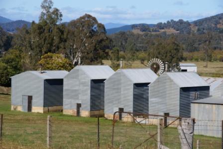
Myrtleford (45km from Wangaratta) is now close to hand, and on the way into town, there is a nice picnic area (on the right just after crossing Barwidgee Creek) with a nice example of a tobacco drying shed adjoining the car parking area. Prior to crossing Barwidgee Creek, there is a larger (less formal) picnic area, also to the right of the GAR.
A few hundred metres closer to the town centre, The Phoenix Tree, a wood carving of a bird enclosed in a red-gum tree root, can be seen on the left side of the roadway. The sculptor was Hans Knorr (1915-1988), a local artisan who was an internee at the Whorouly POW camp. The carving was unveiled in 1986.
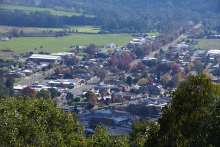
Myrtleford makes a good stop-over point as there is plenty to see and do. The town has a good range of shops and services, and has a pleasing, friendly atmosphere. Accommodation options include two caravan parks and several motels. Dining out is easy with hotels and cafes being in good supply.
Things to see and do in the area include some scenic drives (for example, the Buffalo River Valley and the Rose River - King River Loop); cycling the Rail Trail, walking around the slopes of Reform Hill, walking to the Hume and Hovell Memorial, and taking the riverside walking path. See the township description (on the Main Menu) for further details.
Ovens (Happy Valley) and Eurobin
The small settlement of Ovens is about six kilometres east of Myrtleford, and was an important staging post during the gold rush era. In present times Ovens is home to the Happy Valley Hotel (established 1854), a popular stop-over for users of the Murray to Mountains Rail Trail, and other travellers who appreciate good food.
The C534 heads off to the north from Ovens, and provides a scenic 55km link between the Great Alpine Road and the Kiewa Valley Highway that was completed in 1937.
Highlights along the way include great scenery and the Mount Buffalo Lookout (23km).
Note that if you are travelling from the GAR towards the Kiewa Valley Highway, then access to the Mount Buffalo Lookout is quite dangerous, as you will need to swing over double white lines on a blind corner to get to the parking area. It is better (safer) to drive past the Lookout, and then make a u-turn several hundred metres later, and return to the Lookout. A similar manoeuvre will also be required when leaving the Lookout.
The scattered settlement of Eurobin is a further 16km east of Myrtleford, and as well as being a stop on the Alpine Rail Trail, has imposing views of nearby Mount Buffalo, with several hop fields in the foreground. Just beyond Wobonga Lane, there is a nice roadside picnic area, to the left of the roadway.
Porepunkah and Bright
Continuing on, the small township of Porepunkah is 24km from Myrtleford, and, like Myrtleford, has a range of accommodation options, including several riverside caravan parks and motels.
Porepunkah town centre is slightly off the main road and has a hotel, fuel outlet, mini-mart and some nice cafes. The signpost at the town turn-off (a left turn immediately before the Ovens River Bridge) says Local Traffic only, but the turn-off does in fact lead (via back roads) to Bright; see the township description for more details.
The turn-off to Mount Buffalo National Park (see the Porepunkah description) is over the Ovens River, at the roundabout on the edge of the township.
Bright (five kilometres from Porepunkah) is a major tourist centre of the North-east, and was named after the nineteenth century political and social reformer, John Bright. It was originally settled in the 1820s, and at that time called Morses Creek. See the township description for more details.
The final approach to the high country starts with a smooth advance up the Ovens Valley Highway from Bright township. This is a great drive in springtime as there are spectacular views of snow-capped Mount Feathertop to the left (north) as you drive up the valley.
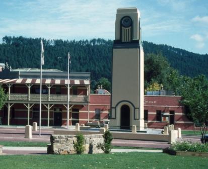
The Bright to Harrietville shared pathway (pedestrian/cycle) is intermittently visible to the left of the roadway. This 22km ride, which closely follows the Ovens River, incorporates several new river crossings, and finishes at Pioneer Park, Harrietville.
The small settlement of Germantown is at the junction of the Great Alpine Road and the C536 (the last link between the GAR and the Kiewa Valley Highway), a very scenic route that passes through Tawonga Gap; see separate description for more details.
Just beyond this intersection there is a pull-in (on the left) with some information boards that provide an overview of what to expect on the Great Alpine Road. As well, the pull-in offers some exceptional views of the not-too-distant high country.
Freeburgh Village is about three kilometres from the C536, and is a popular holiday destination, with several accommodation options including cabins, and a pleasing riverside caravan park.
The small settlement of Smoko is a further six kilometres up the Ovens Valley, and offers spacious bush camping alongside the Ovens River, with a toilet block nearby. Access to this delightful bushcamp is via Miley Road, but it is not sign-posted.
Freeburgh and Smoko both date from the gold rush era, when they were a bustle of frenzied digging and dredging.
Continuing on, there is a roadside rest area (on the left) at Bibby Lane, and this provides a picnic table with a riverside setting.
The township of Harrietville is now not far away, and a few kilometres prior to this, the Mountain Fresh Trout and Salmon Farm is on the left side of the roadway. This is an interesting place to go shopping (lots of trout and salmon goodies) as well as the opportunity to go fishing.
Harrietville
Harrietville is the last settlement encountered down-in-the-valley, and is a pretty sub-alpine village, with a variety of rustic accommodation, and some really nice eateries; see the township description for more details, and for some interesting local walks.
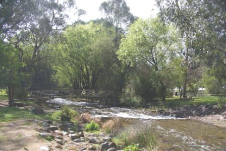
The GAR starts to climb soon after leaving Harrietville, and drivers need to tackle The Meg, and then enjoy several notable landmarks in the first hour of driving.
These include crossing the Great Dividing Range after about 20km, the St Bernards Hospice site (just before the Dargo Road - see History of the GAR below), the Dargo Road, Mount Smythe, CRB Hill, Dannys Lookout and many spectacular views.
In this alpine area, the Great Divide splits the catchments of the Ovens, Kiewa and Mitta Mitta Rivers (all tributaries of the Murray, flowing into the Coorong, about 2 300km away) from that of the Wonnangatta/Mitchell River, which flow into Bass Strait (via the Gippsland Lakes).
The Dargo Road is unsealed (but well surfaced) for most of the distance to Dargo township, the township taking about 90 minutes to reach from the Alpine Road (see the separate description for details).
See also, the description of the walk to The Twins - detailed in More Walks from the Great Alpine Road; this great walk starts from the junction of the Dargo Road and the GAR (see the link at the end of this file).
Mount Smythe [AWTGS-2]
Just beyond the Dargo Road, the slip road to Mount Smythe goes off to the left; this is a short walk that takes about 30 minutes all up (about 20 minutes there, about 10 to get back).
The views from Mount Smythe are exceptional, and it is well worth taking a break at this point to enjoy those views, and to read the storyboard about Robert Smythe (1830-1889).
Having safely parked your vehicle (there is not a lot of space at this point) and put on your walking shoes, and grabbed your trekking poles (there are some steep sections en-route to the summit) the track sets off, upslope, to some pleasing mini alpine meadows.
Onwards an upwards it goes, with some quite rocky sections to negotiate before reaching the storyboard, and the summit cairn in that order.
The storyboard makes for interesting reading, and gives much background info about Smythe, the local geology, surveying and the former (nearby) St Bernards Hospice.
The cairn was erected by surveyors Black and Allen during their survey of the Victorian High Country in 1868, but is in disrepair
Black and Allen had previously laid out the ‘straight section’ of the Victoria-NSW border (that is the section that leads from the headwaters of the Murray River, south-east to the coast).
It is thought that this piece of high ground was named after Smythe because of his work as Secretary for Mines, and as head of the Department of Mines (in Bendigo)
The Razorback and Mount Hotham
About seven kilometres after the Dargo Road (about 21km from Harrietville), the Razorback Walking Track is encountered on the left, directly opposite the Diamantina Hut. This leads (via Bon Accord Spur and The Razorback) to Mount Feathertop, 13km away; whilst all of the other routes to Mount Feathertop involve a long, and sustained, climb, this one basically follows an undulating ridge system.
It is a 26km loop to Feathertop, so it is a significant undertaking to tackle this walk [AWTGS-4]; however there is no impediment to just walking out along the ridge for a few kilometres, making sure that you keep right at the Bon Accord Track junction (Bon Accord Track leads downhill to Harrietville, and is to be avoided if you are heading for Feathertop).
Car parking is in short supply on the roadside near the Razorback, and it is best to swing off the GAR completely, and park near the Diamantina Hut before setting off on foot.
See More bushwalks from the Great Alpine Road (link below) and Bushwalks and Urban Walks on the main menu for more details of this iconic walk.
Back at the bitumen, the highest point of the GAR passes under your wheels; this is also the highest stretch of bitumen in Australia - see the storyboard at The Cross, on the left-hand side of the roadway.
After this, Mount Hotham Village soon comes into view, the Village being slightly to the east of the summit of Mount Hotham (1868m).
A short tunnel forms an informal gateway to the Village, the tunnel being part of an overpass built to provide safe passage over the roadway for skiers, and the mountain pygmy possum.
The village is very scenic, with great views out over the high country, and endless versions of alpine architecture to admire.
Whilst Hotham has many wintertime beds, some of the resort goes into hibernation for the other months of the year, and it is wise to check beforehand regarding accommodation or services out of season.
However, accommodation and services are always available - see the links at the end of this description.
There are several walks that can be accessed from the Mount Hotham area, and the Parks Victoria website has a downloadable brochure that provides a nice overview of these walks. For definitive descriptions of these, and many other alpine walks, see Bushwalks in the Victorian Alps by Glen van der Knijff (details at www.osp.com.au).
See also, the previously mentioned More bushwalks from the Great Alpine Road (link below) and Bushwalks and Urban Walks on the main menu. The Mount Hotham website also has some excellent information on the village, and its walking tracks (see link below).
Back on the Great Alpine Road, the southern side of Mount Hotham marks the start of a slow 55km descent to Omeo.
However the road remains well above the snowline for many kilometres after Mount Hotham, providing plenty of opportunity to admire and photograph alpine and sub-alpine vegetation.
The road passes through JB Plain, Whiskey Flat, Wire Plain, Mother Johnstons, Dinner Plain and many other colourful place names; favourite haunts of many a mountain cattleman.
The rustic huts of these legendary figures can still be seen, occupying sheltered locations amongst trees, or on the lee side of a ridge.
Wire Plain
The shelter at Wire Plain (on the right of the roadway) provides access to the Dargo Lookout Loop, a 2.5km walk to a good viewpoint over to the Dargo High Plains.
Once at the Lookout there is a picnic shelter, with table and bench seat to take a rest on, and to enjoy the views from. Allow about an hour for the complete loop.
Wire Plain was named by the early pioneers of this area, and was so-named as this was the first tranche of property to be enclosed by wire fences.
A memorial to one of the cattlemen of this area is almost directly opposite the Wire Plain shelter, that of Bill Howard. The hut (that is, the green hut) in this locale was built by the Howard family in the early 1960s.
Close at hand to the Dargo Lookout Loop, the adjoining Possum Flat Loop also covers about 2.5km, and branches off from the Dargo Lookout not far from the GAR.
A few kilometres further on, there is a nice picnic area at Mother Johnstons (on the right) about a kilometre beyond the Mount Hotham Resort boundary, with JB Plain following shortly after, and Dinner Plain being about 11km east of Mount Hotham.
Brabralung Trail [AWTGS-3]
The Brabralung Trail links Dinner Plain with Mount Hotham, and is an enjoyable (albeit, hard) 12km adventure, taking about four hours to complete. This excellent trail meanders through the snowgums, with many interesting features, and optional detours.
There are carparks at both ends, and intermediate access points, so if you don’t want to walk a 24km loop, you can just organise a car shuttle, and complete a shorter outing.
A detailed map, with lot of other handy information, is available on the Trail PDF, accessible from either the Hotham or Dinner Plain websites (see links below).
If you take some of the detours, then the one-way walk extends out to 18km+, and makes for a full day’s outing.
Tradition has it that that the walk starts off with a capuccino at the Hotham General Store and Cafe, and from here the walking track heads off to the south, towards Dinner Plain.
The General Store has a popular elevated patio, with great views of the surrounding range country, as well as an expert team of barriste, and barristi.
See More Bushwalks from the Great Alpine Road (link below) for details of the walk, and the detours.
JB Plain
JB Plain is the next landmark, and is home to a popular camping area, as well as access to Mount Tabletop (1600m).
JB Plain was named after cattleman Jim Brown, who brought cattle into the region in the 1850s. The hut located here is thought to have been constructed in the Swifts Creek area for forestry use, and was relocated to JB Plain in the 1970s by Cobungra Station, and the Bairnsdale Scout Group.
The hut is typical of many in the high country, with its vertical weatherboards, iron roof, and a large stone fireplace. The adjoining camping area is set amongst snowgums, and is a great place to spend a night.
Mount Tabletop offers some great views over the southern ramparts of the High Country, with access being via a 5.5km walk (each way), and an altitude change of about 400m. The walk is rated as AWTGS-3, and the overall time for this adventure is about five hours.
A formal set of walking shoes/boots are essential, and trekking poles are highly recommended.
As with the other walks in this area, a detailed map, and other essential information, is available on the Trail PDF, accessible from either the Hotham or Dinner Plain websites (see links below).
The action starts from the walks signpost at JB Plain, and from here you need to set off in a south-westerly direction, taking a footpad that follows an old fence line.
This leads across some extensive grasslands, with great views of the high country to the south.
At a faint sign saying ‘Mount Tabletop’ swing left, and continue over JB Plain to some gorgeous snowgum country.
The footpad now meanders through these snowgums, beginning a relentless descent to a creek.
From this low point of the walk, the route now begins a gradual climb up to the environs of Mount Tabletop, meandering extensively through some more snowgums.
Keep an eye out for the red track markers, and Mount Tabletop gradually comes into view.
There is a rocky outcrop on the left as you reach the summit, and this is a favourite place for lunch.
If you have the energy, it is feasible to walk over to the southern side of the Mount (for about 300m) so as to enjoy some great views of the not too far distant Wongungarra, and Wonnangatta, Valleys.
Inevitably, the return route is by retracing your steps back to JB Plain.
Dinner Plain
The excellent Dinner Plain Resort, and surrounding area, offers very good cross-country skiing in wintertime, and walking in summer.
There is a good range of eateries in the Village, and an extensive repertoire of places to stay, including dozens of charming alpine cottages.
See the Dinner Plain Accommodation website (link below) for details.
Notable walking tracks include . . .
Carmichael Falls are about two kilometres south of the village, and the reasonably well signposted track leads (mostly downwards) to a viewing platform, where you can see Precipice Creek leaping over an abrupt basalt ledge.
To get to the trailhead you need to cross over the southern curve of Grand Muster Drive, and then turn left onto Dinner Plain Track.
Alternatively, you can drive along Dinner Plain Track, with access to this roadway being just on the Hotham side of the Village.
In either case the trailhead is to the right, and has a well worn sign to announce its presence.
The walk is rated AWTGS-3, and covers about two kilometres, taking at least an hour to complete.
Room with a View is a moderately graded walk [AWTGS-3], through snowgum woodlands, taking about 90 minutes to complete.
The initial access to the walk is just to the east of the main entrance to Dinner Plain Village, alongside the signage that points to the Montane Loop, the Montane Walk (details in More Bushwalks from the Great Alpine Road - Link Below), as well as Room with a View.
Following the narrow footpad leads to another set of signs, with Room with a View being off to the left at this point. Further signage shows Room with a View as being off to the right, down a short, albeit steep, access point.
From here the narrow footpad leads through very pleasing snowgum woodland for several hundred metres, before encountering an unsignposted intersection.
Keep right here, and follow the track through the woodlands, and some exceptional views of The Razorback, Mount Feathertop, and the upper reaches of the Cobungra River Valley way down below.
The track now continues to swing over to the left, and there is a well placed bench for some morning tea, and some more great views.
From here, the track leads to the unsignposted intersection mentioned above, and from here you need to keep right, so as to retrace your footsteps back to the Great Alpine Road.
Just south of Dinner Plain, the Alpine School is on the right, followed by Flour Bag Plain and a memorial to the Rundells, a local pioneering family.
The highest airport in Australia (Mount Hotham Airport) follows just after this, and alpine meadows give way to smooth river basins as the headwaters of the Victoria River are entered.
This marks the start of a fairly steep, and twisty, 23km descent to Omeo.
On clear days there are excellent views of distant Mount Kosciuszko, and the Main Range of the Snowy Mountains off to the north (left), at a designated viewpoint can be found approximately seven kilometres before Omeo, on the left (north) side of the roadway.
A story board at the viewpoint details some of the geological, and human, history of these not too distant mountains.
There is plenty of parking space here, and this is a great place to take a break.
Victoria Falls
The Victoria River is a tributary of the Cobungra River, and was the site of the first Hydro-electric power station in Victoria. Although there is little remaining evidence of this enterprise, Victoria Falls Historic Park is worthy of a visit, and is clearly signposted off the Alpine Road (Victoria Falls 7km).
The power station itself is about seven kilometres from the Alpine Road, and is an easy drive, albeit narrow, and dangerously slippery after recent rain.
The designated (informal) camping area is about two kilometres from the turn-off, with several dispersed sites set amongst alpine grasses and open woodland, very pleasant indeed. A nearby information shelter offers interesting snippets about the power station, and how it operated.
A diversion weir above the Falls took water out of the river, which was then taken by open sluice to a small pondage above the power station (the former route of the sluice is now the road). Until production ceased in 1916, electricity from the station was transmitted to the Cassilis gold mine, 16km away.
Continuing down the road, there is a designated lookout point which offers views of the Falls, and the steep-sided gorge of the Victoria River. Although close to the Falls, the view from the lookout is somewhat oblique.
Better views can be obtained by leaving your vehicle at the lookout, and taking a leisurely stroll to the headworks of the power station further down the track. This takes about 30 minutes each way, and offers excellent views of the Falls, and very enjoyable walking.
The headworks consist of a small pondage and the intake works (now filled in). If you are feeling energetic, an extension of this walk leads down to the Cobungra River (very scenic) and the actual power station.
Returning to the Great Alpine Road, the expansive Cobungra Station is on the right; this is a landmark property, being Victoria’s largest cattle station.
On the final approach to Omeo, the GAR passes over Livingstone Creek, a waterway closely associated with gold mining in this area (see the Omeo description for more details). The bridge over the Creek is a modern era concrete and steel structure, but the first bridge here was built in 1921, and is still standing, off to the right as you drive over the Creek.
The original bridge was built in the art-deco style, and is a memorial to the servicemen and women of World War 1. The bridge, with its information board, can be viewed by making a careful right-hand turn into a parking area, on the Omeo side of the new bridge.
Omeo
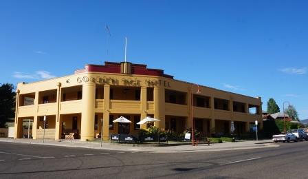
The friendly town of Omeo (population 300) has a wide range of accommodation in and around the town, including motels, two art-deco hotels, apartments, and a nice caravan park alongside Livingstone Creek.
Dining options include the hotels (The Golden Age, and the Hilltop) as well as the bakery, and two coffee shops.
See the separate description on the Homepage (link below) for more details on the township.
The distance from Omeo to Bairnsdale is about 115km, and although this can be covered in about one and a half hours, it is worthwhile allowing two hours for this part of the journey as the roadway is quite twisty in parts, and in any case it is a pity to rush through this scenic area.
Swifts Creek
From Omeo, the road begins a steady descent to Swifts Creek, 27km away. The scenery is very attractive in this section, with pleasing, rolling forested hills all around, and the Great Dividing Range is crossed (at 755m) about seven kilometres south of Omeo.
This marks the divide between the catchments of the Mitta Mitta River (a tributary of the Murray River) to that of the Tambo River (which flows into Bass Strait via Lake King).
The Tambo River rises in sub-alpine country near the Bowen Mountains east of Omeo, and flows south for about 150km to Lake King, part of the Gippsland Lakes System. Many millions of years ago, the Mitta Mitta River also flowed into the Gippsland Lakes, but a major geological fault occurred, forcing the Mitta Mitta to take a long sweeping path around to the north, thereby becoming part of the enormous Murray-Darling Basin, despite being so close to Bass Strait.
A nice detour can be made at the Bindi Road (a left turn) as this leads to Nullamunjie Olives; see their website for details of their opening times (nullamunjieolives.com.au).
About five kilometres before Swifts Creek, there is a nice picnic area on the east side, just near Sheep Station Creek
Swifts Creek is a small farming and logging community with a population of about 350 and has a small supermarket, a hotel, several cafes and a fuel outlet; a favourite stopping place here is the High Plains Bakery, the source of excellent bread and bakery items. Just to the north of the township (on the east side of the roadway) a historic marker commemorates the journey of explorer Angus McMillan in 1829.
See the cameo of this great adventurer at the end of this description.
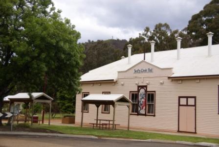
Accommodation in town includes a small, but pleasant camping area on the banks of Swifts Creek (turn east in the centre of town). Further out of town, the Miners Cottages offer excellent rustic accommodation in a great bush setting.
Back on the Great Alpine Road, Connors Hill Lookout is worthy of a quick stopover; this is about 35km from Omeo, and has a picnic setting, as well as an interesting storyboard explaining how the Omeo area first came to be settled by Europeans in about 1836.
The entry-exit point to the Lookout is not the safest, particularly if you are travelling northwards. In any case the views are not all that spectacular, and there are better picnic/rest areas close by.
Ensay South
The Road starts to follow the Tambo River after Swifts Creek, but leaves it temporarily from about 10km north of Ensay South, rejoining the river 10km later. If you prefer to follow the river, turn right (west) at Sandy Creek Road and take the old road through to Ensay South.
This small detour is well worth the effort as it is a very quiet roadway, with many opportunities for a riverside picnic. The Tambo is a very pretty river, and has excellent river scenery, with spectacular cliff-faces and small rapids; there are not too many places in Australia where a main road follows a scenic river, but this is one of them.
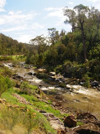
If you stay with the Great Alpine Road, all the way from Swifts Creek to Ensay South, the roadway straightens out considerably, and it is a smooth 16km drive. Ensay South has a few shops, a service station and a hotel, as well as another memorial to explorer Angus McMillan. The main part of the township is slightly off the main road.
Between Ensay South and Bruthen, the GAR follows the Tambo River Gorge very closely for about 20km, and then passes through superb hardwood forest. This is a beautiful drive in early springtime as the Tambo is showered in wattle blooms.
There are several riverside picnic areas where a pleasant coffee break can be enjoyed amongst the fragrance of wattle bloom and tea-tree, one of the nicest being on the east side, about 21km south of Swifts Creek.
Wattle Circle (about 24km south of Swifts Creek) is a large u-bend in the roadway, and is host to an informal picnic and/or camping area in dry weather.
At Tambo Crossing there is an information board (on the right when heading south) and this details the orginal crossing at this point, as well as a brief history of the Sir Walter Scott Hotel that stood on this site from 1890-1961. Tambo Crossing is also home to another historic marker (on the left when heading south) that commemorates the journey of Angus McMillan.
About 63km south of Omeo, there is a signposted turning to the east (left when heading south) that leads to a small picnic area, and a series of storyboards regarding the history of the GAR. The access roadway is signposted Mount Elizabeth and leads to a low level bridge over the Tambo, with the picnic area being just over the bridge, to the left.
Bruthen
The GAR leaves the Tambo River behind temporarily for the final run into the pleasing rural community of Bruthen (population 300). As you approach the main t-junction in Bruthen, the historic marker commemorating the journey of Angus McMillan is the last one along the GAR.
Bruthen has a nice bakery, and some equally nice cafes, and is a good place to take a break. Accommodation wise, there is a caravan park (alongside the Tambo) as well as a couple of B&Bs.
The final 22km of the Great Alpine Road lead from Bruthen to Bairnsdale (population 8,500), where the Great Alpine Road merges with the Princes Highway, just east of Bairnsdale. On the way there is plenty of rolling hill country to enjoy, with the occasional view of the not too far distant Gippsland Lakes.
Bairnsdale
The Bairnsdale area was first settled by Europeans in 1842, initially for pastoral purposes, but the discovery of gold in the hill country to the north of the settlement in the mid 1850s brought an influx of miners to the district, and demands for a more formal township. Bairnsdale was surveyed and declared a township in 1860.
The railway from Melbourne to Bairnsdale was completed in 1888, and this helped the town to further develop, as did the expansion of settlements, and holiday infrastructure, around the Gippsland Lakes.
The town has a great setting (just to the west of the Mitchell River) with a lovely main street, the centrepiece of which is a wide strip of greenery, with nicely manicured gardens. Other landmarks include the famous St Marys Catholic Church (built in 1913), with its amazing painted ceilings being completed during the depression years of the early 1930s.
Bairnsdale is a fitting place to end a great journey along the Great Alpine Road.
DETOURS FROM THE GREAT ALPINE ROAD
If you have driven the GAR a few times, there are several detours that can be taken from the main route that offer a bit of variety . . .
start the drive by taking the Snow Road exit from the Hume Freeway, rather than the GAR exit (see separate description of the Snow Road). This joins up with the GAR a few kilometres west of Myrtleford.
the Wangaratta - Beechworth Loop via Tarrawingee and Buckland Gap (see separate description)
Victoria Falls (see description above)
the Cassilis Gold Mining Area (see the Omeo description)
The Ensay South Detour (see description above)
HISTORY OF THE GREAT ALPINE ROAD
The Mount Hotham Road (or the Great Alpine Road, as it became known) originated in the late 1870s, and like many other alpine routes its impetus was gold. The road was originally surveyed to provide a mail and supply route between the Ovens Valley and the Omeo Goldfields.
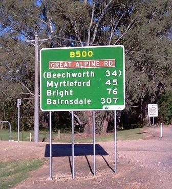
The Hotham route superseded Dungeys Track (a pack-horse route which followed the West Kiewa Valley for much of its distance to Mount Hotham) as the main road.
Whilst the new road was an improvement over the old, it had the misfortune to cut across some very exposed country, close to, and above the tree line at Mount St Bernard and Mount Blowhard. Even today closures of the Mount Hotham Road are still centred on this precarious sector. Much talk has been aired about the possibility of re-routing the road but the snow ploughs still battle it out year after year. One low-level proposal was for a short-cut from Little Mount Blowhard, across the headwaters of the Dargo River to pick up the existing road south of Mount Hotham.
The Hotham Road was proclaimed a tourist road in 1936, but official snow clearing did not begin until the early 1950s. However, even with snow clearing, the road still came under criticism and the southern approach (from Omeo) was upgraded in order to (hopefully) provide all-weather access.
The southern approach has the advantage of using up all of its steep gradient well below the snowline, and of being in shadow snow conditions, (snowfalls being much less voluminous south of Mount Hotham than north of the resort). Because of these differences in local weather conditions and topography, Hotham, more by luck than design, is rarely totally isolated.
After the road from Omeo to the Ovens Goldfields had been surveyed and constructed the government authorised the surveying of another alpine road, this time from Dargo through to the Ovens Valley. The surveyor was Angus McMillan, whose chosen route brought the Dargo Road into contact with the Omeo Road at Mount St Bernard.
As the intersection of two busy trade routes, 20km from Harrietville, Mount St Bernard became the site of a few hostelries, the most well-known of these being the St Bernards Hospice. The Hospice was originally known as Mother Morells, and was built in 1863 of timber with a shingle roof.
Mother Morells passed into the hands of William Boustead and the building became known first of all as Sailor Bills (Boustead was previously a sailor) and eventually as St Bernards Hospice.
Descendants of Sailor Bill ran the Hospice until its destruction by fire in 1939. It was a well-known landmark both for its design and for its hospitality; a memorial cairn to the Hospice can be found on the roadside, about 30m towards Bright from the Dargo Road.
The development of a ski-resort at Mount Hotham dates from the 1920s. At this time W B (Bill) Spargo obtained permission to use one of the Country Roads Board (CRB) resthouses along the Alpine Road as a guesthouse (the Board had built a series of resthouses along the tortuous route for their patrolmen).
Timber framed, sheet covered shelters were erected at Blowhard and Diamantina (on the Harrietville approach to Mount Hotham) and at Dinner Plain and Whiskey Flat on the Omeo approach.
A more elaborate, but still rustic, shelter was erected in 1924, on the bottom slopes of Mount Higginbotham, opposite Mount Hotham. This solid stone cottage became known as Hotham Heights, and could accommodate 20 people.
The problem of trying to run a patrolmans hut, and a guesthouse, became apparent after the rise in popularity of skiing in the 1930s and in 1933 the CRB handed the Hotham Heights Chalet (as it had become known) to Victorian Railways.
The Railways were to run the Chalet as part of a network of alpine accommodation enterprises (the other two were the Mount Buffalo Chalet and Feathertop Bungalow).
Plans to further expand the Hotham Heights Chalet were checked by the disastrous bushfires of January 1939. Black Friday (13/1/1939) claimed the Hotham Chalet, Feathertop Bungalow and the St Bernards Hospice. Of these only the Mount Hotham accommodation was reinstated, and this in record time ready for the 1939 ski-season, which perversely lasted well into December of that year.
In the early 1950s the Chalet was sold to the Ski Club of Victoria for £8000. A name change (to Hotham Heights Hotel) occurred in 1955 when the Chalet became licensed, and after many additions the building survived until 1976 when it was accidentally burnt down.
The Mount Hotham Resort is still on the same part of the mountain as the original shelter and a wide range of excellent cafes, restaurants and accommodation have clustered around the original CRB resthouse.
The last two big events in the life of the Great Alpine Road, were firstly to be named as such (this was in 1995) and secondly, the entire length of the roadway was sealed; this was in 1998, with the last unsealed section being between Harrietville and Mount Hotham.
CHARLES HOTHAM
Mount Hotham, and Hotham Heights were named for the former Victorian Governor, Sir Charles Hotham – the second such appointee after Victoria separated from New South Wales in 1851.
Hotham was born in Norfolk, England, and went to sea at an early age. A self-made man, with no ‘establishment’ connections, Hotham rose through the Royal Navy ranks, and amongst other adventures was heavily involved in suppression of the slave trade out of Africa.
His appointment as Governor came in the lead-up to the uprising at the Eureka Stockade (1854), and he was criticised by some for his handling of that event.
However, he is also credited with having helped heal the social wounds of the uprising.
Hotham passed away in November 1855 (of pneumonia), a few days shy of his 50th birthday.
[See Shirley Roberts book ‘Charles Hotham - A biography’ for more details of Hotham’s busy life.]
ANGUS McMILLAN
Angus McMillan (1810-1865) was born in Scotland, and migrated to Australia in 1838. Amongst his luggage, he had letters of introduction to the wealthy Captain Lachlan Macalister, who subsequently employed him on one of his properties, just west of Sydney.
However, McMillan was appalled at the treatment of convict labourers on this property, and moved to another location (also owned by Macalister), this time in the Monaro District of southern NSW. It was here that McMillan learnt much of his bush skills, and developed a keen interest of the geography of the known, and unknown, parts of his new surroundings.
On one of his forays, he glimpsed, and then visited parts of what we now call Gippsland, and wrote enthusiastically to Macalister about what he had seen. There was a significant drought in much of NSW at the time, so Macalister agreed to finance an expedition to explore the unknown areas of eastern Victoria, and to (hopefully) find a stock route to a southern port.
So, with a group of convicts, McMillan travelled from the Monaro, into the Omeo area in August 1839, continuing down into the Tambo Valley early in 1840. McMillan then found, and documented, the Nicholson, Mitchell, Perry, Avon, Macalister and Thomson Rivers, establishing two pastoral properties near the mouth of the Avon, one for Macalister, the other for himself.
The other notable explorer of Gippsland, Strzelecki, mostly followed McMillan’s footsteps, and was the first to use the word Gippsland after the current Governor of Victoria (McMillan wanted to call the area Caledonia Australis).
After this initial exploration, McMillan settled at Bushy Park and was a prosperous man for many years, but fell victim to unwise speculation and bushfires.
In 1864, McMillan was offered the leadership of the State Government’s Alpine Expedition, the object of which was to open up tracks in the gold mining areas of Dargo, Matlock and Omeo. McMillan, and his party, set out from Stratford, and pioneered over 350km of new tracks, covering much of the catchment of the Avon, Mitchell and Thomson Rivers. However, towards the end of this arduous trek, a pack horse fell on McMillan, and he set out for home, only reaching Iguana Creek, where he died on May 18, 1865.
He was buried in the Sale Cemetery (on the east side of town), and was survived by his wife Christina (they were married in 1857) and their two sons, Ewan and Angus. The family were quite destitute at this time, and were to depend on the State Government for ongoing support.
McMillan pioneered much of what we now call Gippsland, and spent the latter part of his life as a popular member of society, making a significant contribution to his new found homeland, and its welfare. Although he accrued very little wealth from his farming endeavours, and resented the credit given to Strzelecki as an explorer of the area, his memoirs show that, like many migrants of that era, he had a great love for his adopted country.
There are many monuments to the achievements of McMillan throughout Gippsland - see the MonumentAustralia website (link below) for a full listing.
If you can locate a copy, more details of McMillan’s life can be found in "Angus McMillan : Pathfinder" by Kenneth Cox, 1973 and 1984.
In 1988 a 210km long distance walking track was created in honour of McMillan's adventures. This great walk leads from the junction of the GAR and the Victoria River Track, eastwards to the small community of Woods Point.
Up-to-date details can be found in the excellent guide book McMillans Walking Track, produced by John Chapman and the Ben Cruachan Walking Club (www.bencruachanwalkingclub.com; link below) in 2020.
MORE BUSHWALKS FROM THE GREAT ALPINE ROAD
As well as the walks already described as part of the main text, the walks detailed via this link are for those travellers with plenty of spare time, and a sense of adventure. The longer walks require formal walking shoes/boots, and trekking poles.
More bushwalks from the Great Alpine Road
Wangaratta - Beechworth Loop (via Tarrawingee and Buckland Gap)
OMEO (includes Oriental Claims Historic Area and Justice Precinct)
Omeo Visitor Information Centre
Copyright © 1995-2020, Chris McLaughlin.