MOUNT BEAUTY - OMEO
via Bogong Village, Falls Creek
and Bogong High Plains
(www.northeastvictoria.online - smartphone site)
TRAVELLING TIME: 4-5 hours, depending on your interests.
DISTANCE COVERED: 115km to Omeo (Mount Beauty to Falls Creek is about 33km, the Omeo Highway about 75km).
OVERVIEW MAPS: Spatial Vision, Touring the Victorian Alps; or a good touring map of Victoria.
DETAILED MAPS: Spatial Vision, Bogong Alpine Area.
SHOPS and SERVICES: Mount Beauty has a good range of shops and services, as well as several fuel outlets. En route, Bogong Village has a lakeside cafe, and Falls Creek has a supermarket and several cafes. At the finish, Omeo has a range of shops and services, as well as fuel outlets.
ACCOMMODATION: Mount Beauty has a good range of holiday accommodation, including motels, a riverside caravan park, and several other excellent choices.
On the way to Falls Creek, there is cottage accommodation at Bogong Village; and at Falls Creek itself, there is a wide range of accommodation on offer during the snow season. Things go a little quieter during the warmer months, and you need to make advance bookings for any accommodation at these times.
On the Bogong High Plains there are campsites at Pretty Valley, Langford West, Raspberry Hill and Bucketty Plains; the banks of the Mitta Mitta River also offer several excellent bush camping sites; see the text for details of all of these options.
The excellent Blue Duck Inn (at Anglers Rest, on the Cobungra River) has motel style cabins. Click here for the Blue Duck Inn website.
Omeo has motels, two hotels, apartments and the Omeo Caravan Park alongside Livingstone Creek. Click here for the Omeo Caravan Park website.
WHEN TO GO: Very scenic in the spring, particularly at wattle time, but any of the warmer months are enjoyable. Wildflowers are usually at their peak in January. The route is not passable beyond Falls Creek during winter due to gate closures, and snow cover.
ROADWAY DETAILS: A good bitumen surface, with some tight bends on the Mount Beauty and Omeo sides, and some steep sections on the Omeo side; overall, this route is not suitable for medium/large caravans, large motorhomes or any large vehicle.
During the official snow season, chains are compulsory for all vehicles travelling to Falls Creek, and if necessary may be hired from Mount Beauty (the road is closed to all traffic during winter).
The road is normally quite clear of snow outside of late autumn/winter/early spring.
OTHER INFO: One of Victoria’s best high routes; great scenery, plenty of interest and many great bushwalks to choose from walks that can be completed as part of your journey, and whilst staying overnight en route.
See also More Bushwalks on the Bogong High Plains at the end of this description.
Distances quoted may vary by several kilometres from one vehicle to another. The route described forms a key part of the Bogong Alpine Way. See also, Useful Links at the end of this description.
This description covers some very interesting walks; click on the following list for details.
Circuit of Marum Point [AWTGS-3]
Falls Creek Aqueduct [AWTGS-2]
Falls to Hotham Alpine Crossing [AWTGS-4]
Heathy Spur and Two Huts [AWTGS-3]
Mount Hotham to Falls Creek [AWTGS-4]
Pretty Valley to Jaithmathang [AWTGS-4]
Pretty Valley to Tawonga Huts [AWTGS-3]
Ryders Huts/Campbells Yards [AWTGS-3]
Wallaces Hut/Heritage Trail and Cope Hut [AWTGS-2]
This is one of the most interesting and impressive crossings of the high country in Victoria. The route is now completely sealed, but the roadway from Falls Creek onwards is officially closed from late autumn through to early spring because of snow cover.
On the Mount Beauty side, the road closure takes place at a locked gate, well into the snowline, between Falls Creek ski-village and Rocky Valley Dam; on the Omeo side, the closure takes place just below the snowline.
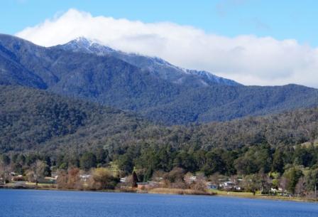
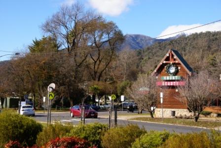
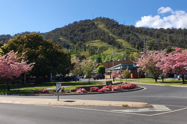
Mount Beauty is located on the Kiewa River, set in a beautiful valley, with excellent views of Mount Bogong (1986m) the highest peak in Victoria. The township has an array of shops and services, as well as motels and some restaurants; see the separate description for more details.
With the tripmeter set to zero, and heading south out of Mount Beauty, this route is known as the Bogong High Plains Road (as well as the Bogong Alpine Way) and starts its climb up to the high country before it is even out of sight of Mount Beauty. It twists and turns up the East Kiewa Valley, providing many spectacular views of surrounding peaks, including Mount Bogong.
Cranky Charlie is a notable u-bend on the High Plains Road, and is located at the base of the access road to the West Kiewa Power Station. The corner is named after a (supposedly) cranky local resident, who owned the land in this area prior to the hydro-scheme going through. The u-bend was built so as to allow large trucks the room to swing around onto the access road to the West Kiewa Power Station.
The road to the power station splits shortly after leaving the main road, with the left side leading upslope to the signposted Big Hill Lookout - a great place to enjoy some views of the Kiewa Valley.
Clover Dam, Bogong Village and Lake Guy
Clover Power Station and its water storage (Clover Dam) receive outfall from the East Kiewa based power stations, and is one of the smaller hydro-electric power stations in Australia. The power station, and water storage, are visible down to the left, alongside one of the straightest pieces of bitumen in the high country. All of this interest being about nine kilometres from town.
Clover Arboretum is just beyond Clover Dam, and marks the area where a small village was built in the late 1940s. The village housed workers employed on the Kiewa Scheme, most of them immigrants from war-torn Europe. Nostalgia for the old country led these hard workers to plant the town gardens with lots of European trees and shrubs. Whilst the buildings are long gone, many of the original plants remain, albeit severely battered by successive bushfires.
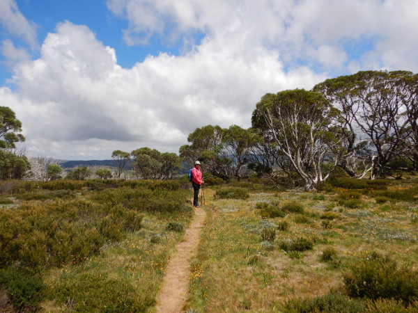
Bogong Village is about 14km out of Mount Beauty, and is very picturesque, making it well worthwhile turning off the main road so as to enjoy the village’s tranquil atmosphere; it has a great lakeside setting alongside Lake Guy.
Lake Guy is a small storage of the Kiewa Hydro-electric Scheme, the water level rising and falling to meet the operating requirements of the Hydro Scheme. In hot weather the grassy banks near the gardens and the picnic area are pleasant resting spots.
A walking track [AWTGS-2] winds around the lake, through to the dam wall, and gives very scenic views of the lake and village.
To enjoy this walk, leave your vehicle opposite the Cafe, or near the well laid out picnic/barbeque area. To get your bearings, turn and face the lake, and then head off to your right through the picnic area. This soon leads to a well formed, signposted, walking track which clings to the hillside, providing excellent views of the lake’s waters through the trees.
The track passes the new Bogong Power Station, and just beyond this semi-underground structure there is a bridge over the Pretty Valley Branch of the East Kiewa River. Although it might look inviting, the waters of this stream are always numbingly cold.
Once over Pretty Valley Stream, turn left and take time to enjoy the coolness of the forest, and the sound of rushing water.
Tables and chairs are located nearby, so there is the opportunity to take a break at this point. This area is particularly scenic in autumn, as the trees produce a wide range of browns and yellows.
The track off to the right splits, and the right side of this split leads to the Rocky Valley Stream walks (see later on in this description) whilst the left leads to the Rocky Valley gauging station via a poorly maintained bush track (30 minutes return, excellent rocky scenery).
Staying with the main track, cross over Rocky Valley Stream (another tributary of the East Kiewa River) via a small footbridge, and keep generally left as the track continues.
The tracks heading off to the right lead further into the forest, and the headwaters of Rocky Valley Stream.
The track meanders around the lake giving further excellent views of the Lake’s waters and Bogong Village which is now on the opposite shore.
There are a couple of small creeks to cross before the dam wall is reached.
Just before the dam wall, the track drops down, so as to lead through the concrete heart of this interesting structure, emerging at the opposite bank.
Here you need to take the stairway, off to the left, and then follow a well maintained walking path back to the car park.
[If the walk through the dam wall is closed, then the return route is by retracing your steps, without descending down to the innards of the dam.]
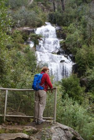
Fainter Falls
Back on the Bogong High Plains Road, the climb continues for a short while before dropping down briefly to cross the Pretty Valley Branch of the East Kiewa River.
This is an intriguing alpine stream, one of few Australian rivers where snowdrifts float downstream.
Just before the bridge, Fainter Creek, home to Fainter Falls, joins Pretty Valley Stream.
Getting to the Falls is quite easy [AWTGS-2], and well worth the effort.
Walking time is about fifteen minutes, with the trail head being clearly signposted on the right of the roadway, about 100m before the Bridge.
There is plenty of car parking spaces opposite the trail head, and this is a popular stop-over.
The Falls start life around the high country known as Fainter North (1845m) and Fainter South (1883m), giving then a small, but very productive catchment.
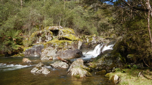
Rocky Valley Stream
This section describes optional walks down to Rocky Valley Stream that are rated as AWTGS-2; they require a good set of formal walking shoes/boots, as well as a set of trekking poles.
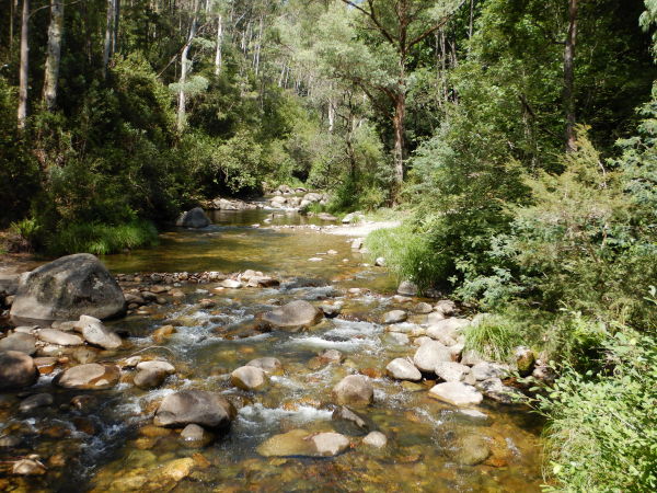
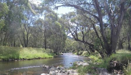
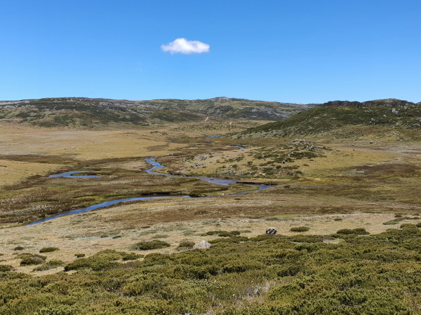
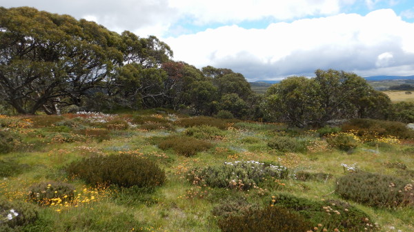
Rocky Valley Stream forms a major part of the Kiewa River, and rises in the heart of Victoria’s Alpine Region. Its catchment area includes much of the Bogong High Plains, as well as parts of Mount Bogong itself. Rocky Valley Stream is particularly scenic in this section, and is very photogenic.
Access to the start of these walks is by continuing up the Bogong High Plains Road from Pretty Valley Stream, up over the next ridge, where there is a small roadside pull-in on the left.
There are three tracks leading off from the pull-in; starting from the uphill (Falls Creek) end these lead to:
Rocky Valley Stream (45 minutes each way)
Rocky Valley Stream (30 minutes each way)
Bogong Village (45 minutes)
[The last named track can be used to link up with the Lake Guy walk already described, but take care as this is quite a steep track, with a bitumen base, and is slippery underfoot.]
The first track leads off to a particularly scenic section of Rocky Valley Stream, following a little used forestry track (the track is gated, and locked, at the start so there is little chance of meeting any vehicles).
Having kept straight ahead at a steep hairpin bend to the right after about 900m (this leads to Howmans Gap), the track provides enticing views of Rocky Valley Stream, before actually arriving at the water.
Although this walk can be completed at any time of the year, springtime is probably the best. Walking in springtime has several advantages, such as wattle blooms, and generally higher water levels.
However, at any time of the year, this is a very enjoyable walk, and it takes about 45 minutes to reach the water. The return route involves retracing one’s steps back upslope to the Bogong High Plains Road.
The second of the three access tracks, like the first is gated and locked, and provides about 30 minutes of pleasant walking before reaching Rocky Valley Stream. The contact point with the stream at this point is several kilometres downstream of that reached in the previous walk.
Once at the water there is a small grassy area, and extensive rocky cascades, providing a pleasant refreshment venue. The finish of the walk involves retracing your steps uphill.
Howmans Gap
The next landmark is a sweeping bend, known as Turnback Creek (at 35km) and the private access road to McKay Power Station. Just beyond Turnback Creek, Howmans Gap comes into view.
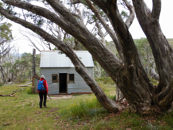
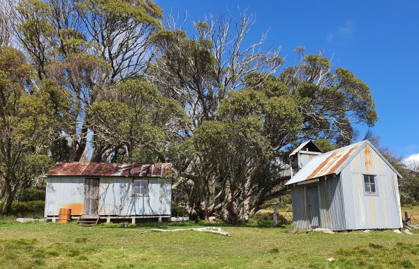
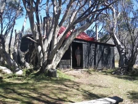
Howmans Gap is home to Howmans Camp, originally a cattleman’s hut, later a housing complex for workers on the Kiewa Hydro-electric scheme, and now an accommodation and activities centre operated by the YMCA. The Howman Family ran cattle on the high plains from about 1876 onwards, and built six separate huts around the Falls Creek and Mount Bogong areas; none of them are left standing.

The Packhorse Heritage Trail [AWTGS-2] is a newly developed trail that leads from Howmans Gap to Falls Creek Village, utilising a former packhorse trail that cattlemen once used to access the Bogong High Plains.
This is a four kilometre walk, and takes about 90 minutes each way - it leads into Falls Creek Village, just near Gully Carpark. More details at www.fallscreek.com.au/PackhorseHeritageTrail.
Another item of interest in this area, is to walk from the accommodation complex down to Rocky Valley Stream (the scenic waterway that notionally flows out of Rocky Valley Dam; this is a very scenic alpine stream, with crystal clear water and endless cascades).
Check in with management at Howmans Gap, and then follow the signage down to Rocky Valley Stream (quite steep, but well engineered).
Once at the stream frontage, it’s time for morning/afternoon tea, and then to face the music, and head back uphill.
Allow about 90 minutes for this AWTGS-3 foray, and take care on the single file sections.
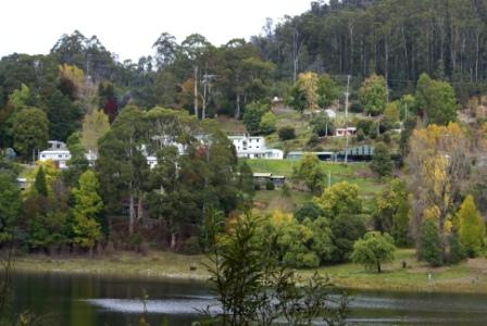
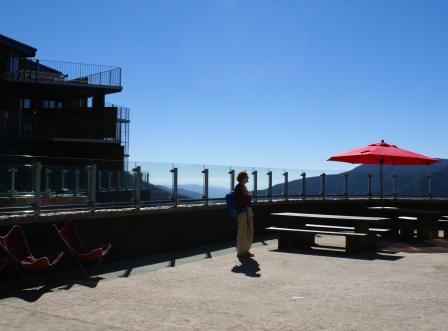
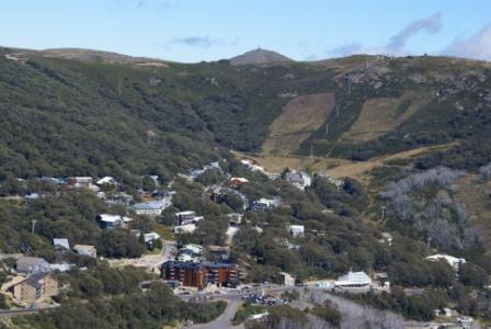
Falls Creek Ski Village
Falls Creek ski-village comes into view shortly after Howmans Gap (at about the 32km mark from Mount Beauty) and is accompanied by an abrupt change in vegetation, mountain ash and alpine ash forests giving way to snowgum woodland as you arrive at the village.
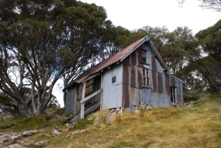
The first ski accommodation in the Falls Creek area was right on the Bogong High Plains, and not in the present comparatively sheltered location. Cope Hut (built in the late 1920s) was one of the first ski accommodations in the area, whereas the village itself has its origin in a project by the Ski Club of Victoria to build a War Memorial clubhouse, with access to reasonably steep slopes for downhill skiing and undulating terrain for cross-country skiing.
The site chosen was in the Ruined Castle area, north of the present day ski-village, however construction works for the Kiewa Hydro-electric Scheme precluded use of this site for several years, and in 1946 an alternative site between Frying Pan Spur and Ruined Castle Spur was selected.
Construction soon began, and by 1960 Falls Creek could offer all the comforts of the high life.
The resort has a well integrated and extensive array of lifts for downhill skiers, and the Bogong High Plains with its impressive cross-country ski trails adjoins the village.
Falls Creek is the typical Australian alpine village - a mix of rustic chalets, the steel and concrete moderns, and the ubiquitous snowgum woodland.
Whilst the village is very busy during the snow season, things go a little quieter during the warmer months, but it’s still a very enjoyable place to spend an active holiday.
Things to do include bushwalking, mountain biking, boating (on Rocky Valley Dam) and sightseeing.
The village has a supermarket, cafes, bars and restaurants, and there is a wide range of accommodation on offer.
See the separate description of the village (link below) for more information on this great place.
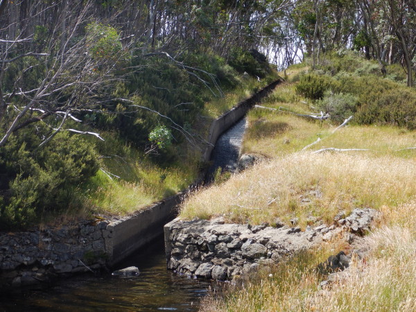
Falls Creek Aqueduct
The aqueduct was built as part of the water supply for the original village, and traps, and transports, water from several natural springs on the hillslopes above the village.
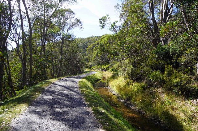
This is a there and back walk, and there are several access points from near the upper part of the village, notably Schuss Street and Parallel Street.
In both cases, a short slope leads to a nicely maintained gravel path that curves around the southern, and western, slopes above the village.
There are many great views to enjoy, not only of the village, but also the high country beyond.
The trail covers about three kilometres, and on the west side finishes where the steep trail known as "Home and Away" heads off to the left; on the south side it finishes at the bitumen of the Bogong High Plains Road.
It's possible to follow the continuation of the aqueduct walk on the south side - by carefully crossing the High Plains Road.
This leads down to the lower parts of the Rocky Valley Dam, and thence to the start of the Roper's Lookout Track.
In either direction, the aqueduct is a popular walking/jogging track, and is rated as AWTGS-2.
Pretty Valley and Mount McKay
Soon after leaving Falls Creek the route crosses the wall of Rocky Valley Dam, and swings south-east for its traverse of the Bogong High Plains. Prior to making this traverse the short side-trip to Pretty Valley beckons. This is a signposted turn-off (Pretty Valley Road) just before the dam wall, and leads west for about four kilometres to the car park at the upstream end of the Pretty Valley pondage.
Note that there is little in the way of signage on this route (the only signs are for wintertime skiers) and that after leaving the bitumen (this is an unsealed detour) you need to keep right at the first junction, and then keep left at the next three intersections for Pretty Valley. Also, this route is quite narrow, and not suited to motorhomes, nor medium/large caravans.
About a kilometre before the car park, the Pretty Valley camping area is encountered; this is alongside Pretty Valley Hut, and the camp sites are nicely located amongst the snowgums.
A variation of this route leads to Mount McKay; this is an un-signposted turn-off the Pretty Valley Road, and leads for about a kilometre to the car park near the top of the mountain. Here a short stroll leads to an observation hut, and some amazing views of Rocky Valley, the Bogong High Plains and all of the surrounding high country.
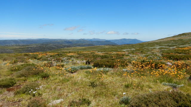
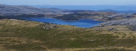
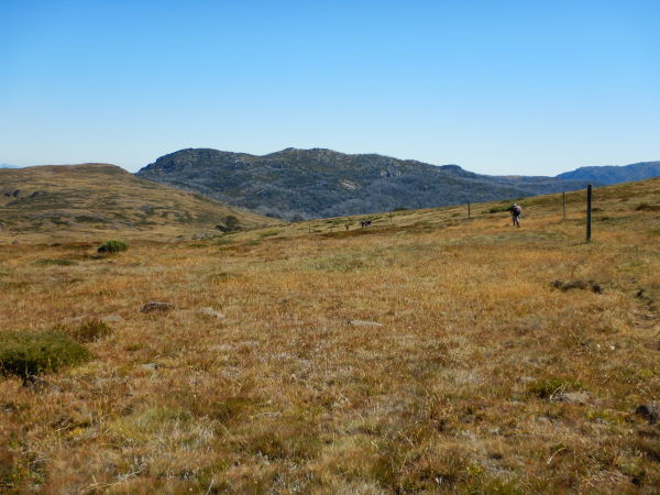
Bogong High Plains
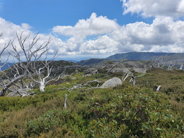
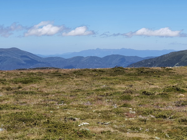
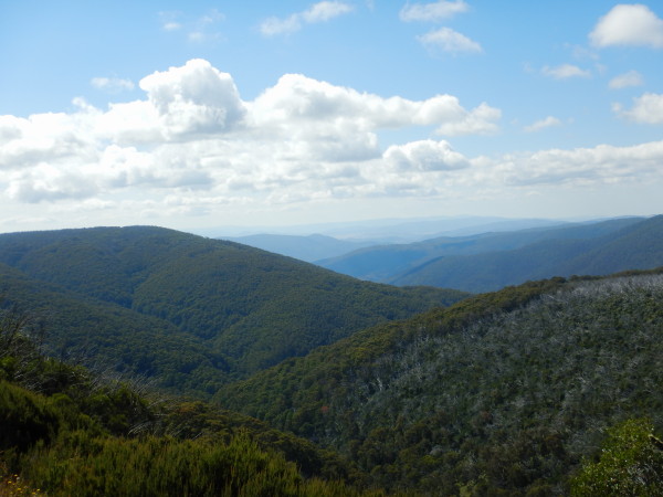
Back on the main route, the Bogong High Plains form a spectacular, undulating high country area, with altitude varying from 1600m to 1700m, with occasional high peaks over 1800m. The High Plains were formed by ancient basalt lava flows, and were first documented by stockriders Brown and Wells in 1851. Other early visitors to this fascinating area included Angus McMillan (1839), Paul Strzelecki (1840) and Baron Ferdinand von Mueller (1854).
As well as being enthusiastic about their new found homeland, the early settlers were keen to exploit the perceived benefits of grazing cattle on the nearby high country. For example, the Wallaces of Kergunyah (in the Kiewa Valley) had a summertime routine of high country grazing, a practice that was followed by many other early settlers of the Kiewa and Mitta Mitta Valleys.
Although grazing is now restricted in alpine areas, some of the huts built by these early pioneers still stand. For example, Wallaces Hut is classified by the National Trust, and is certainly worthy of a visit.
The hut and its surroundings are very photogenic, and the hut is of interest for its construction methods, and for the insight it provides into the conditions under which these early explorers and surveyors of the high country lived.
See More Bushwalks on the Bogong High Plains at the end of this description for details of the Wallaces Heritage Trail.
Gold prospectors were amongst the next wave of travellers across the High Plains, and the activities of these defacto explorers led to the construction of tracks and snow pole lines across the Plains. One of the first extended from Mount Fainter (in the south) to Mount Wills (in the north), and was completed in 1895.
Later routes followed the lines pioneered by mountain cattlemen of the Kiewa and Mitta Mitta Valleys. With the decline of mining, pole lines fell into disrepair and were not replaced or repaired until the mid-1920s when the tourist potential of the area was first recognised. For example, in 1927 a pole line was built from Mount Hotham to Mount Jim, using numbered poles for the first time. The pole at Mount Hotham was #1, and the pole at Mount Jim #255.
Tracks quickly followed the pole lines, and a vehicular route across the High Plains was subsequently constructed from the northern edge of the Plains (at Falls Creek) to Bucketty Plains and the Mitta Mitta River near Shannonvale Station.
From the dam wall, the High Plains Road follows the shore of Rocky Valley Lake quite closely, and there are several good vantage points along the way which make good photography stops.
The scenery is the true alpine stuff; the High Plains offer great views and, with the undulating terrain, the driving is basically easy. However it has many abrupt turns, and is quite narrow in places so care should be taken.
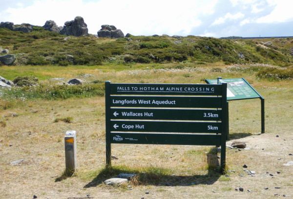
At Watchbed Creek, the High Plains Road leaves the Lake behind and heads over to Cope Hut and Raspberry Saddle. On the way the walking track access to Wallace Hut, Cope Hut and Mount Cope are encountered.
Cope Hut also marks the transit point of the long distance Australian Alpine Walking Track (AAWT) over the High Plains;
See More Bushwalks on the Bogong High Plains at the end of this description for details.
There are several designated camping areas in this section, that of Langford West, Raspberry Saddle and Bucketty Plains.
Mitta Mitta River
After Raspberry Saddle and Hill, the route begins its dramatic descent from Bucketty Plains to the Mitta Mitta River. Take time on the descent to admire the views of the valley that emerge before you. In particular the views of Shannonvale Station (to the left) are very evocative of high country grazing properties.
The steep descent from the High Plains via Bucketty Plains finishes abruptly at the Mitta Mitta River, near the Middle Creek confluence. From here turn right (south) to Omeo, and the route now follows the Omeo Highway, which in this section basically follows the Mitta Mitta River Valley.
The Mitta Mitta rises in the beautiful snow country of the Bogong High Plains and parts of Mount Bogong itself. Some of the run-off into the Mitta Mitta catchment is now diverted via aqueducts into the Kiewa Hydro-electric Scheme.
The Joker picnic-camping area follows soon after meeting up with the Mitta Mitta River, and is accessible from a slip road off to the left of the roadway. This is quite a large area, with an extensive river frontage - a very popular area during the warmer months.
Bundarrah and Cobungra Rivers
Leaving The Joker behind, it is a short run to the Mitta Mitta - Bundarrah River confluence, and an informal picnic area (down to the left, just before crossing the Bundarrah River). There are no facilities here, but this is quite a popular area for anglers, and is also used by white water paddlers as a launching spot to tackle the Mitta Mitta Gorge which starts a few kilometres downstream from here.
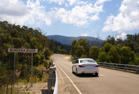
If you have time, the rugged, and scenic, Bundarrah River is worth exploring; a little bit of rock-hopping reveals some good views of the Bundarrah’s excellent riverside scenery.
Just around the corner from the Bundarrah, the rustic Blue Duck Inn sits alongside the alpine Cobungra River; a great setting, and welcoming sight, for many travellers for almost a hundred years. Just before reaching the Inn, there is a linear camping area alongside the Cobungra River; another great spot to stretch out for a night.
The original (1900) building at the site of the Blue Duck was a slab construction cut from local timber, and operated as a butcher shop, servicing the Glen Valley and Mount Wills Goldfields. Miner Billy O’Connell bought the building in 1912, and obtained a hotel license, on the understanding that the new main road would pass his front door; like many politicians’ promises, this one did not eventuate for a long time (until the late 1920s).
At the time of the gold rush in the Omeo area, the route from Omeo to Glen Valley was much further east, via the Knocker Track (so-called because of the steep climb involved), and a punt over the Mitta Mitta River at the Hinnomunjie Bridge site. The failure to build, what is now, the Omeo Highway induced O’Connell to christen his lodge ’The Blue Duck’ - a mining term for a gold lease that produces no gold.
In the early 1920s, O’Connell transported two houses from Omeo; one became the main building of the Blue Duck, and the other a residence. Billy settled there with his wife Lillian and raised nine children. The small log structure behind the Inn was originally State School Number 4286, and was built by O’Connell in 1926, when five of his nine children were of school age.
Despite a negative start to their enterprise, the Blue Duck was a successful enterprise, and one of their regular visitors was Sir Harold Clapp, head of Victorian Railways. In the 1930s, Clapp arranged for the Newport rail yards to cast the beautiful art deco bronze blue duck at the entrance to the Inn. The O’Connells left in 1946, after which time the Blue Duck had several owners, but relinquished its liquor license in 1967, when local gold mines closed.
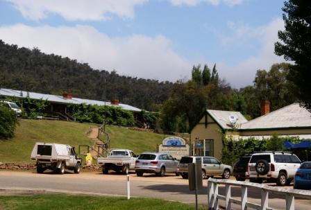
The Blue Duck regained its license in 1998, and is now a popular stop-over, both for motel style cabins, and for its meals. Click here for the Blue Duck Inn website.
It is now about 30-40 minutes to Omeo, and continuing along the Omeo Highway, CRB camp is just around the corner, and is a short distance from the roadway, with pedestrian access down to the Cobungra River.
About nine kilometres beyond CRB camp, there is a signposted walking track that leads down to the Mitta Mitta Gorge at a large rapid. This is an interesting walk, as it leads down to the heart of the Mitta Mitta Gorge, a sight not usually seen by anyone but white water paddlers. The last few hundred metres are quite steep, and this is a tiring walk.
The Home Run
At Bingo Gap, Omeo is now a little under 20km away, and apart from the occasional glimpse of the Mitta Mitta River way down below, the best of the scenery is now left behind.
Bingo Gap Road goes off to the left, and can be used to view the historic Hinnomunjie Bridge (mentioned above), as well as being a short-cut to the Omeo Valley. Bingo Gap Road itself is unsealed, but the remainder of the route to the Bridge is sealed.
If you don’t want to take the short-cut, the Omeo Valley Road itself is encountered (to the left) several hundred metres later.
The route to Benambra, and subsequently Corryong, also goes off to the left a few kilometres after the Omeo Valley Road; see the separate description for more details of this scenic run.
All that remains now is to enjoy the final few kilometres of pastoral country that provides the final run to the township of Omeo. The tripmeter should now be reading something like 115km, but this will depend on how many times you pulled off the road for points of interest, picnic areas, camping areas etc.
The friendly town of Omeo (population 300) has a wide range of accommodation in and around the town, including motels, two hotels, apartments and a nice caravan park alongside Livingstone Creek. See the separate description on the Homepage (link below) for more details on the township.
More Walks . . .
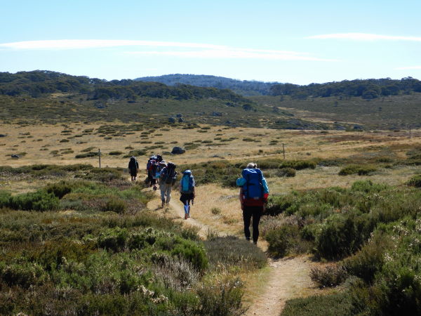
As well as the walks already described as part of the main text (Mount Beauty - Omeo), the walks detailed below are for those travellers with plenty of spare time, a sense of adventure, formal walking shoes/boots and trekking poles.
All of the walks listed here are shown on Rooftop Maps Bright - Bogong - Hotham Forest Activities Map and Spatial Vision Bogong Alpine Area, and you should refer to one of these maps prior to starting any walk, and take it with you on the walk.
See also Bushwalks in the Victorian Alps by Glen van der Knijff (details at www.osp.com.au).
Pretty Valley to Tawonga Huts [AWTGS-3]
Start this adventure by driving to Pretty Valley Pondage via the Pretty Valley Road from Falls Creek (make sure you get to the causeway over the Pondage, not the dam wall; see main text for access details). Walk over the causeway, and follow Fainter Fire Track to the west. The track climbs over a spur, and leads mostly westwards towards Tawonga Huts.
On the way, there is the memorial Ben Cooper Memorial Cairn to check out, as well as some amazing views of Mount Feathertop and Mount Jaithmathang.
At the 3.5km there is a noticeable swing to the right of the track, with the left option being the single file track that leads to Westons Hut etc, and the continuation of the main track being the chosen route for today.
It is now about 750m to the collection of huts known as Tawonga Huts; these nestle in a small clearing, and have been a welcome sight to many a weary traveller.
The return to Pretty Valley is by retracing your steps. Overall walking time (there and back) is about three hours, and the distance covered is about 8.8km.
Pretty Valley to Jaithmathang [AWTGS-4]
This is an optional extension of the previous walk (Tawonga Huts), and leads to the 1852m peak of Mount Jaithmathang.
The single file footpad that leads up to this notable feature meanders around the hillslope, and you will need a copy of the 1:50 000 VicMap sheet Falls Creek to give a general indication of where the track is heading from the environs of Tawonga Hut.
It is about 2.2km each way to the summit, and is hard work via an alpine style ascent, with a few short rock scrambles; allow about 90 minutes walking time each way.
On the way there are magnificent views of Mount Hotham, Mount Feathertop and the deep valley of the West Kiewa River.
In wet conditions the footpad is quite boggy, but in any case you will need formal walking shoes/boots, and a set of trekking poles.
Pretty Valley Loop [AWTGS-3]
This is a popular 18km loop walk, starting out from the Pretty Valley camping area.
The walk requires a formal set of walking shoes/boots (preferably waterproof ones) and trekking poles; optional extras include gaiters (to ward off those pesky burrs).
As with the previous walk, start this adventure by driving to the Pretty Valley camping area, via the Pretty Valley Road from Falls Creek, and then to the start of the sign-posted Cope Saddle Track.
Having parked your vehicle nearby, the route now meanders around the hill sides, with great views to the right.
As the bridge over the creek is approached there are many excellent views of this alpine waterway, plenty of billabongs, and meanders.
Continuing south, a total of about four kilometres now brings you to Cope Saddle Hut, built during the construction phase of the Kiewa Hydro Scheme. It is shown on some maps as SEC Hut, and is a very basic refuge, but its bright red roof make it a guiding landmark.
From the Hut there are four route options; hard left leads to the Bogong High Plains Road; diagonal left follows Cope West Aqueduct; straight-ahead (well almost straight-ahead) leads to Ryders Huts, and the one we want is off to the right, basically following a snow pole line up to a ridge-line.
This is a single file track (actually part of the Australian Alpine Walking Track, AAWT), and does not exactly follow the snow poles so take care.
The AAWT in this section follows the ridge-line that separates two of Australia’s best alpine rivers, that of the Kiewa River (to the right) and the Mitta Mitta to the left.
Great views are the order of the day here, and it is about 4.5km to the next landmark, the optional turn-off to Westons Hut and/or Dibbins Hut and/or Youngs Hut.
This is at Pole 333, with Westons Hut being 2.5km from here (see the recommended map for details; this is a 5km detour, but you will need to camp overnight unless you are super-fit).
[Westons Hut was built in 1939, the Weston Family having grazed cattle on the Bogong High Plains since the early 1920s. The Hut was lost in the Black Friday Bushfires, but was rebuilt soon after this. It survived the 2003 Bushfires, but was destroyed in the 2007 fires, and rebuilt in 2011.
Dibbins Hut is about 5.5km from Pole 333, and the pathway covered here is part of the Falls - Hotham Crossing (see separate description).
Youngs Hut is about four kilometres from Pole 333, and is located in the scenic headwaters of the Bundarra River (a tributary of the Mitta Mitta River).
Most of the journey to Youngs Hut is through alpine grasslands, but the last kilometre of the route drops down to snowgum woodlands, and is very scenic.
Water is generally available near the Hut (just to the south) and the nearby waterfall/cascade of the Bundarra River (to the east) is well worth a visit.
Both of these detours (Youngs and Westons Hut) cut across several alpine mini-wetlands and there are stepping stones in place to help keep the feet dry.]
Continuing along the main route (the AAWT is now left behind), more great views are the order of the day, in particular Mount Feathertop and Mount Jaithmathang, and after a short climb there are views of the Tawonga Huts area to be enjoyed.
About 1.5km from Pole 333, the single file track meets up with the Fainter Fire Track, and you need to hang a right here, so as to return to the start (the straight-ahead option at this point leads to Tawonga Huts - see separate description).
It is about five kilometres along the Fire Track to get back to the camping area, with nice views of Pretty Valley storage, and Mount McKay.
On the way, a minor detour leads to the Ben Cooper Memorial Cairn, and once at the lakeside, cross over the causeway, and continue uphill to your vehicle.
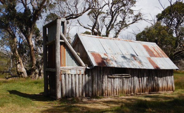
Ryders Huts/Campbells Yards [AWTGS-3]
Ryders Huts were built (of corrugated iron) by Wally Ryder in the early 1970s, and occupy a portion of Campbells Yards, a leasehold of the Campbell Family from Ensay dating back to the 1890s.
The walk to the Huts is one of the best on the High Plains, combining a single-file track and great views.
The start of this walk is reached by driving about 11km from Falls Creek Village, and parking where the Australian Alpine Walking Track (AAWT) veers off to the right (our route) and the left fork at this point leads to Cope Hut.
Setting off from this point, the single-file footpad leads for about 2.2km, where the sign-post says that it is ‘half-a-mile’ to Mount Cope. On the way, apart from the great views, you will have enjoyed the soft surface provided by rubber matting (this extends from before the small footbridge over Cope Creek, to not far beyond the Mount Cope t/o).
Continuing on, it is a further 1.3km to Cope Saddle Hut, a total of about 3.5km from the Bogong High Plains Road.
This now brings you to Cope Saddle Hut, built during the construction phase of the Kiewa Hydro Scheme. It is shown on some maps as SEC Hut, and is a very basic refuge, but its bright red roof make it a guiding landmark.
Just prior to the Hut, the footpad drops down (via steps) to cross Pretty Valley Creek; take care here, as this is a steep descent/ascent to get to the other side of the Creek.
From the Hut there are four route options; hard left follows Cope West Aqueduct; soft-left leads to Ryders Huts; the AAWT is almost straight-ahead, basically following a snow pole line up to a ridge-line, and the right turn (that is, turning alongside the Hut) leads to Pretty Valley Pondage.
The chosen walking route (to Ryders Huts) now follows a vehicular track alongside Cope West Aqueduct, and leads for about 1.2km to a fork in the roadway.
Hang a left here, and this track now leads for about 850m to the un-signposted turn-off to Ryders Huts (off to the left; the Huts are clearly visible, and there is no chance of missing them).
Having enjoyed the ambience of this location, the return is via retracing your steps exactly, making an all-up distance for this walk of about 11.5km.
Ropers Lookout [AWTGS-2]
This popular walk starts at the ’Ropers Lookout-Heathy Spur-Mount Nelse’ sign at the eastern (Omeo) side of the Rocky Valley Dam wall.
From the small car parking area, and information board, follow the aqueduct for 1.5km, then take the track up the gully on the right (at the end of the aqueduct).
Ropers Lookout is on a small basalt knoll, one kilometre from the aqueduct, and has good views over Rocky Valley and Falls Creek Village.
The return is by retracing your steps back along the track.
Overall walking time is about 90 minutes, and the distance covered is about five kilometres.
Heathy Spur and Two Huts [AWTGS-3]
This scenic walk starts at the ’Heathy Spur-Mount Nelse’ turn-off on the Bogong High Plains Road, just over the Rocky Valley Dam wall (Omeo side).
Having parked in the nearby linear car park, the track climbs gently through snowgums to Heathy Spur, and then meanders through very scenic alpine meadows for about 4.5km. The track then meets a vehicular track (Big River Fire Track) and a snow pole line (actually the Alpine Walking Track).
Turn left here, and follow this roadway for about 750m, to the right fork that leads to Johnston Hut (a two kilometre in total side-trip).
Slightly further along the Fire Track (200m), there is a left fork that leads to Edmonsons Hut about 950m away (making another two kilometre side-trip).
Returning to your vehicle via the Heathy Spur route, this will have been a 16km (5-6 hour) adventure, assuming that you visited both huts.
Mount Nelse [AWTGS-3]
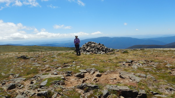
The walk to this 1882m peak starts with a short drive (about two kilometres) along the Bogong High Plains Road from Rocky Valley Dam wall.
Turn left at the Big River Fire Track (signposted ’Mount Nelse’) just after crossing Watchbed Creek, and park your vehicle.
Walk along this track to the locked gate, continuing up past the turn-offs to Kellys Hut, Heathy Spur, Johnstons Hut and Edmonsons Hut, and at about 1.2km beyond the latter turn-off (after a sustained climb) veer right onto the summit access track (near pole 818 of the AAWT).
This is another steady climb (of about 500m distance) with great views as a reward for the effort expended.
Rocky Valley Dam is to the south-west, Mount Buffalo to the west, Mount Bogong to the north, the Main Range of Kosciuszko National Park (New South Wales) is to the north-east, and The Cobberas are to the east.
Return to the Bogong High Plains Road by the same route, but if you have the time and inclination, continue north along the roadway for about a kilometre, and climb Mount Nelse North (1884m, also to the right of the track), or pay a visit to either Johnstons and/or Edmonsons Huts - see the recommended map for more info.
Overall walking time is about five hours, and the distance covered is about 12km (14km if you tackle Mount Nelse North, 16km if you visit the two huts).
Another alternative is to organise a car shuttle, leaving a vehicle on the Omeo side of Rocky Valley Dam. This will enable the walk to be concluded by returning to the bitumen via Heathy Spur Track.
This is a beautiful track, passing through alpine grasslands, with great views of Rocky Valley, and Mount Buffalo. It does however add a few kilometres to the walk; Mount Nelse to the bitumen via this route is 8km, versus 6km via the Watchbed Creek route.
[Optionally, continue beyond the Mount Nelse turn-off to the next track intersection, a locality known as Warby Corner (named after Ben Warby, one of the early settlers of the Nort-east).
There are great views of Mount Bogong from here, as well many alpine mini-wetlands in the foreground - well worth the extra steps.]
Kellys Hut [AWTGS-3]
The start of this walk is the same as that for Mount Nelse, however take the signposted Kellys Hut Track at the saddle, curving around to the right from the saddle. About 700m from here, a pole line (on the left) marks another turn-off, and you can follow this pole line (and associated footpad) for about three kilometres to another ’Kellys Hut’ sign. Note that the footpad leading to the Hut is about 10m to the left (that is, north) of the pole line.
At the final Kelly Hut sign, keep basically left, and continue downhill for about 500m towards the Hut.
Nearby Fitzgeralds Hut (see photo) can also be reached from this access route, the detour (about one kilometre overall) to Fitzgeralds Hut being signposted from just near the final Kellys Hut sign.
Return to your vehicle via the same route, or veer left (south) at the western end of the pole line to pick up the Marm Point Track, and then follow the Langford East Aqueduct down to the Bogong High Plains Road at Langford Gap (7km away via this route).
Marum Point is a notable highpoint on the Plains at 1816m, and is also known as Marum Point. See the recommended map (listed below) for more on this option.
This route initially follows the scenic valley of an alpine creek, and then swings wildly right (almost a u-turn) at GPS 36:51.964 : 147:20.232 (immediately before a notable creek crossing).
The route now follows the aqueduct all the way to the bitumen of the High Plains Road.
A shorter alternative is to take the sign-posted section of the Australian Alpine Walking Track at pole 740. The signage here reads Cope Hut 9km, and this footpad can be followed through to Langford East Aqueduct, and then Langford Gap (4.3km).
This latter alternative is very scenic, passing through some excellent alpine meadows, and passing by some very old snowgums on the south facing slopes.
Overall walking time for the regular route is about four hours, and the distance covered is about 12km.
Recommended map, Rooftop Maps Bright - Bogong - Hotham Forest Activities Map or Spatial Vision Bogong Alpine Area
Circuit of Marum Point [AWTGS-3]
Marum Point is a notable highpoint on the Plains at 1816m, and is also known as Marm Point. This interesting 12km walk follows the Langford East Aqueduct, then cuts around the east side of Marum, tackles a section of the AAWT, and then returns to the aqueduct for the home run.
The adventure starts by driving to the Langford Gap parking area (about four kilometres from the Omeo side of the Rocky Vally Dam). From the car park step it out across the bridge (over the aqueduct) and hang a left for an easy 2.4km to a small picnic shelter cum bridge.
There are great views on the way (to the right) of the catchment of the Cobungra River, with this section being on a basalt paved roadway, basalt being the main road building, and construction, material on the High Plains.
From the picnic shelter, keep following the aqueduct, noting the various engineering works on the aqueduct (a big slide, a tunnel and a weir).
Having arrived at a major creek crossing (2.2km from the shelter) you need to make a wild swing to the left (almost a complete u-turn). This is at GPS reference 36:51.964 : 147:20.232, and the route now begins a steady climb up to higher ground (that is, the aqueduct is now left behind).
The climb (which is on Marum Point Track) reveals more great views to the south, as well as to the north.
After about 2.4km the route meets up with the walking track(s) that lead to Kelly and Fitzgerald Hut.
Veer left here (that is, head west) and follow this through to the sign-posted section of the Australian Alpine Walking Track at pole 740.
The signage here reads Cope Hut 9km, and this footpad can be followed through to Langford East Aqueduct, and then Langford Gap (4.3km).
This is a very scenic of the AAWT, passing through some excellent alpine meadows, and passing by some very old snowgums on the south facing slopes.
From pole 740 it is about 1.9km back to the shelter cum bridge referred to above, with the last section being a steady descent down to the aqueduct (poles recommended).
The route now follows the aqueduct (to the right) all the way back to Langford Gap.
As mentioned above, overall distance is about 12km, and you should allow about four hours for this walk
Wallaces Hut/Heritage Trail and Cope Hut
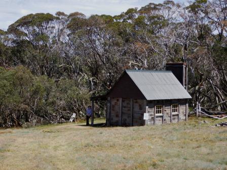
The track to Wallaces Hut [AWTGS-2] leads off the Bogong High Plains Road about eight kilometres from Rocky Valley Dam wall (Omeo side). The Hut was built by cattlemen in 1889, and as well as being classified by the National Trust, is very photogenic.
Return walking time to the Hut itself is about 45 minutes, and the distance covered is about 1.5km, but see below for an extension of this.
The Heritage Trail (about six kilometres, AWTGS-3) is also signposted off the Bogong High Plains Road, and there is an informative story board at the car park.
From the car park, the Heritage Trail heads to the south-east, visiting the famous Hut, and then continuing through to Langfords West Aqueduct (this is one of several aqueducts built as part of the Kiewa Hydro Scheme, and diverts water from the Mitta Mitta catchment, to that of the Kiewa).
Turn right at the aqueduct, and follow this easy trail to the Rover Chalet.

This is the largest of the accommodation huts on the High Plains, and was built by the Scouts in 1940, largely motivated by Scout pioneer Bill Waters. It has been renovated, and added to over the years, and is very photogenic.
Not long after the Rover Chalet there is a sign-posted turn-off (for the Heritage Trail) to the right. This leads upslope to a nice bench, and from there rejoins the main gravel walkway, where you need to keep right.
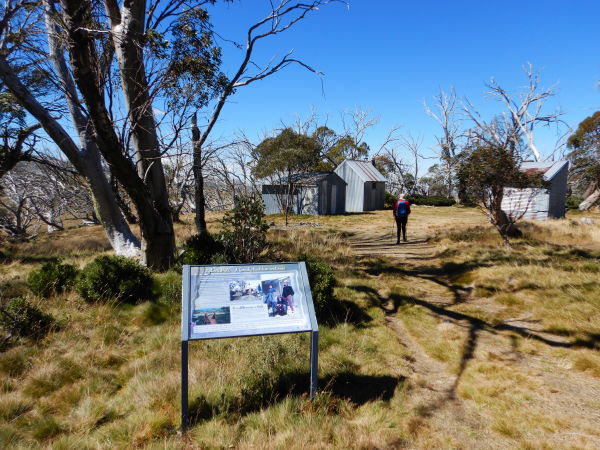
Cope Hut now comes into view; this dates from 1929, and was built at the instigation of Bill Spargo, one of the pioneers to ski-ing at Mount Hotham; this is the largest hut on the High Plains that is open to all-comers.
From Cope Hut the Heritage Trail swings to the right, following the High Plains Road for a short distance, before veering right, so as to take walkers back to Wallaces Hut.
On the way, the track (which is single-file) has several interesting sections of boardwalks, and crosses some excellent high-plains grasslands, before descending back down to the environs of Wallaces Hut.
From here, swing left to get back to the Bogong High Plains Road.
[For a longer version of all of this, turn off the Bogong High Plains at Langfords Gap, and then follow the pipeline/aqueduct through to the turn-off (to the right) for Wallaces Hut.
Keep straight ahead at this point, and follow the aqueduct through to the Rover Chalet, and Cope Hut as described above.
Having finally made it to Wallaces Hut, walk back down to the aqueduct, turn left, and follow this back to your starting point; see the Spatial Vision map Bogong Alpine Area for more details.
This version of the Heritage Trail covers about 12km, and takes about four hours to complete.]
Mount Cope [AWTGS-2]
To reach the start of this walk take the Bogong High Plains Road for 10.5km from Rocky Valley Dam wall, to the signposted Mount Cope turn-out (a small car parking area, on the left of the bitumen).
The walking track starts on the opposite side of the bitumen, a short distance back towards Rocky Valley, and is marked out by poles, and triangular markers.
The walk takes you to the south-west, across grass plains (excellent ski-ing in winter) and then up through snowgum woodlands to the summit of Mount Cope (1800m).
Once at the summit, take time to admire the views from this isolated block of high ground. There are views in all directions, but the ones to the east are the best.
This vista includes the Cobberas Ranges of Victoria, and to their left, the Main Range of Kosciuszko National Park (New South Wales).
Returning via the same route, the overall walking time is about 90 minutes, and the distance covered is about three kilometres.
Falls to Hotham Alpine Crossing [AWTGS-4]
The Falls Creek to Hotham Alpine Crossing, also known as Falls - Hotham Alpine Crossing (FHAC), is a 38.5km (one way) walk, and takes about three days to complete from end-to-end.
There are two campsites; Cope Hut campsite, set amongst snowgums on the Bogong High Plains, 14km from the trailhead and usually the first night’s campsite; Dibbins Hut campsite, on a snow plain in the headwaters of the Cobungra River, about 30km from Falls Creek (that is, about nine kilometres from the Mount Loch car park, a few kilometres north of Mount Hotham)
Each campsite has five sites, four of which have a formal tent platform that is designed to fit a 2-3 person hiking tent, and a larger platform for small groups/larger tent.
At Falls Creek the trail starts from the Heathy Spur carpark, on the eastern side of the Rocky Valley Dam Wall. This is about three kilometres from the Falls Creek Information Centre by road, or you can walk from the village bowl, mostly via formal off-road tracks. At Mount Hotham, the trail finishes at the Mt Loch carpark, just off the Great Alpine Road, a few kilometres north of Mount Hotham.
Some data : Total distance: 38.5km; highest point 1832m; lowest point 1351m; total ascent 1400m; total descent 1190m.
There are several websites that cover the walk in more detail than given here, and most of these offer a downloadable GPX file with all of the crucial GPS waypoints.
See the link below for the official website to this walk
Falls to Hotham Alpine Crossing
Mount Hotham to Falls Creek [AWTGS-4]
This is the less formal version of the previous description; it covers about 18km, and can be completed in one tiring day, in either direction.
See the Great Alpine Road description for more details.
Mount Beauty Visitor Information Centre
Falls Creek Visitor Information Centre
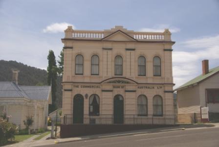
OMEO (includes Oriental Claims Historic Area and Justice Precinct)
Omeo Visitor Information Centre
COPYRIGHT © 1995-2022, Chris McLaughlin.