MOUNT BEAUTY to the MITTA MITTA VALLEY
(www.northeastvictoria.online)
TRAVELLING TIME: About two hours.
DISTANCE COVERED: 45km.
OVERVIEW MAP: VicMap 1:50 000 Mitta Mitta.
DETAILED MAP: VicMap 1:50 000 Mitta Mitta.
SUPPLIES / FUEL: Mount Beauty has a good range of shops and services as well as several fuel outlets. Mitta Mitta has a general store and a fuel outlet.
CAMPING: Mount Beauty has a good range of holiday accommodation, including a riverside caravan park. En route there is good camping on the Kiewa River (at Ryders Lane), and at Mountain Creek (within the Alpine National Park). At the finish there are caravan parks at Mitta Mitta and Eskdale.
WHEN TO GO: Anytime outside of the winter months. Seasonal closures from mid June until the end of October close many roads in the area.
TRACK DETAILS: This is a trip for 4wd vehicles only, but the route generally has a good gravel surface, albeit rocky in places, with some steep sections, as well as many tight corners.
OTHER INFORMATION: A straight-forward route for all 4x4 vehicles in dry conditions, with tall timber and some good views. See also the alternative route via The Hollow Way.
This is a scenic 4wd route from Mount Beauty to the Mitta Mitta Valley, utilizing some infrequently used bush roads.
The route starts at the Mountain Creek Picnic-Camping Area, with access via Ryders Lane and Mountain Creek Lane off the Kiewa Valley Highway between Tawonga and Tawonga South.
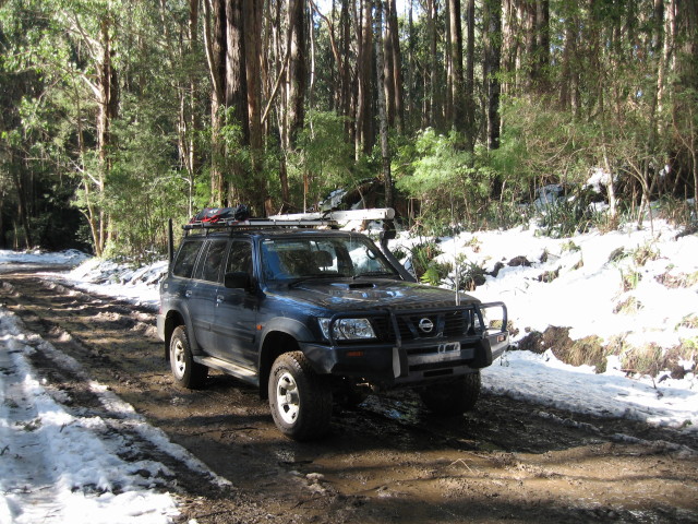
At the Mountain Creek Picnic-Camping Area the adventure heads off into the forest, and is sign-posted Trappers Gap Road – summer route only (that is, a dry weather route only).
Wet conditions, including snowfalls can occur at any time of the year (see photo - taken in April).
Shortly after Mountain Creek there is an intersection with four choices; Eskdale Spur Track, Trappers Gap Road, Trappers Creek Track, and Trappers Gap Track.
The one to take is Trappers Gap Road which now swings to the north-east on its way to pass under the powerlines that link the Lake Dartmouth Power Station with the Dederang Switching Yards.
Dorchap Range Track is the next junction (at about 28km) and the route then continues north-east, following Scrubby Spur, which begins a gradual descent to a small camping area (36km).
The bitumen is encountered at 45km (where the road is now called Scrubby Creek Road) and then the Omeo Highway a few kilometres later.
From here turn right (south) to Mitta Mitta township, just a few minutes away, or left for Eskdale (see separate descriptions of each township - link below).
Alternative route via The Hollow Way
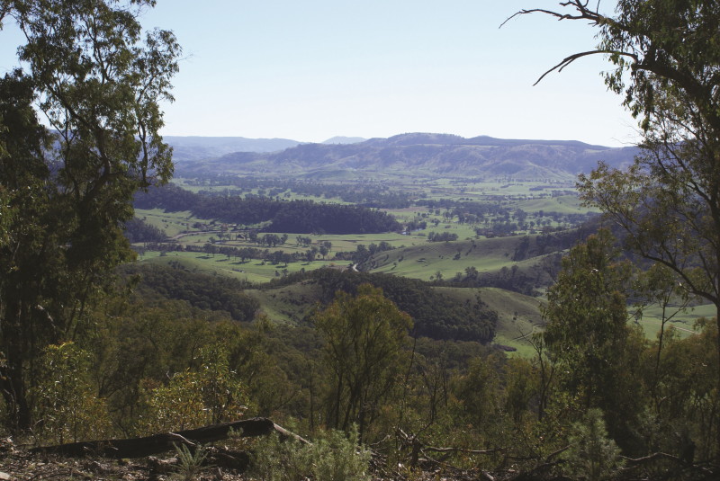
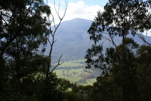
This is a pleasing optional route to Mitta Mitta township, and has the advantage over the main route (as described above) in that it offers many excellent views of the Mitta Mitta and Snowy Creek Valleys on the final descent to the township.
The route starts off as before, up until the intersection with four choices referred to above. However, this time you need to take Trappers Gap Track (also known as Camp Creek Gap Track) off to the right.
Trappers Gap Track/Camp Creek Gap Track leads to an unsignposted track (off to the left) and then a sweeping bend cum t-junction, where a side track (to the right) leads to one of the walking track routes to the summit of Mount Bogong. This sweeping bend is about 5.7km from the four way intersection, and is at GPS 36.42.129s : 147.18.873e.
Continuing on, it is a further six kilometres to where Granite Spur Track heads off to the right at GPS 36.42.393s : 147.20.200e. Granite Spur Track is one of the high country’s many seasonally closed roads, and provides bushwalkers with yet another alternative walking track route to Mount Bogong.
It is now a short drive to The Hollow, where there is a pleasant clearing with plenty of flat ground for camping, with The Hollow Hut being a stone’s throw from here.
A nice ridge line run now leads to another intersection where Rootsy Spur Track heads off to the right. This is at GPS 36.40.084s : 147.22.466e, and is about 19.7km from the four way intersection.
The route now continues to follow a ridge line before encountering an unsignposted y-junction at 23.8km (GPS 36.38.674s : 147.23.867e).
Keep right at this junction, and get ready for one of the most scenic descents in the Victorian high country, an eight plus kilometre descent to the floor of the Snowy Creek Valley, with many great vistas to stop and enjoy. This is a good route for the autumn, as the autumn colours, and the patchwork created by different land usages are clearly visible.
Once down on the valley floor, you need to make a left turn for Mitta Mitta village, a nice 11.5km away.
This last part of the route is on the Omeo Highway, and has many pleasing contact points with the alpine stream known as Snowy Creek.
As with the main description, the VicMap 1:50 000 Mitta Mitta will be a useful asset on this optional detour.
More details of the Omeo Highway can be found in the separate description of that route (Wodonga to Omeo; link below).
WODONGA to OMEO (via Mitta Mitta township, Mount Wills, Glen Valley and the Blue Duck)
Mitta Valley Website - camping
Mount Beauty Visitor Information Centre
Intro Screen on a fresh browser page
COPYRIGHT © 1995-2024, Chris McLaughlin.