
MOUNT SAMARIA STATE PARK
(www.northeastvictoria.online)
TRAVELLING TIME: Allow at least two hours for the south-north traverse of Mount Samaria (as described here) and a further 30 minutes to continue on to Benalla, or to get back to Mansfield via the bitumen.
DISTANCE COVERED: About 40km from Mansfield to Samaria Wells (on the northern edge of the State Park); allow about the same again to get to Benalla, or back to Mansfield via a different route (see access details below).
OVERVIEW and TRIP PLANNING MAPS: RACV Kelly Country.
DETAILED MAPS: Rooftop Maps, Bright - Mansfield Adventure Map. The tour is also covered by VicMap 1:50 000 Samaria. The Parks Victoria website (see below) also has some handy PDF downloads, with maps and further information on the Park.
SUPPLIES and FUEL: Benalla and Mansfield have a full range of shopping and services, as well as some great eateries.
ACCOMMODATION: Benalla and Mansfield have a range of accommodation options, including motels and a caravan park.
There are a couple of small camping areas associated with the walking tracks, and the largest one is at The Kilns, a historic area (some of the buildings are still there) alongside the camping ground.
The walk-in Camphora Camping Area is reasonably close to Back Creek Falls (signposted to the left of the road) and Wild Dog Creek Falls Camping Area (also a walk-in area) is (logically) close to the Falls of the same name, and is also signposted to the left of the road. There is also a camping ground on the northern (Benalla) side of the Park, at Samaria Wells.
ROADWAY DETAILS: Good gravel roadway, albeit with many cobbled sections that offer slow progress. The tour is only suited to 4wd vehicles and soft-roaders. There are some narrow tracks along the way, and for this reason camper-trailers and caravans are not recommended.
WHEN TO GO: Avoid wet weather, and any super-hot days.
OTHER INFO: Mount Samaria State Park features very good camping and, given enough water, several very scenic waterfalls, all within easy walking distance of a very pleasant camping area. The Park covers 7600 hectares, mostly at sub-alpine altitudes (700-900m) with Mount Samaria (949m) being the highest peak, and Back Creek and Wild Dog Creek being the two major watercourses.
Another major feature of the Park is the transition of the vegetation from south to north; elegant tall timber in the south, and on the plateau (both of which face south, and are quite cool and damp), thinning out to open woodlands on the north side (which is exposed to dry north winds and strong sunshine).
This is a great drive with plenty to see and do, and it is easy to spend the best part of a day at the Park. Distances quoted may vary by several kilometres from one vehicle to another.
Access from Mansfield
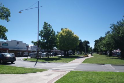
Mansfield (population 8000) is the notional starting point for this tour, and is conveniently located on the Maroondah Highway.
The Mansfield area was first settled by pastoralists, such as the Hunter and Watson Families in the late 1830s, and the township of Mansfield was first surveyed in 1851. Typical of many communities of the day, the main street (High Street) was made extra wide, so that bullock teams could make that all important u-turn.
The township, and surrounding communities, expanded rapidly during the gold rush days. Mansfield became a major stopping off point for gold miners in the Upper Goulburn and Jamieson River Valleys.
Starting off from Mansfield (with the tripmeter at zero) this nice route leads north via the Tolmie Road (C521), and veers left onto Blue Range Creek Road (a y-junction, a little over nine kilometres from town, soon after crossing Bridge Creek). This is signposted Mount Samaria State Park, and you also need to swing left at the next intersection (10km) which is similarly signposted.
Blue Range Creek picnic area is on the left, just after crossing the Creek of the same name, whilst the camping area is to the right at this point. Both are well laid out alongside the Creek, and both are popular during peak periods, and on weekends.
Just after these features, the roadway splits in two, with the right fork heading off up a pine plantation ’avenue’. Taking the ’avenue’, follow this through to a road junction where Mount Samaria Road goes off to the left, and West Boundary Track is to the right.
A short distance beyond this junction, there is a y-junction, where a large sign board announces that you are now entering the State Park.
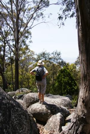 Swing right at this sign board, and you are about four kilometres from the first major item of interest - Rocky Point Lookout. This is signposted on the edge of the roadway, and involves a short walk (about 100m to the right, AWTGS-2) to get to a rocky cairn. From here there are good views of the not too distant high country, but the vegetation obscures much of the foreground.
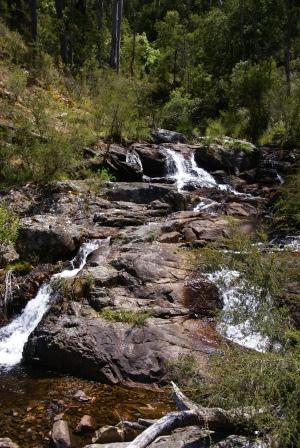
This is at about the 21km from Mansfield, and continuing on from here, it is a further two kilometres to the signposted walking track to Back Creek Falls (AWTGS-3).
The walking track leads off through open forest, and it is about 1.5km to reach the Falls. Wildflowers are profuse in the spring, and this is probably the best time of year for a visit, as this is when the Falls are usually at their best.
Camphora Campsite is a further two kilometres from the Falls access track (about 25km from Mansfield), and this is a well equipped area, having tables and toilets etc, as well as a great setting.
The next significant feature is a signposted walking track (to the right, AWTGS-2) that leads to the historic Tramway Winching Station, and it’s accompanying Braking Station. Both of these structures date from the timber felling days (which had a short life on the plateau) and both are in very bad repair.
This is at about the 27km mark, and from here it is short drive to the kilns, where charcoal was produced during the Second World War. Spring Creek Picnic Area is about 50m beyond this feature, and it is rewarding to stop at the picnic area, and check out the information board at the kilns.

A further 300m or so now leads to a the Spring Creek Camping Area, and then a short drive to the walking track access to Wild Dog Creek Falls. The camping area is excellent, and is one of the most popular in the State Park, given its proximity to many features of interest.
The walking track to Wild Dog Creek Falls also leads to the camping area of the same name. The camping area is about 600m from the main roadway, and is therefore not well suited to vehicle based camping.
Take care if you walk through to the Falls (AWTGS-4), as there are a confusing set of routes to choose from. Make sure that you have a GPS, a topographic map of at least 1:50 000 scale, and a keen sense of direction before setting off.
The Falls are about 1.5km from the roadway, and the complete three kilometre walk takes about an hour.
Continuing northwards from the walking track access point, the vegetation starts to thin out, and the roadway begins its descent to the valley floor.
Keep right at the Williams Road intersection, and this soon leads to a t-junction, with Mount Samaria Road being to the left, and Samaria Wells to the right.
Samaria Wells is home to the northern most campsite in the Park, and is well used in peak periods. Mount Samaria Road (which has been followed all the way through the Park) now heads north, soon becoming a bitumen roadway that leads north to Benalla, east to Tatong, or west to pick up the Midland Highway on the way back to Mansfield.
Access from Benalla
Starting off from downtown Benalla (with the tripmeter at zero) the route leads south via the Midland Highway (the B300) for about 25km to the small township of Swanpool. From here a left turn leads onto the Swanpool Road, meeting up with a t-junction at about the 30km mark.
The signpost at this point reads ’Tatong 10km’ (to the left), ’Benalla 24km’ (also to the left) and ’Mount Samaria State Park’ 6.5km to the right. Turning right here leads (via Samaria Road, and then Moorngag Road) to the Samaria Wells camping area referred to in the tour header.
Continuing on from here, the road narrows down, and begins its ascent to the top of the Samaria Plateau.
Whilst travelling to the Park along the Midland Highway from Benalla, Lima East Road leads to James Camping Area, a large camping area alongside the scenic Lima East Creek. James has picnic facilities, a toilet block and lots of flat ground, so that even the biggest of crews will have no problem finding somewhere to set up their tents.
At Lima itself, the Midland Highway Park has powered sites, camping sites and cabin accommodation.
BENALLA (includes Lake Benalla, Art Gallery and Rose Gardens)
MANSFIELD to the KING VALLEY (via Lake Nillahcootie, Tatong, Stringybark Creek and Powers Lookout)
Intro Screen on a fresh browser page
COPYRIGHT © 1995-2020, Chris McLaughlin.