BENALLA
(www.northeastvictoria.online)
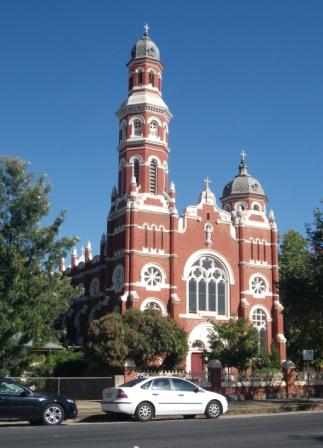
Benalla’s attractions include a prosperous township, many historic buildings, pleasant lakeside parklands, a well endowed art gallery, and the annual Rose Festival in springtime.
The lakeside areas of Benalla (adjacent to the town’s main shopping area) are particularly pleasing, and offer endless hours of enjoyable recreation. The Lake Benalla Walk (see below) is one of several lakeside walks that can be completed in and around the town’s waterways.
Overview
The Benalla area was first settled in the late 1830s, when the pastoral run Benalta was taken up by the Reverend Joseph Docker. The township was originally called Broken River, but was renamed when it became more of a substantial community in the mid-1850s.
Prior to this, the Benalla area was occupied by several aboriginal communities, and there was conflict between the traditional owners of the land, and the new settlers.
The Faithfull brothers were amongst the first settlers in the North-east; George Faithfull took up land near Wangaratta, and William Faithfull went further south, to the present day site of Benalla.
The township grew rapidly from those early days, helped along by good pastoral land, and the discovery of gold in the nearby Reef Hills during the 1860s. The arrival of the railway in the 1880s, and the completion of the Melbourne - Sydney main road (now the Hume Freeway) also helped Benalla establish itself as one of the major centres of the North-east.
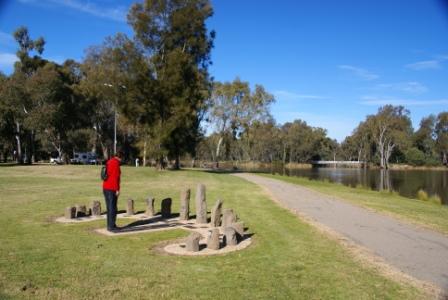
Analemmatic Sundial
Analemmatic sundials are usually found in the grounds of science museums, and planetariums, but Benalla’s Sundial is in a public space, just to the east of the Monash Bridge, on the city side of the Lake. Analemmatic sundials typically have a ball on a flagpole, with the sundial face (the time of day) painted, or etched, onto the pavement below.
In the middle latitudes of planet earth, you can dispense with the ball on the flagpole, and let the observer’s head form the shadow on the ground. This is the modus operandi of the Benalla Analemmatic Sundial, with a figure-of-eight etched into the pavement allowing for different places to stand during different times of the year; go and try it out! More details on these devices can be found at www.wikipedia.org.
Benalla Art Gallery
Benalla’s Art Gallery is one of Australia’s best provincial art galleries, with an excellent collection of Australian art. Paintings on display include works by Arthur Streeton, Rover Thomas, Tommy McCrae and Eugene von Guerard.
The Gallery occupies a stylish building on the waterside of Lake Benalla, and incorporates a popular cafe, with a nice elevated section overlooking the Lake. More details at www.benallaartgallery.com.
Botanical Gardens
Benalla’s Botanical Gardens were designed and established in by Alfred Sangwell in 1886. They are listed on the Register of the National Estate and incorporate curved walking paths defined by a wide array of rare and exotic greenery. The Gardens also feature a recreation oval, with the adjoining rotunda being a popular entertainment venue since it was built in 1911.
Ceramic Mural
Benalla’s Ceramic Mural is the outcome of one of Australia’s largest, and longest running community art projects. The Mural adjoins the north-west corner of the Monash Bridge (in Bridge Street). The project began in 1983, and includes the handiwork of several hundred artists, students and other volunteers.
The actual structure that houses the mural follows the form of an axenstrasse the european style mountain road that uses tunnels and bridges to negotiate alpine terrain.
Costume and Pioneer Museum
Amongst other things, this interesting museum has a special display on the Kelly Gang, and is located alongside the Visitor Information Centre (VIC) in Mair Street (just near the northern side of the Monash Bridge).
Lake Benalla Walk
This urban lake is close to the commercial centre of Benalla, and is a popular retreat on a hot day. However at any time of the year it offers very enjoyable and relaxed walking. The walk described is referred to locally as Dr Nicholson’s Walk after a former distinguished resident of the town.
There is easy access to the lake from several points in Benalla, the most convenient being at the parklands near the Art Gallery in Bridge Street. The VIC has a handy street map of the town, which shows the path taken by the walk in nice detail.
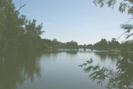
The lake, and some of its surrounds, have been gazetted as a wildlife sanctuary and it is possible to observe many species of water birds on the lake, particularly in the back waters. The lake is usually full but is occasionally drained (in winter or if major flooding is expected on the Broken River; the Broken is a major tributary of the Goulburn River).
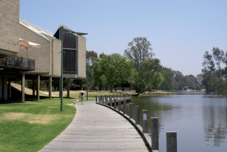
The walk starts from the car parking area near the Art Gallery, and takes about 30 minutes to complete. From the car parking area, turn and face the water, and then turn to your left, picking up the well maintained walking track that passes in front of the Art Gallery. The track leads to the retaining wall and sluice gates at the northern end of the lake near the Melbourne - Sydney rail line.
Continue past the retaining wall, under the rail line, and then turn right onto Ackerly Avenue for a short distance. This leads over the Broken River, as it leaves the Lake, and then back under the rail line once more into open parkland, picking up a narrow pathway close to the lakeshore.
The track continues past the swimming pool, and eventually meets up with the old Hume Highway Bridge (Bridge Street). Either turn right, and cross over the bridge (so that the Art Gallery comes into view once more), or turn left for the downtown area, and head towards some nice coffee shops.
Little Casey Island Walk
This interesting walk weaves in and out of a small island system on Lake Benalla and the Broken River, just upstream of the main urban area. Like the Lake Benalla Walk (described above), this enjoyable walk is close to the commercial centre of Benalla, and is a popular retreat on a hot day, with plenty of shade and many contact points with the Lake’s backwaters.
The walk can be started at several places around the southern side of town, but it is probably easiest to start at the car parking area near the Civic Centre. The Visitor Information Centre in Mair Street has a handy street map of the town, which shows the path taken by the walk in nice detail.
Having parked the hardware, stand and face the water, and then head off to the left, following the lake’s shoreline for a short distance, before hopping over to Jaycee Island via a pedestrian bridge. Having walked the full length of the Island, another bridge allows you to get back to the ’mainland’, where the track again follows the lakeshore, taking you to yet another bridge.
You are now on Link Island, and the walking track now quickly leads to a t-junction. Keeping straight-ahead at this point leads to Arundel Street, however to complete the loop, you need to turn right at the t-junction, getting ready to tackle Little Casey Island. The walking track is now pointing back towards the starting point, but having reached the other end of the Island, the track veers to the left, picking up another bridge which leads to the west side of the Lake (the walk started on the east side).
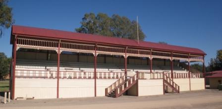
The track now skirts the Showgrounds and adjoining sporting facilities, with the noted Showgrounds Stadium being visible to the left.
The John Monash Bridge now comes into view, with the walking track passing underneath this structure and leading to the parklands alongside the noted Benalla Art Gallery.
From here you can continue around the Lake by completing the Lake Benalla Walk (see below), or loop around across the grass to the Weary Dunlop Memorial (see below) and then cross over the Bridge back to your vehicle.
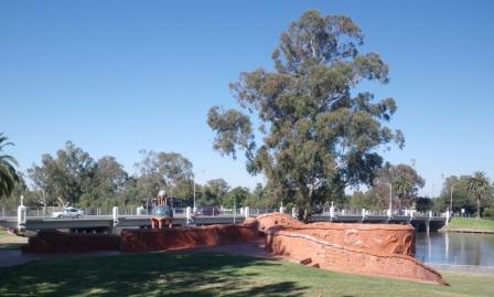
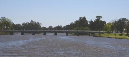
Monash Bridge
The bridge over Lake Benalla was designed by noted engineer and military leader, Sir John Monash.
The previous bridge at this location was a Toll Bridge, and was built in 1874, only to last as such for four years (all internal Victorian tolls were abolished in 1878). A memorial plaque on the south-eastern corner records these events.
John Monasch (the family name would later be anglicised), the son of Prussian-Jewish migrants, was born in Dudley Street, West Melbourne in 1865, and went on to earn a BA from the University of Melbourne in 1887, a Master of Science in civil engineering in 1893, and a Law Degree in 1895.
During his engineering career, Monash was to play a major role in introducing reinforced concrete to construction projects in Australia, but it was his military achievements that would gain him a knighthood.
Monash initially served with the Australian Army at Gallipoli, before becoming commander of the Australian Corps on the Western Front.
As well as being a good tactician, and a meticulous planner, Monash was to become a notable commander of the First World War, as he was as much concerned about the people under his command, as he was about the outcome of any fighting.
He was a noted advocate of the use of artillery and tanks to protect, and enhance the efforts of, the infantry.
On 8 August 1918, the Battle of Amiens became the first decisive win of the War for the Allies, with the allied attack being led by the Australian Corps, under Monash.
On 12 August 1918 Monash was knighted, as a Knight Commander of the Order of the Bath, on the battlefield by King George V, the first time a British monarch had honoured a commander in such a way in over 200 years.
After the War, Monash became a noted, and highly respected, member of Victorian society. He died on 8 October 1931, with about 250,000 people attending the state funeral.
A full biography of Sir John Monash can be found at www.wikipedia.org.
Benalla Murals
Benalla is currently the mural capital of the North-east, with 20 of these masterpieces being on display, and more are planned.
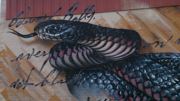
The murals have many a varied theme, and are dispersed around the central part of the city.
There is only one way to experience the visuals of these murals, that is, on foot.
With plenty of good cafes to choose from, this is a great way to spend a day in a great town.
Prior to stepping it out to see all this great artwork, have a look at the Benalla Murals website (link below).
Ned Kelly Touring Route
For a large part of the Kelly era, Benalla was the epicentre of the hunt for the Kelly Gang members, and the Benalla VIC has a brochure called the Ned Kelly Touring Route.
This details all of the buildings of interest in the town, that have an association with the Kelly Gang; the brochure also details some of the other locations that are of interest to Kelly Buffs (for example, Stringybark Creek; see the Benalla - Tatong - Stringybark Creek - Greta West Tour for details). As well as Benalla, other VICs in the North-east also have the Ned Kelly Touring Route brochure.
Rose Gardens
Benalla’s renowned Rose Garden is on the southern section of Bridge Street (that is, south of the Monash Bridge) and were initiated in 1959 as part of Benalla’s Botanical Gardens. They have since formed a major part of the city’s psyche, with Benalla being known to many as The Rose City, and the former City of Benalla having a rose as its emblem.
The Garden is currently being expanded to incorporate an Old World Rose Garden featuring a ’Sangwell Path’, named after Alfred Sangwell who designed and established the Botanical Gardens in 1886.
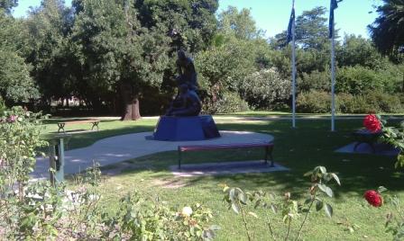
Sir Edward (Weary) Dunlop Memorial
Edward Dunlop served in the Australian Army during World War II, and like many other Australian men and women, was captured by enemy forces after the collapse of Singapore. As a surgeon, Dunlop witnessed the mal-treatment of his fellow captives with different eyes to many others. He consistently stared down his captors, demanding (and mostly getting) basic medical supplies, and was thus able to save many hundreds of lives that would otherwise have been lost for the sake of a few resources.
Weary Dunlop was born in Wangaratta, and spent much of his early years on the family farm north-west of Benalla before going to university. Sir Edward’s statue is near the Art Gallery and is a ’must see’.
Winton Wetlands
The Winton Wetlands were created out of what was formerly Lake Mokoan; however, prior to the creation of the Lake (in 1971), this was a wetland system, so things have gone full circle.
Aboriginal people once occupied the areas around the original wetland area, and would have found this to be close to an ideal environment for their hunter-gatherer life-style.
In 1971, the wetlands were flooded to create Lake Mokoan, an off-river irrigation storage for the waters of the Broken River, which rises to the north-east of Mansfield. In 2006 the Lake was decommissioned as a storage, and following this decision water was no longer siphoned out of the River, and restoration of the original wetland habitat was commenced.
Starting the tour from Benalla, the action starts by taking the old Hume Highway north from town, and then swinging left onto the Yarrawonga Road, about six kilometres later. This leads to the north-west, and you need to keep right where the signage indicates that Yarrawonga is to the left (this is at a y-junction), and then take the signposted Lake Mokoan Road to the right (this is about seven kilometres from the old Highway).
This leads onto a nice quiet bush road, with a series of rolling hills to the left, and great views to the high country over the wetlands to the right.
Continue along this road, and after about seven kilometres, there is a signposted entry gate (to the right) that leads to an expansive carpark, and this is the main entry to the Wetlands.
The car parking area then leads to some nice picnic area, with plenty of shade, and the usual array of day visitor amenities. The views over the water are very pleasing, with some great profiles of the not too-distant Warby Ranges as as backdrop.
Planning for the Wetlands includes the construction of walking tracks, and a boardwalk system to make the wet areas more accessible to pedestrians.
New walks include the Spit Walk and the Greens Hill Walk, both of which are shown on a PDF map available via the Winton Wetlands website (see link below). The Spit Walk leads out onto a geographic feature known as a lunette - lunettes form down-wind of shallow lakes, and a so named because of their semi-lunar shape. Lunettes are found all over southern Australia, most notably at Lake Mungo in New South Wales.
The Spit Walk starts off with a few story-boards that relate to some of the european history of the area, and this leads to a loop of about 2.5km, taking you out along a spit of land (the lunette), and back.
Greens Hill used to be an island in the days of Lake Mokoan, but is now just a piece of high ground. Setting off from the car park here leads to a one kilometre formed track, with some great views, and some interesting story-boards. The track finishes at a story-board, and from here you need to retrace your footsteps, having covered about two kilometres overall.
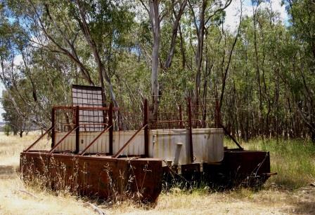
If you access the Greens Hill area via Boggy Bridge Road (see PDF map) then you will pass one of several barges that were used to transport cattle out to Greens Island in the Lake Mokoan days. The barge is high and dry, and is one of three lying idle on what was once a vast lake.
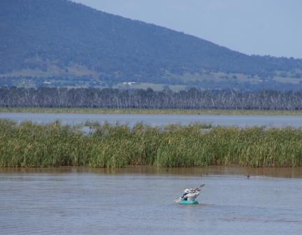
As well as these walking tracks, the Wetlands are quite a popular paddling venue (given enough water), and setting off from the boat ramp, there are extensive reed beds close by, and a small island not too far away. As mentioned, birdlife is prolific, and this is a very enjoyable paddling venue.
Access from Wangaratta is by taking the Old Hume Highway south, and swinging right onto the Taminick Road (just before the Freeway on-ramp) and then turning right onto the signposted Taminick Gap Road a short distance later. This leads over the said Taminick Gap (great views) and then down the western slopes of the Warby Ranges to a t-junction with the Glenrowan-Boweya Road. Turn right at the t, and then left onto Lake Mokoan Road a few kilometres later. Follow this scenic back-country road through to the car park mentioned above.
The Wetlands-Lake is shown on most touring maps, however the VicRoads Directory shows the location in more detail. See also www.wintonwetlands.org.au for a PDF that includes a map of the wetlands.
TATONG - STRINGYBARK CREEK - GRETA WEST LOOP
Benalla Visitor Information Centre
Intro Screen on a fresh browser page
COPYRIGHT © 1995-2020, Chris McLaughlin.