CORRYONG - OMEO (via SASSAFRAS GAP)
(www.northeastvictoria.online)
TRAVELLING TIME: Four hours.
DISTANCE COVERED: About 150km (depending on which route you take from Benambra to Omeo; see text for more details).
OVERVIEW MAPS: Touring map of Victoria.
DETAILED MAPS: Rooftop Maps, Corryong - Omeo - Thredbo Adventure Map.
SHOPS and SERVICES: Corryong has a full range of shops and services; Benambra has a general store, hotel and a fuel outlet; Omeo has fuel, a small supermarket and some nice eateries.
ACCOMMODATION: Corryong has a nice caravan park and some motels; Colac Colac (on the Murray Valley Highway just west of Corryong) also has a good caravan park. Omeo has motels, two hotels, apartments and a caravan park. Excellent bush camping at Staceys Bridge, and alongside the Gibbo River (see text).
WHEN TO GO: Avoid sustained wet weather, and any super-hot days; the warmer months are best as this enhances the camping experience.
ROADWAY DETAILS: This tour follows a typical high country route; it is mostly well constructed, but becomes slippery when wet, and is quite narrow in sections (keep left, and keep your headlights on). Take it slowly from Staceys Bridge through to the Gibbo River; this is one of the slipperiest sections, with steep drop-offs from the roadway.
OTHER INFO: In dry conditions this is an easy, and very scenic, route that is easily passable by sedans, soft-roaders, camper-trailers and small (4wd rated) caravans. In wet conditions, it should be regarded as a 4wd only route. Distances quoted may vary by several kilometres from one vehicle to another.

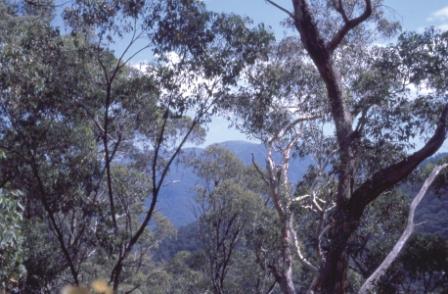
The Corryong - Omeo Route cuts through the heart of some of Victoria’s best high country; the scenery is excellent all the way, with great views of mountain ranges and tall timber valleys.
Corryong (the start of the tour) makes an interesting base camp, and provides easy access to many outstanding attractions, with a wide range of accommodation, shops and services. See the separate township description for further details.
Starting out from Corryong (with the tripmeter at zero) take the Murray Valley Highway west for about eight kilometres to Colac Colac, a small settlement on Nariel (Corryong) Creek which has a caravan park-camping area with plenty of shade. A bike trail links the settlement with Corryong.
Swing left (south) at Colac Colac, onto the signposted Benambra - Omeo Road, and enjoy a pleasing mix of pastoral and mountain scenery in all directions.
There are several informal camping areas along this section; first McNamaras Bridge Camping Area, which is followed by Carmodys Camping Area and then Staceys Bridge (one of the more popular sites) where there is an extensive flat area alongside Nariel Creek, with plenty of shade.

The road now skirts east of the Alpine National Park, gradually climbing away from the Upper Murray Floodplain. The road passes through many excellent stands of native forest, and offers spectacular views of the high country from several vantage points. This part of the route is particularly scenic during the autumn when the many stands of poplar trees provide a blaze of colour.
Continuing south, Gibb Range Road (a back-country route to Wodonga) comes up on the right at about 52km.
Wheelers Creek Logging Road is on the left at about 60km, providing access to two popular camping areas if required. The first of these (Zulu Creek) is about eight kilometres away, and is a nice area amongst tall timber, with running water at hand.
Wheelers Creek Hut is a further eight kilometres away, a large flat area that is a very popular camping area on long weekends; you can sleep in the Hut, but most people take their tents.
Continuing south on the main route, there is a signposted lookout that takes in Mount Bogong and Lake Dartmouth; the lookout being at the high point on the Omeo - Corryong Road (1342m).
From here, it is a short haul to sneak through Sassafras Gap (70km from Corryong; 1295m), with great views to the west of the Victorian high country. It is a long winding descent from Sassafras Gap to the Gibbo River, this being a tricky section of the road in wet conditions, with many steep drop-offs down into rugged river valleys.
This leads into Trolley Wheel Gap, and this is quickly followed by Blacksmiths Corner.
A timber bridge provides passage over the Gibbo at 90km, and from here the road follows the Gibbo River downstream - often within metres of the water, providing excellent camping.
Turnback Creek and Kings Flat appear at about 93km, and these are soon followed by Carols Gap and then Exhibition Creek, with Sykes Camping Area further along, to the right.
Continuing south, Pluto Creek offers great camping, and from here you start to leave the Gibbo River behind, before moving over to the Morass Creek catchment; like the Gibbo, Morass Creek is a Mitta Mitta River tributary, and flows into Lake Dartmouth.
There are several points along the later part of this section where it is possible to walk down to Morass Creek. This is a rugged mountain stream, exceptionally pretty at wattle time, with large, granite rock based, cascades and waterfalls.
By now the bitumen is under your wheels, and it is a straight-forward 15km run into Benambra township, 125km from Corryong.
Benambra (690m) is on the eastern shore of the usually dry Lake Omeo, and has a small general store cum cafe, a hotel (that serves a nice meal) and a fuel outlet.
A historic marker (on the left, near the church, immediately after the cross-roads) commemorates the passing of explorer McFarlane in 1835.
From Benambra you can either,
Take the Mount Blowhard Road, a dry weather road linking Benambra with the Omeo Valley Road. On the way you can enjoy some panoramic views from this steep gravel road as it climbs away from Lake Omeo.
Lake Omeo is worthy of a visit if it has a reasonable water level, however the waters of the lake are usually receding rather than rising. This is a natural lake, formed by lava flows blocking local drainage (similar features can be found alongside the Hume Freeway near Beveridge, an area renowned for its fogginess).
Blowhard Lookout is worth stopping at, with its expansive views over surrounding pastoral country, and the not too far distant high country.
Once at the Omeo Valley Road, make a left turn (followed by a further left turn at the Omeo Highway) and it is an easy meandering run to Omeo.
Or, take the Main Benambra - Omeo Road south from town, skirting Hinnomunjie Racecourse, and encountering McMillans Lookout on the way to joining up with the Omeo Highway.
Swinging left at the Highway, it is about four kilometres to the centre of Omeo.
See the Omeo township description for details of the town, and the surrounding area.
GREAT ALPINE ROAD (Wangaratta, Bright, Mount Hotham, Omeo, Bairnsdale)
MOUNT BEAUTY to OMEO (via Bogong Village, Falls Creek and Bogong High Plains)
WODONGA to OMEO (via Mitta Mitta township, Mount Wills, Glen Valley and the Blue Duck)
Intro Screen on a fresh browser page
COPYRIGHT © 1995-2020, Chris McLaughlin.