THE SNOW ROAD
(Glenrowan to Myrtleford)
(www.northeastvictoria.online)
TRAVELLING TIME: About one hour.
DISTANCE COVERED: About 45km.
OVERVIEW MAPS: Touring map of Victoria.
DETAILED MAPS: None required.
SHOPS and SERVICES: Wangaratta has several supermarkets, and number of fuel outlets. Basic groceries, and fuel, are available at the Hume Freeway service station (just north of the Glenrowan exit), at the Oxley general store and at the Milawa general store. Myrtleford has a wide range of shops and services.
ACCOMMODATION: Glenrowan has a motel and caravan park; Wangaratta has a wide range of accommodation options; Milawa has some B&Bs, a caravan park and the Lindenwarrah Country House Hotel; Myrtleford has a good range of accommodation options, including a nice caravan park. There are also some other accommodation offerings en route; these are detailed in the text.
WHEN TO GO: Anytime of the year.
ROADWAY DETAILS: Bitumen all the way.
OTHER INFO: A great way to access the high country. See the Wineries Listing for further details of the wineries mentioned in the text. See also the Milawa Gourmet Region website (link below). Distances quoted may vary by several kilometres from one vehicle to another.
The link between the Hume Freeway, north of Glenrowan, to the Great Alpine Road, north of Myrtleford, is formally known as the C522, but has become known as The Snow Road, since it is used by thousands of skiers heading for Victoria’s High Country from the south. Although many people use the Snow Road as a shortcut, there are some interesting features along the way, and it is worthwhile allowing extra time for the drive. Distances quoted are from the Snow Road interchange on the Hume Freeway.
Having left the Freeway behind, one of the first landmarks is the Greta Road cross-roads, with Wangaratta being about nine kilometres to the left at this point, and the small settlements of Greta, and Great South being to the right.
Laceby cross-roads come into view about six kilometres from the Freeway, and the Wangaratta-Whitfield Road (C521, nine kilometres from the Freeway) is the next encounter. This intersection is a large roundabout, with Wangaratta being about 11km to the left at this point, and Whitfield (and the King Valley) being to the right (see the separate description of this route on the Homepage).
The C521 intersection also brings contact with the Wangaratta - Oxley - Milawa bike path; this is a 20km route from the centre of Wangaratta leading to the small village of Oxley (see below) and then the Milawa cross-roads. From Milawa, a continuation leads to the Milawa Cheese Factory. Future plans provide for a continuation of this bike path to Whitfield, following the route of the now-dismantled King Valley Railway. More details under Bike Paths, Rail Trails and Cycle Routes.
Oxley
Just beyond the C521 cross-roads, Sam Miranda Wines are on the left, and as well as an excellent vintage, has a popular cafe, with an alfresco dining area.
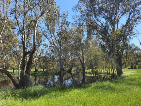
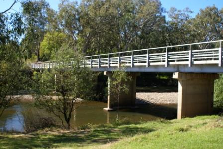
Continuing on, the C522 crosses a section of the King River where there are numerous flood channels and billabongs to admire. A small rest area near the River (on the right just before the main bridge) is a popular picnic venue, and is named after Oxley local, Stan Allan.
Just beyond the Bridge, there is a right turn that leads to Evans Lane, and then Blue Ox Berries.
The small township of Oxley (11km) is also just beyond the King River Bridge, and is supposedly the second oldest place name in inland Victoria (after Mount Buffalo). Explorer Hamilton Hume named Mount Buffalo a day before he came upon, and named, the Oxley Plains. He chose the names because Mount Buffalo does in fact look like a buffalo from certain angles, and the Oxley Plains were named after surveyor-general John Oxley, this was on 26th November 1824.
George Faithfull took up the Oxley Plains Run in 1838, and later built a homestead, which he called ’Wangaratta’. The Oxley area prospered with the influx of European settlers, more so after gold was discovered in the 1850s, when Oxley became a stop-over on the main Cobb and Co route to the North-east goldfields.
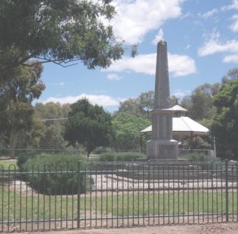
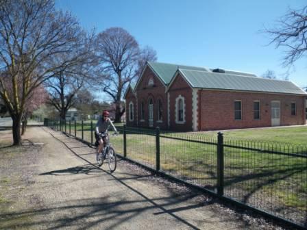
Given its history, Oxley has an interesting collection of historic buildings. The Shire Hall, for example, was built in 1875 and, now classified by the National Trust, is one of the oldest buildings in the Shire. Land was set aside for a hall in 1868, and the building was commissioned in 1873.
Another old building, the Oxley Flour Mill was built about 1868; at 106 years old it has the same National Trust classification as the Shire Hall. Other buildings of historical interest include the Methodist Church (1885) and the Baptist Church (1890).
The General Store in Oxley was once Clancy's Hotel (1880), and the excellent King River Cafe occupies the site of Dunlop’s Hotel. The Cafe is a popular venue, and is renowned for its comprehensive menu and efficient service; for more details about KIng River Cafe - click here!
As you drive out of Oxley, a right turn (the Oxley - Meadow Creek Road) leads to Gehrigs Lane, home to John Gehrig Wines (1.6km away), and the Oxley Recreation Reserve (3.2km away). Gehrig's is one of many family owned wineries, stretching back several generations, in the North-east.
The Recreation Reserve has a nice camping area (short-term only), with toilets, and a dump-point. A track leads off from the camping area, down towards the King River, with several wetland areas on the way - good bird watching terrain.
Milawa
Continuing on from Oxley, the next town en-route is Milawa, where the cross-roads are always busy, with many interesting gourmet food possibilities at hand. Since the bike path from Wangaratta now reaches Milawa, this is a great destination from Wangaratta; see the Rail Trail and Cycling Path section for more details.
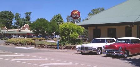
On the left corner as you approach the cross-roads (which are about 15km from the Freeway) the Milawa Hotel (1865) has an excellent menu, and is well known as a good place for lunch and dinner. The adjoining caravan park is quite small, but with a great position.
Opposite the Hotel, there is a gourmet pie shop, a well stocked general store and Ava Restaurant and Bar.
Just over the cross-roads, on the left, the Old Emu Inn (a former Cobb & Co depot) was for many years home to Milawa Mustards (now located around the corner - towards the Cheese Factory).
The Old Emu Inn was built in 1861, and is now the home of RedBank Wines and Henley's Restaurant.
Around the corner, there is a pharmacy, followed by the Milawa Bakery and The Olive Shop, showcasing olives from many of southern Australia’s wine growing areas.
Opposite the Bakery, the Post Office/Newsagent has plenty of parking space, and those all important items to peruse over morning coffee.
Turning right at the cross-roads leads to the well known Brown Brothers Winery; well worth a visit at any time of the year, and always popular for its fine wines, and collection of historic buildings. The restaurant at Browns serves up one of the best meals in Victoria, with great ambience. There is also a casual dining (indoor and outdoor) at the winery.
Further down the road that leads to Brown Brothers (that is, the Milawa-Bobinawarrah Road) the Hurdle Creek Still, makers of small batch Australian Gin can be found (more details at www.hurdlecreekgin.com.au).
Turning left at the Milawa cross-roads leads to the Milawa Cheese Factory, a very popular destination that serves up morning tea, and light lunches seven days a week. A wide range of local produce (including all those tempting cheeses) is also on offer in the retail section. The complex that houses the Cheese Factory is also home to Wood Park Wines, one of the Milawa Region’s boutique wineries.
Another winery (Rose Hill Estate) is just around the corner from the Cheese Factory.
Continuing on from Milawa, the Everton Road (a left turn at 21km) leads to EVOO, a renowned producer, and processor of most things to do with olives. The Everton Road also leads to a small recreation reserve alongside the Ovens River; this is accessible by swinging right just before crossing over the Ovens, and is quite a popular bush camping venue.
Continuing past the small scattered settlements of Markwood and Whorouly East, the road climbs around the north side of some hill country, providing some excellent views of the surrounding ranges, and the Ovens River flood plain.
Whorouly
An optional detour to the small village of Whorouly can be made at about the 27km mark, rejoining the Snow Road about six kilometres closer to Myrtleford. Whorouly is home to the Whorouly Cafe, and the equally well known Whorouly Hotel. The Cafe serves light meals, and is well stocked with many items of gourmet produce from the North-east.
The Whorouly Hotel is one of several iconic hotels in the North-east, and serves a great meal, but not every day of the week. The Hotel is also renowned for its live entertainment.
Apart from these attractions, on a historical note, the Hume and Hovell Expedition of 1824 passed through here on their epic journey south, and a memorial to this event can be found diagonally opposite the Cafe.
Whorouly was also the epicentre of the hunt for the Kelly Gang following the shoot-out at Stringybark Creek. There were several false alarms in the Whorouly area, before the Gang became embroiled in their final shoot-out, at Glenrowan Railway Station. See the Bushrangers section for more details.
Being ’off-the-main-road’ Whorouly is a popular location for B&Bs; the Myrtleford and Wangaratta Visitor Information Centres have the listings.
Back on the Snow Road, there are some great views of the not too distant high country, and a small roadside rest area at about 27.5km. Kneebones Gap Road heads off to the right at 33km, with the Wombi Toy Factory (also being to the right) a short distance beyond Kneebones Gap Road.
Continuing towards Myrtleford, Storey Grove Nut Farm is to the right at about 39km, and has nuts of almost any variety.
After about 40km the Snow Road crosses over the Ovens River, an interesting river that rises north of Mount Hotham, and from its headwaters flows past the towns of Bright, Myrtleford and Wangaratta before joining the Murray River in the backwaters of Lake Mulwala.
Once at the Great Alpine Road intersection (shortly after crossing the Ovens River), turn left (west) for Wangaratta, right (east) for Myrtleford, Porepunkah and Bright. Take care at this intersection as vehicles approaching from either direction will be travelling quite fast.
See the Great Alpine Road description for a continuation from this intersection.
Intro Screen on a fresh browser page
COPYRIGHT © 1995-2020, Chris McLaughlin.