WANDILIGONG
(www.northeastvictoria.online)
Wandiligong is a small sub-alpine community located about five kilometres east of Bright.
Like many other townships in the North-east, Wandiligong grew up as a gold mining settlement, and although much rehabilitation has taken place, there is still widespread evidence of the gold mining era around the township.
The area was first mined in about 1856, and was known as Growlers Creek until about 1875, when the present name was adopted. At one time the population of Wandiligong vastly out-numbered that of Bright, but in the modern era, the permanent population is about 250. Services on-hand include the Wandiligong Hotel, a nice caravan park/camping ground and some neat B&Bs.
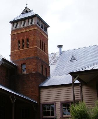
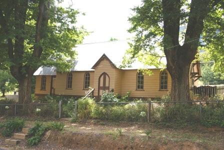
Buildings of interest in the township include the original Post Office (1885), the Wesleyan/Methodist/ Uniting Church (1878), Anglican Church (1865), the Wandiligong Library on the corner of School Lane (1878), the Wandiligong School at the top of School Lane (1877) and Manchester Unity Hall (1874). This last named building is at the junction of the main road and Centenary Avenue.
For more of the history of this great township, see the excellent publication Wandiligong : a valley through time (produced by the Wandiligong Preservation Society).
Access to the township from Bright is quite easy, either by taking the signposted turn-off on Churchill Avenue (the Mount Hotham Road), or by taking Park Street/Coronation Avenue, from just south of the main shopping area. In either case, this leads to a t-junction just near the Morses Creek Bridge. If you took the Churchill Avenue route, you need to turn left here, otherwise keep straight-ahead.
With great views to the left and right, it is now an easy run to your destination.
If you prefer to burn some blubber on the way to Wandi, there are several options for you, the first of these being to cycle down Coronation Avenue, and then continue on from the t-junction mentioned before. Alternatively you can take the shared walking-cycling path that leads from Bright to Wandi. See the Rail Trails and Bike Path section on the Homepage for more details.
You can also walk to Wandi, making use of part of Bennetts Walk (as detailed in the Bright description - see link below) and then continue to follow Morses Creek upstream. This walking track clings tightly to the Creek, and provides many great views of the Creek’s rocky cascades on the way.
By either of these methods, once at the township there is plenty to see, including many historic buildings, some nice walking tracks, Australia’s largest living maze (which also houses a popular cafe) and Nightingales ’Alpine Apples’ Orchard (excellent produce store, with a wide variety of gourmet goodies to choose from).
The Wandiligong Hotel (also known as the Wandi Pub) serves a great meal, with indoor and outdoor settings. The Pub is popular, and it pays to make a booking.
Bright Visitor Information Centre (VIC) has an ’Explore Wandiligong’ brochure that includes some more blurb on the township, as well as a basic street map. The VIC also has a booklet called "Bright and surrounds - Walks and Trails Guide" that details most of the walks in the area.
Items of interest in the Wandiligong area include,
The Diggings Walk [AWTSG-2]
The walk described here is one of several that can be completed within close proximity to the main part of Wandiligong. It largely centres on an area known as ’The Diggings’ - part of the Morses Creek floodplain that was extensively mined for gold. There are some other walks in the area (as detailed in the Short Walks brochure referred to above) and this walk is an amalgam of sections of these walks.
The complete walk, as described, takes about two hours. However road access is frequent, so walks of varying times can easily be organised.
The start and finish of the walk is at Alpine Park, on the northern edge of Wandiligong, where there is plenty of parking space, as well as a band rotunda.
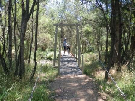
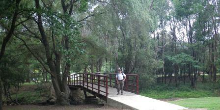
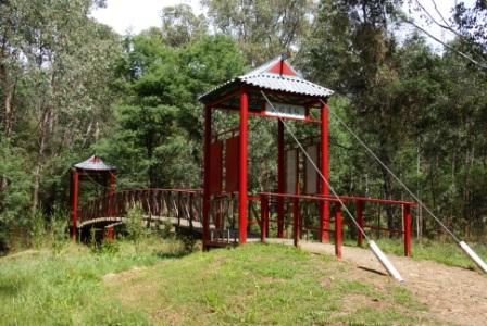
Once inside Alpine Park, turn and face Morses Creek, and then head over towards the Creek, passing over this pretty little stream via a hump-back bridge. Turn right and then follow the walking track which follows the creek upstream, passing Centenary Avenue, before arriving at a small pedestrian ’swing bridge’, near the Morses Creek/Growlers Creek confluence.
There are normally two options here, either cross over Morses Creek (which involves crossing Growlers Creek almost immediately) or ignore the swing bridge, and continue along the roadway to the Chinese Bridge.
In the short-term there is only one option, since the swing bridge was badly damaged in the 2011 floods - so continuing towards the Chinese Bridge, the walking route follows a minor vehicular track to a small car parking area, and from here it is only a short distance to the Chinese Bridge.
Crossing over the bridge takes you to an area known as Lardis Picnic Area, and from here you can optionally head upslope via Lardis Lane to the former Post Office (1885).
However, for more exploration of The Diggings, keep right at the Picnic Area, and continue to follow Growlers Creek upstream to the Royal Bridge. This is about 150m from the old Post Office, and a short diversion over the bridge brings you back to the main road, just near the Mountain View Hotel, site of the original Junction Hotel which dated from 1865.
Returning to the downstream side of the bridge, a signposted walking track to the left (a right turn as you approach the bridge for the first time) leads back over towards Morses Creek, where a right turn points you downstream - in line to meet up with the Chinese Bridge again.
Having made it back to this interesting structure, cross over Morses Creek once more, and then veer right to pass by the Swing Bridge. Continue downstream to Centenary Avenue, and thence Alpine Park.
BRIGHT (includes Canyon Walk and Bakers Gully)
Bright Visitor Information Centre
Intro Screen on a fresh browser page
COPYRIGHT © 1995-2020, Chris McLaughlin.