BRIGHT
(www.northeastvictoria.online)
Bright, a major tourist centre of the North-east, was named after the nineteenth century political and social reformer John Bright. It was originally settled in the late 1830s, and at that time was called Morses Creek. The name change, and many other significant changes, came in the 1860s, with the discovery of gold.
Bright soon became a stop-over on the main supply routes to the Omeo, Dargo and Wandiligong goldfields, and was to ultimately out-grow all of these communities.
The railway from Wangaratta to Myrtleford opened in 1883, and was extended up the valley to Bright in 1890, paving the way for the ascent of Bright as one of Victoria’s best known holiday destinations. In particular, the station at Porepunkah (five kilometres before Bright) enabled large numbers of people to visit the newly developed areas of Mount Buffalo for the first time.
See the Bright and District Historical Society Museum (link below) for more details of local history.
Amongst Bright’s attractions are its beautiful tree-lined streets; most of the trees were planted in the 1920s and 1930s, and provide a very pleasing and colourful streetscape to much of the town. Delaney Avenue is particularly attractive in autumn when the alternating species of trees are a blaze of colour.
The town has a good range of shops and services, as well as a wide range of accommodation options, including a nice riverside caravan park.
Bright is one of the most photogenic of the high country towns, and a very popular base camp for ’north-east explorers’. Here you will find a sense of history, interesting shopping, a wide range of accommodation, cafes and restaurants and a good selection of enjoyable walks, and things to see and do.
There are many enjoyable walks in, and around the township, for example . . .
Apex Lookout [AWTGS-3]
This is either a moderate walk, or a tough one that is as much about progress in the vertical, as the horizontal.
In either case, a set of formal walking shoes are recommded, as is a set of trekking poles.
Access to the moderate version is via Star Bridge from the centre of town, turning right on to Back Germantown Road, and then Mount Porepunkah Road to Quinns Gap (1.5km away), where the start of the track is signposted. There is very little car parking space here, and no amenities.
Starting out from the Gap, look for the entrance to the walking track, and follow this narrow footpad all the way to the Lookout.
On the way up to the Lookout there are some excellent views, as well as several vegetation changes to look out for as the slope aspect and soil type changes. For example, box can be found on the north facing slopes, whilst peppermints prefer the shadier, southern facing slopes.
Also on these latter slopes, Springtime (September and October) produces some nice flowering shrubs, and wildflowers.
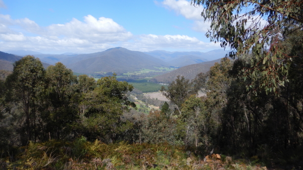
Once at the Lookout, there are two lookout areas to check out; the first offers some great views of the Upper Ovens Valley (that is, towards Freeburgh and Harrietville), whilst the second looks directly down on Bright township.
The views are very pleasing at all times of the year, however the autumn views are probably amongst the best, as the reds and browns provide a nice mosaic down on the valley floor.
After admiring the views, the return route is by retracing your footsteps down the hill. Walking time is about 1.5hrs, and the distance covered is a little over three kilometres.
The longer walk makes use of an un-signposted ‘goat track’ that leads off from the Back Germantown Road, just near the ‘40km/hr when frosty’ signpost. This is a steep track, taking about 90 minutes to reach Quinns Gap, and then another 45 minutes to the Lookout. This option is not recommended in moist conditions.
Bakers Gully Reservoirs [AWTGS-2]
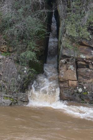
These small reservoirs (built in 1892 and 1916, but no longer used as water storages) are located about 1.5km out of town, and have a couple of small waterfalls, and some recently renovated walking tracks.
Access is via Bakers Gully Road from the centre of town, with the walk start being signposted to the left of the roadway. Park near the information board (or walk up to it from town), and take your pick from the selection of very easy walking trails on offer, both of which loop around the reservoirs.
The first reservoir can be cirumnavigated in about 25 minutes, and the second in a further 25 minutes. There are table settings at regular intervals around the reservoirs, and the background scenery is a mix of pine plantation and native bushland. Fido is welcome (on a leash, of course) and this is a popular walk for the locals and visitors alike.
If you walk from town, the total distance (according to the Map-My-Walk app) is about 5.25km.
Bennetts Walk [AWTGS-2]
Bennetts Walk leads from the north side of the bridge on Hawthorn Lane to Dohertys Bridge, weaving its way through a former gold mining area. The track basically follows Morses Creek upstream, with a return route via the opposite bank (see below). Distance covered is about 2.5km, and the walking time is a little short of two hours.
During peak holiday periods, a gold stamping battery (at the far end of the walk) is open for inspection, in which case allow another 30 minutes or so for the walk.
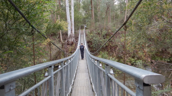
There are two suspension bridges over the Creek, the first of which is not marked on maps of the township; however these can be used to cross over to the other side of the Creek, and to access Pioneer Park. From Pioneer Park, you can continue upstream to the previously mentioned gold stamping battery.
Alternatively, you can set off from the south side of the Hawthorn Lane Bridge, and still reach the battery, and Doughertys Bridge. This route is more scenic than the one that sets off from the north side of the Bridge, as the north side skirts around the back of much of Bright's light industrial area.
Canyon Walk [AWTGS-2]
There are several variations of this walk. The most popular section is described first, followed by some optional extensions.
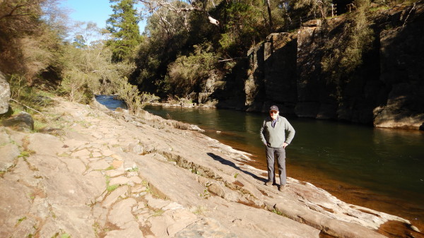
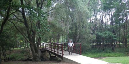
Vehicles can be left in or close to the commercial centre of Bright township. Take Star Road, which is a left turn (when heading towards Mount Hotham on Gavan Street) at the centre of town. Star Road leads down a short slope to a bridge (Star Bridge) over the Ovens River. Don’t cross the river, but veer left to pick up a well surfaced walking track, signposted ’Canyon Walk’.
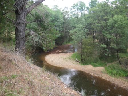
The track follows the mini-gorge of the Ovens River quite closely, giving tantalising glimpses of the river’s inviting waters, and the occasional opportunity to get down to a small beach.
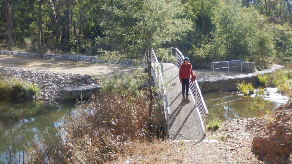
About twenty minutes later you will reach a small suspension bridge. Cross over the bridge, taking time to have a look at the upstream and downstream sections of this very pretty river.
Once over the bridge, turn right and head back upstream. The first road encountered is Star Road, and then it is only a short walk back to the centre of town.
On the way back to the town centre, the sluices (hand cut slots, built for gold-mining) can be clearly seen along the opposite bank.
Extensions to the walk can be made by, either starting further upstream, and/or finishing further downstream.
An alternative upstream starting point is at Hawthorn Lane, which runs off the Mount Hotham Road. The Lane is a left turn near the Wandiligong Road, when heading towards Mount Hotham, and finishes at the River near an electricity sub-station.
Park near the footbridge over the river, and from here follow the walking track downstream to Morses Creek Park, near the centre of Bright. Take a break and/or swim here before continuing through to Star Bridge via Howitt Park.
From the downstream end of Howitt Park, keep close to the river and pick up the short section of track that leads through to Star Bridge. This upstream extension adds about 25 minutes to the previously described ’core’ section. Howitt Park can be used as an alternative start/finish point, as it has direct access (via Howitt Street) to the Mount Hotham Road.
A downstream extension to the walk involves continuing on from the suspension bridge, and following the river through to Dashwood Crescent, near the railway line.
Cherry Walk [AWTGS-2]
This 5.5km loop walk follows the Ovens River upstream from town, passing through areas that have been rehabilitated following the impact of alluvial gold mining.
There are several story boards on the walk, on both sides of the river, and these make interesting reading.
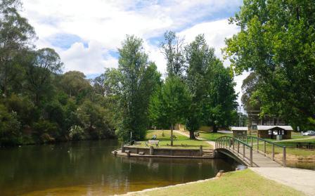
The walk starts at the water slide near the Morses Creek Bridge, and follows the Ovens River upstream to a small footbridge.
[There is an alternative starting point, accessible via Hawthorn Lane, which runs off the Mount Hotham Road. The Lane is a left turn near the Wandiligong Road when heading towards Mount Hotham, and finishes at the River near an electricity sub-station.]
From the footbridge, either follow the walking track upstream to another small bridge over the Ovens, and then return via the other bank; or cross over the Ovens via the footbridge, and complete the loop in the other direction.
In either case the walk will have taken you through the first area in Australia that was rehabilitated using the North American radiata pine.
Huggins Lookout [AWTGS-2]
This pleasant walk starts from Park Street, and then Deacon Avenue, providing a steady climb through peppermint forest to Huggins Lookout. The lookout provides an excellent view of Bright and its environs. Return walking time is about one hour and the distance covered is about 1.5km. The lookout also makes an interesting bike ride from Bright (access via Bakers Gully Road and the signposted turn-off).
Alternative access is via Bakers Gully Road, with a left turn at McFadyens Lane. Follow this narrow-ish roadway through to a small-ish vehicular turn-around, and then park the hardware. The signposted track to the Lookout is on the left as you approach the turn-around, and this leads to a steady climb up to the Lookout.
Valley View [AWTGS-2]
This 2.5km (two hours return) walk begins by following Bakers Gully Road to a right turn at Sommer Avenue, where the first of several direction signs can be found. There is a small amount of car parking available here, but the walk from the town centre is not difficult, so many choose to walk all the way.
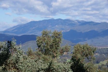
From the car parking area, follow the signs up the hill to an initially steep, but short, section which is followed by a well graded climb around a ridge. On the way up the slope keep looking to the side for excellent views of the Ovens Valley, and the surrounding high country.
There are many good places for a look at Bright through the peppermint and box forest, and from late spring through to early summer there is a diverse display of colour in the area which includes bluebells, bush peas, orchids and wattles.
From the road at the top of the ridge, turn left and walk down past Valley View Lookout to the ’Bright’ signpost. Follow the firebreak between the pine plantation and native forest, keeping an eye out for the yellow marker indicating the return walking track on the left. On the way down there are views of the high country (towards the right) and of course Bright.
Wandiligong Walk [AWTGS-2]
Whilst many people enjoy the short drive to the historic township of Wandiligong, if you have the time there is a very enjoyable walking track that will take you all the way there. The walk starts, either by completing Bennetts Walk (see above) or by driving to Dohertys Bridge (accessible via Coronation Avenue or Churchill Avenue from the eastern edge of town).
Having arrived at Dohertys Bridge, the walking track to Wandiligong is signposted to the hard right, and follows Morses Creek fairly closely all the way. The creek has some excellent riverine scenery, with many places to take a break to admire the outlook. The first contact with Wandiligong is at Alpine Park, on the northern side of the township; see the township description for details of what to do from here. Distance covered is about five kilometres, and the walking time will have been about 90 minutes (from Dohertys Bridge).
If you want an easier walk, you can take the sealed route of the newly opened bike path from Doherty’s Bridge. Although quicker, the bike path is not as interesting as the original walking track (as described here), but it does offer some great views of the valley sides.
All of these walks are detailed in the brochure Short Walks around Bright and District, available from the Bright Visitor Information Centre.
Porepunkah [AWTGS-2]
Another popular walk is to follow the Murray to Mountains Rail Trail to Porepunkah (about seven kilometres, two hours, each way).
BOGONG ALPINE WAY (Bright - Mount Beauty - Falls Creek - Omeo - Mount Hotham - Bright)
GREAT ALPINE ROAD (Wangaratta, Bright, Mount Hotham, Omeo, Bairnsdale)
MURRAY TO MOUNTAINS RAIL TRAIL
WANDILIGONG (includes The Diggings Walk)
Alpine Getaways (accommodation bookings)
Bright and District Historical Society
Bright Visitor Information Centre
Intro Screen on a fresh browser page
COPYRIGHT © 1995-2020, Chris McLaughlin.