RUFFY and the Snowgum Reserve
(www.northeastvictoria.online)
The rolling hill country of Ruffy,and its surrounds, was first settled in the 1880’s, and is closely linked with the introduction of merino sheep to Australia. Sheep are still a mainstay of the area, alongside horse breeding, wine growing and tourism.
This part of the Strathbogie Ranges was first documented by the explorers Hume and Hovell in 1824, with settlement originating after the further explorations of Major Mitchell in 1836.
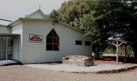
A small coummunity gradually developed to support the surrounding pastoral properties, and a Post Office was opened in 1881, and a Mechanics Hall in 1893 (this is still in use, and hosts the Ruffy Art Show in November).
Ruffy became the birthplace of one of three local Victoria Cross recipients; Leslie Cecil Magyar was awarded the Victoria Cross in the Second Boer War, and details of his exploits can be found in the Victoria Cross display in Euroa (see separate description).
Maygar is also remembered with the naming of the nearby Maygars Hill Winery, and Maygars Hill on the old Hume Highway.
In the modern era the village has become well known as a great place to head for an excellent meal - the venue being the modestly named Ruffy Store (see link below).
Ruffy is also home to an interesting walk [AWTGS-2] that displays the vegetation of a micro-climate, that of the Ruffy Snowgum Reserve. The walk commences at the Recreation Reserve (about a kilometre from the village, via Buntings Hill Road and Noye Lane - both of which are unsealed).
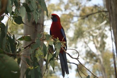
From here, the walking route follows a disused roadway (actually a continuation of Noye Lane) and this leads to the Ruffy Flora Reserve, where the really interesting part of the walk begins.
The Reserve has several information boards, and these detail the nitty-gritty about the local environment, leading you through a loop system, and back to the access roadway.
All you need do now, is to return via the access road way to Noye Lane, and the Recreation Reserve, having covered about three kilometres.
See also the downloadable brochure on the walk, available via the link shown below (Strathbogie Ranges Conservation Network).
For art lovers, there is an annual art show in the village, usually in November - see the link below for more details.
The village is easily accessible via several different routes . . .
Coming up the Hume Freeway from the south, take the Longwood exit, cross over the Freeway bridge, and from here it is about 22km to Ruffy via the meandering Longwood-Ruffy Road.
From just south of Euroa, take the Creightons Creek exit, and then follow Creightons Creek Road south to the cross-roads with the Ruffy-Yarck Road, where you need to make a right turn for the final 4.5km of the 30km journey from the Freeway.
On the way (in the initial part of the journey, just over the Longwood-Mansfield Road) there is a memorial to Robert Parrish, a volunteer firefighter who died while fighting bushfires in the Strathbogie Ranges in 1990.
EUROA - STRATHBOGIE RANGES (Balmattum Hill, Gooram Falls, Polly McQuinns Weir and Mount Wombat)
Euroa (Strathbogie Shire) website
Intro Screen on a fresh browser page
COPYRIGHT © 1995-2020, Chris McLaughlin.