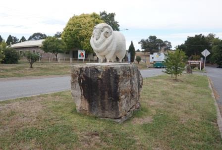
STRATHBOGIE and the sheep
(www.northeastvictoria.online)
Strathbogie is located about 18km south-east of Euroa, and has a number of different (and interesting) access routes.
The village was named after the nearby Strathbogie pastoral run, which in turn was probably named after the Bogie River Valley in Aberdeenshire, Scotland (the word ‘strath’ is derived from the Gaelic word for valley.)
Like nearby Ruffy, the hill country of Strathbogie, and its environs, were first settled in the 1880’s, and the area is closely linked with the introduction of merino sheep to Australia.
Sheep are still a mainstay of the area, alongside horse breeding, wine growing and tourism.
This part of the Strathbogie Ranges was first documented by the explorers Hume and Hovell in 1824, with settlement originating after the further explorations of Major Mitchell in 1836
During the 1870s the original pastoral run was broken up and thrown open for selection. This lead to the establishment of the Strathbogie Village, with a post office, several schools, and the inevitable butter factory.
Modern day attractions of the village include a great location, tennis courts, a golf course, a church, a hall a school and a pleasing general store/cafe.
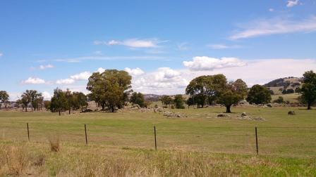
Nearby Kithbrook Gardens are also a popular attraction, as is the scenic drive shown below.
As well as via the scenic drive, the village can also be accessed via several exits from the Hume Freeway, notably the Strathbogie Road out of Euroa (about 24km) and the Violet Town exit.
This latter route is significantly longer than that from Euroa, but is more scenic.
EUROA - STRATHBOGIE RANGES (Balmattum Hill, Gooram Falls, Polly McQuinns Weir and Mount Wombat)
Euroa (Strathbogie Shire) website
Intro Screen on a fresh browser page
COPYRIGHT © 1995-2020, Chris McLaughlin.