UPPER MURRAY CIRCLE
(ALBURY - CORRYONG -
TALLANGATTA - WODONGA)
(www.northeastvictoria.online)
TRAVELLING TIME: Eight hours (best taken over 1-2 days).
DISTANCE COVERED: 290km (distance measured from the Riverina Highway exit on the Hume Freeway, back to the same place). See also Alternative Access after the main description.
OVERVIEW MAPS: Touring map of Victoria.
DETAILED MAPS: None are really needed unless you are taking any of the optional tours or detours, or going bushwalking. If required, Rooftop Upper Murray Adventure Map does the job nicely. For Granya State Park and Mount Lawson State Park the VicMap 1:50 000 sheet is Granya, For Burrowa - Pine Mountain National Park the VicMap 1:50 000 sheet is Corryong. Details of these venues can be found in the National Park - State Park listing on the HomePage. The Parks Victoria website (www.parks.vic.gov.au) also has some handy PDF files for the State and National Parks.
SHOPS and SERVICES: Albury - Wodonga has a full range of shopping and services; Walwa has a general store, as well as a fuel outlet; Corryong and Tallangatta have a good range of shops and services.
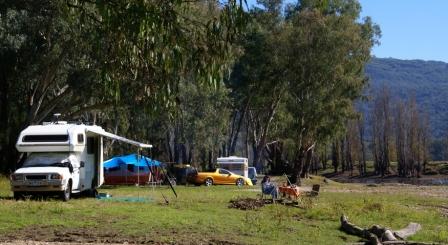
ACCOMMODATION: Commercial camping areas are located at Jingellic, Walwa, Tintaldra, Corryong, Colac Colac (on the Murray Valley Highway, just west of Corryong) and Tallangatta. Corryong also has several motels, as does Tallangatta. Bush campsites are detailed in the main text.
WHEN TO GO: Spring is good for waterfall viewing; summer is good for the wildflowers, and autumn is good for the changing colours and stable weather.
ROADWAY DETAILS: Mostly bitumen roadways, albeit narrow in places. Some of the scenic drives and bushwalk access points utilise gravel roads and tracks; given dry conditions all of these drives are suitable for any reliable car.
OTHER INFO: Water is scarce in summer, so bring your own if you are planning any bushwalking. Distances quoted may vary by several kilometres from one vehicle to another.
This tour loops around Lake Hume, and its major tributaries, the Murray and Mitta Mitta Rivers, providing Australia's best, and longest, lakeside drive. Although this route is described in a clockwise direction from Albury, it can be done in the reverse direction, or any combination, to include items of interest.
Ideally several days should be taken, as there is certainly plenty to see and do. The scenery is excellent all the way, with tantalising glimpses of Lake Hume, the Murray River and its floodplain for much of the distance.
Starting out from Albury (with the tripmeter at zero) pick up the Riverina Highway at the Hume Freeway overpass, and take the 12km drive along the Highway towards the dam wall of Lake Hume. Just prior to the environs of the dam wall, there is a signposted left turn to Corryong and a right turn to Bonegilla and Wodonga; if you complete the full tour, this latter junction will be your return route.
However, continuing on (straight-ahead) towards the Lake, will lead to the parklands alongside the dam wall. Except on really busy days, there is plenty of parking here, with adjoining picnic areas etc. The Lake was named after the explorer Hamilton Hume; see the Early Exploration section for more details of this intrepid man.
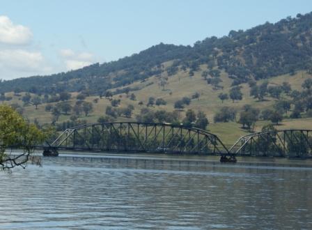
Returning to the ‘main road’, and taking the Corryong Road, the next landmark is Bethanga Bridge, a total of about 15km from Albury. The bridge, over the inundated course of the Murray River, is an impressive sight; it was constructed in 1930 and is worthy of at least one photograph. Hume Weir Park, on the right just before the bridge, makes an enjoyable stop-over location for morning tea, some fishing, or maybe some boating activities.
Once on the eastern (Victorian) side of the bridge, swing right for the small settlement of Bellbridge, or left for the Talgarno - Walwa - Corryong Road (the C542).
Talgarno via Bellbridge
Bellbridge has a number of lakeside picnic areas and boat ramps, as well as an enjoyable walking track; a nearby general store that serves ice cream seals the deal. Further round on this lakeshore, swing around to the left, and enjoy some great views on the climb up to Kurrajong Gap (1000m). There is a lookout (on the right) on the way through the Gap, but given that it is on the 'wrong' side of the roadway, is not very convenient for large rigs.
The road now descends to the small settlement of Bethanga (22km), where you need to keep left and then take the Talgarno Gap Road (if you follow the 'main road' out of Bethanga, this leads over to the Mitta Mitta Arm of Lake Hume, and subsequently to a causeway over the backwaters of the Lake, just east of Tallangatta).
The Talgarno Gap Road is very scenic, and leads to a t-junction with the previously mentioned C542 at the small settlement of Talgarno (32km from Albury, no shops or services).
Talgarno direct
Turning left after the Bethanga Bridge, the roadway clings to the lakeshore, and leads to the small settlement of Talgarno (32km from Albury, no shops or services).
Continuing on from Talgarno, Georges Creek Road comes up on the right, after about two kilometres, and provides an alternative route that leads to Jarvis Creek Regional Park, the western edge of Mount Granya State Park and Tallangatta (both parks are described separately below).
Further around the lakeshore, there are many formal, and informal, picnic areas, down on the lakeshore, however all of these have specific ‘No Camping’ signs.
Wymah Ferry
The C542 (the side road to the Wymah Ferry) is a left turn, about 11km from Talgarno. The Ferry is cable operated, runs seven days a week, is toll-free, doesn’t take trailers and leads to the Bowna Road, and thence the Hume Highway.
The ferry service at this point dates back to 1936, when Lake Hume first started to fill. Because of varying water levels, the ferry operates between adjustable floating landing stages, which can be moved up or down to match the level of the water.
Wymah is one of only two cable ferries over the Murray between New South Wales and Victoria; the other being the Speewa Ferry, near Swan Hill (500 river kilometres downstream).
Another eleven ferries operate on South Australian sections of the Murray. Many other ferry services have been withdrawn from duty over the years, several in quite recent times; for example, the ferry at Barmah was retired in 1966.
A further eight kilometres of driving leads to a t-junction with the C546 (the Murray River Road, 51km from Albury). At this point the small settlement of Granya is to the right, as is the eastern boundary of Mount Granya State Park (see the Tallangatta section for a full description of the Park).
Murray Grey Memorial and The Kurrajongs
Keeping left at the t-junction, the C546 skirts alongside the Murray River, with many great views, both of the River, and of the distant high country. It is about seven kilometres to the small riverside village of Bungil, and a further 11km to Thologolong. Neither village has any shops or services, however Thologong is the ancestral home of the famed Murray Grey cattle, and a roadside memorial (immediately to the east of Thologong Track) provides details of this breed.
Several kilometres around the lake shore, and off to the right, there is access to the Flaggy Creek Gorge Walking Track, as well as The Kurrajongs camping area (excellent camping).
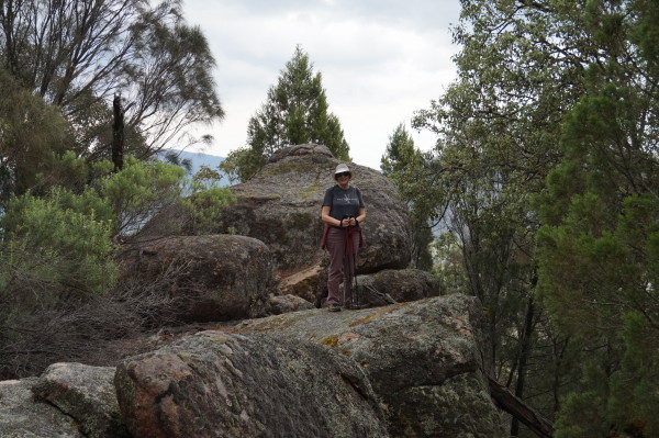
The Flaggy Creek Gorge Walking Track [AWTGS-5] leads off from just near the campsite, and end-to-end is a 14km route (that is, seven kilometres to get to the end of the track, and seven to get back to the start) that leads to the rugged, and photogenic, gorge of Flaggy Creek.
The Gorge is best seen with some water in it, and for this reason the walk is best tackled in Spring or early Summer.
Allow at least eight hours for this walk; it is graded ‘hard’ and the pathway is not always easy to discern.
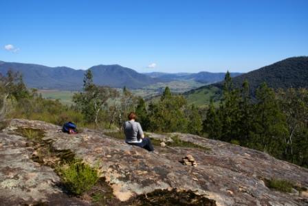
On the way up to the Gorge, Valley View provides a good vantage point over the upper sections of Lake Hume, and the pastoral country beyond.
This is about 1.5km from the campsite, and can be treated as a separate short walk (three kilometres, three hours all up).
Whichever walk you choose, the mix of murray valley pine woodlands, and granite studded bushland provide an excellent venue.
Both walks require formal walking shoes/boots, trekking poles, a GPS and a topographic map of the intended route.
Kennedys Reserve and Burrowye Reserve
Kennedys Reserve is the next landmark, and is off to the left, about 2.5km after the Kurrajongs. This is one of few surviving camps from the original stock route along the Upper Murray, and has a lakeside setting, given that Lake Hume is more than about 90% full.
We could not find any map that shows the Reserve, so (for the technically minded) the GPS reading for this feature is 35.27.30s : 147.26.39e.
Staying with the C546, as it heads east, it is about 16km to the Burrowye - Guys Forest Road going off to the right (this is about 85km from Albury).
Just prior to this turn-off, there is a nice campsite (Burrowye Reserve, down to the left) alongside the Murray; the bed of the River having narrowed down considerably in the last few kilometres.
Continuing eastwards, the rocky ramparts of Mount Alfred provide some pleasant viewing of dry land, whilst Alfred Gap, slightly further on, provides some good river views.
Jingellic and Walwa
The Jingellic turn-off is now a few kilometres away; this small settlement being on the NSW side of the Murray, and having a nice hotel with an adjoining camping area. Gadds Reserve, a few kilometres before Jingellic, provides a pleasant riverside camping area.
The tripmeter should be recording something like 105km at Jingellic, with Walwa being a further five kilometres away. Just east of the Jingellic turn-off, the Upper Murray Resort has a range of nice accommodation options on offer, as well as canoe hire, and canoe shuttle services; more details at www.uppermurrayresort.com.au. A little way beyond the Resort, Lankeys Creek Winery is on the right-hand side of the roadway.
Walwa has limited services and shopping facilities, however, it has a general store, a pleasant hotel, and a caravan park down at the riverside. A small boat ramp (with limited turn-around room) adjoins the caravan park.
The C547 (Walwa - Shelley Road) runs south from Walwa township, and this leads into the Walwa - Cudgewa North Road, thereby providing access to the northern side of Burrowa - Pine Mountain National Park. Neills Reserve is about eight kilometres east of Walwa, and offers riverside camping with plenty of shade.
Jim Newman Wayside Reserve
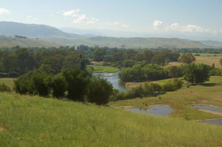
The next landmark is Jim Newman Wayside Reserve, and this can be found on the left side of the roadway, with excellent views over the floodplain of the Murray River.
All the typical features of a floodplain are here, billabongs, oxbow lakes and an extensively meandering river bed. The views are also good, with fold after fold over the distant ranges obscured by that evocative blue haze that typifies mid-latitude forests right around planet earth. Tables and chairs make for a comfortable stop at this point, and this is a great place to get out the flask and some muffins.
Tintaldra and Towong
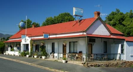
The small community of Tintaldra is about 24km east of Walwa (135km), and has a general store, a caravan park and a hotel.
The hotel dates back 150 years and offers good pub grub as well as enjoyable accommodation in the adjoining caravan park. There is basic riverside access at the Tintaldra Bridge for small boats (such as canoes), about 200m from the caravan park.
From Tintaldra, the C546 starts to head more south than east, making a broad sweep around to the settlement of Towong, 11km away.
On the way, the road to Mount Mittamatite is off to the right (about four kilometres from Tintaldra; see the Corryong description for more details), and Farrans Lookout (a few kilometres later, on the left) offers more good views of floodplains and distant ranges.
A short run south of the Lookout leads to a t-junction, with Tumbarumba (NSW) being to the left, with Towong and Corryong being to the right.
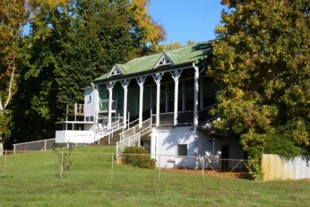
Towong has few facilities, but is home to the noted Towong Races; the Grandstand of the Racecourse is widely photographed, and is often featured in tourist brochures.
Corryong
Corryong (population 1400) is a further 11km west of Towong, the route now having made a u-turn and swung back to start facing Albury-Wodonga once more.
Corryong has a good range of shops and services. The caravan park (Mittamatite) is on the western edge of the township, with another (larger) Park being at Colac Colac (on the Murray Valley Highway, just west of Corryong); the town also has several motels. See the link below for more information on Corryong.
From Corryong the route back to Albury traverses the western foothills of the high country, passing to the south of Cudgewa. This is a fairly twisty route although well surfaced and well maintained. There are many excellent views to be enjoyed en route, and it is always worthwhile allowing plenty of time for the journey.
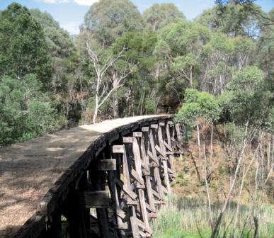
There are many opportunities for a casual picnic on the way, as well as espying relics from the now dismantled Cudgewa Railway; there are many indications of the former railway clearly visible from the highway. Cudgewa was the terminus of the railway, and Shelley railway station had the distinction of being Victoria's highest.
If you venture off the beaten track a little there are many examples of railway engineering still to be seen, in particular, trestle bridges in the most unlikely locations. See the Railways section on the Homepage for the full history of the railway.
Leaving Corryong with the tripmeter set to zero, the first notable landmark is the Colac Colac Caravan Park (a great place to stay) on the right after about six kilometres. This is immediately followed by the Omeo Road going off to the right; see the Tour Descriptions on the Homepage for further details.
Cudgewa and Wabba Gap
Back Cudgewa Road (unsealed) is to the right after about eight kilometres and is quickly followed by the Cudgewa - Tintaldra Road (C548). This latter route is one of the best valley drives in Australia, with Mount Mittamatite to the right, and the Burrowa - Pine Mountain massif to the left; pick a nice warm day, so that you get plenty of that blue haze leading all the way down the valley.
Cudgewa has a nice pub, and this is a popular place to catch up with some local gossip, and to enjoy some excellent pub grub. On the way into Cudgewa, there is a dilapidated railway trestle bridge to your left, and the site of the former Cudgewa Railway Station is on the right as you enter town.
Shortly after the C548, the Highway curves through Wabba Gap, just after crossing Wabba Creek; the Gap offers one of the best roadside views in the North-east, unfortunately without much of a safe haven to park and admire the scenery. The panorama is best when driving towards Corryong, so there are a few seconds to admire the grandeur when heading east. The township of Wabba is no longer around; this was one of many Victorian towns to disappear when the gold mining faded away.
The Needles Picnic Area is on the right after about 23km, and has the usual amenities, with the added attraction of a railway trestle bridge being about 100m away.
Lawrence Lookout
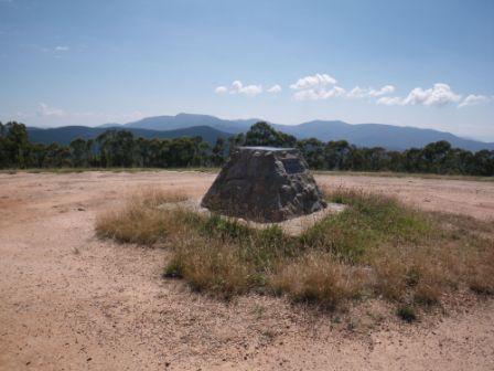
Lawrence Lookout is also on the right, this feature being about 39km from Corryong. It is a two kilometre drive (on gravel) to the Lookout, but well worth the effort. The central part of the Lookout is taken up with an obelisk (erected in 1966) that points out all of the notable surrounding peaks of the high country; expectedly, there are plenty of them given where you are standing. There is also a picnic area (with toilet, nearby) both of which are accessible via a short walk down a saddle.
Thomas Mitchell Reserve
Back on the bitumen, it is a short drive to the C547 (the Shelley - Walwa Road) going off to the left. About three kilometres further down the bitumen the Avondale Road is a left turn, with the Thomas Mitchell Rest Area overlooking this intersection.
Thomas Mitchell was a state member of parliament for many years, and was a direct descendant of Walter Mitchell (referred to in the Man from Snowy River information). Thomas served in the Australian Army during World War II, and was imprisoned in the notorious Changi Prison in Singapore.
Thomas’ wife (Eleyne, nee Huon de Kerrileau) was well known for her children’s books, notably The Silver Brumby; this is a series of books that portray the life and adventures of Thowra, a magnificent pale brumby stallion, and his descendants. All of the books are set in the high country.
Thomas and Elyne both represented Australia at international ski-ing events.
If you feel like a short detour, there are two items of interest along Avondale Road, namely Shelley Station and Avondale Gardens.
Shelley Railway Station (optional detour)
Turning into Avondale Road (which is gravel) it is a short run to where Station Street goes off to the right. This almost immediately splits, with Railway Terrace being the left part of a y-junction. Follow Railway Terrace for a few hundred metres, to a sharp right-hander, which then leads into what was formerly the Shelley Railway Station Yards.
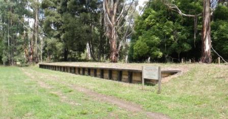
The Station here was opened in 1916, and closed in 1979. This was Victoria's highest railway station (780 metres according to the Information Board; 810m according to our GPS) and was a hive of activity for many years. All that remains today is the platform and the railway cuttings, where trains where shunted up and down the yards seven days a week. More details in the Railways section on the Homepage.
Avondale Gardens (optional detour)
Return to Avondale Road from Shelley Station, and follow the gravel for about another eight kilometres, where an airstrip will be visible on the left. Continue past this infrastructure, keeping a lookout for the Avondale Gardens turn-off to the left.
This leads, after about two kilometres, to another signposted turn-off (also to the left). Follow this minor track round to the car parking area, park the hardware, and prepare for a leisurely stroll through Avondale Gardens.
The homestead (and gardens) at this point were established in the 1950s by the Bird Family. All that remains today are a few stone walls, and a great array of exotic trees and shrubs. Most of the greenery has an information plaque nearby, and it is easy to spend an hour wandering around here. The adjoining picnic area is quite inviting, as is the camping area.
Return to the bitumen by the same route, and then swing left for some more scenic delights.
Shelley and Koetong
Shelley is the first townsite encountered out of Corryong (41km west) and approximately 25km further west the small settlement of Koetong is encountered, and this provides views and access to the nearby Mount Lawson.
Koetong is also home to a historic trestle bridge; this railway bridge (over Boggy Creek) was built around 1915 as part of the Wodonga - Cudgewa Railway. The Koetong Hotel dates back to the 1860s, and has been a popular place for a meal ever since.
From Koetong it is only a short hop to the Cravensville Road going off to the left, and from here the Highway makes a sustained descent, with several railway cuttings being clearly visible (the roadway passes over the railway easement).
The small settlement of Bullioh is next on the horizon, with a side trip to nearby Mount Granya State Park being an easy option in this area. Access is via the Murray Valley Road (C546), a right turn about 70km from Corryong. The C546 also goes all the way through to the Murray River Inlet of Lake Hume. See the Tallangatta description for details of things to see and do in the State Park.
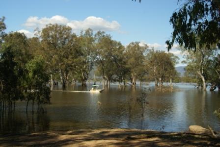
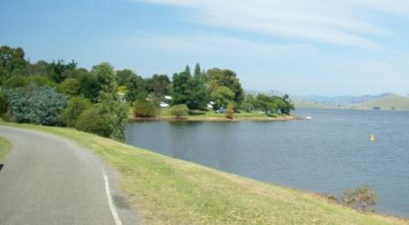
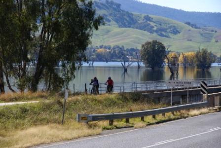
Lake Hume and Tallangatta
The next major landmark is the backwaters of Lake Hume, where the route crosses over the Mitta Mitta Arm of Lake Hume. The Omeo Highway joins the Murray Valley Highway at the western end of the bridge, where there is also a nice Rest Area (on the left).
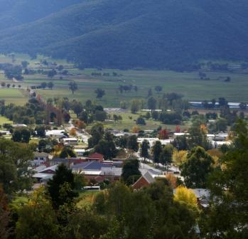
This area is known as Tatonga Inlet, and from here it is about five kilometres to the lakeside township of Tallangatta (population 900), with several relics from old Tallangatta being visible to the right (given that the Lake is quite low).
The present township of Tallangatta is quite new as the old one was drowned when the wall of Lake Hume was raised in the 1950s. The new town is slightly off the Highway, and makes an excellent base camp for touring the surrounding area. In peak holiday periods this is a busy place, as it provides many opportunities for boating and fishing, as well as touring. See the link below for more on Tallangatta.
As mentioned, in very low water, it is still possible to pick out the basic layout, and some of the infrastructure of the old town, and the Tallangatta 50s Festival is held in late October/early November to celebrate the town's rejuvenation at its new home.
Back on the Highway, it is a short drive to Tallangatta Lookout which provides excellent views of the Lake's waters stretching away into the distance; it is only when you get to vantage points like this that the enormity of the Lake really strikes home.
Bonegilla
From Tallangatta, the Highway follows the shoreline of Lake Hume quite closely, and Bonegilla is reached 29km after leaving Tallangatta. On the way, Murrays Wayside Stop is about five kilometres from Tallangatta (on the right), with the Tangambalanga Road being a further six kilometres. Unlike the next three rest areas, Murrays does not have lakeshore access.
Huon Reserve is also on the right (about seven kilometres from Tallangatta), and has the usual picnic area amenities, as well as plenty of shade, and that all important water access.
On the drive to Huon, you will have passed over Sandy Creek Inlet, a large indent in the lake's shoreline. Whilst the roadway curves around the Inlet, the Wodonga - Cudgewa Railway went straight over the mouth of the Inlet. A row of tall pylons were constructed to carry the rail line over the water, and these had to be extended when the Hume Dam was raised in the 1950s; the different layers of concreting are still visible.
Ludlows Reserve comes into view about 14km from Tallangatta, and offers the same amenity as Huon Reserve, similarly for Ebden Reserve, at the 17km mark. For history buffs, just opposite the Reserve there is a marker commemorating the Hume and Hovell Expedition of 1824.
Ebden Caravan Park is a short distance from the Reserve, and is a great place to stay; excellent amenities, and one of the best possible lakeside locations.
From here the Murray Valley Highway goes off to the west, and the route swings north, towards the dam wall (see note below). A short distance from this road junction, Kookaburra Point is another great water access point, with extensive parklands providing very comfortable surroundings.
Just to the north of here, Bonegilla was once the site of a large immigration centre (from 1947 to 1971) and is now home to a migrant museum; details are in the description of Wodonga, accessible via the Homepage.
From Bonegilla, continue to Heywoods Bridge, just below the outlets of Lake Hume, and from here it is short hop to pick up the Riverina Highway, and the finish of the Loop.
Alternative finish
It is easy to make an alternative finish to the tour by staying with the Murray Valley Highway all the way to Wodonga; that is, shorten the tour by not driving past Kookaburra Point and Bonegilla.
The Highway crosses over the Kiewa River a few kilometres before the Wodonga urban area, and joins up with the Kiewa Valley Highway at Bandiana (the site of a large army base). The Highway is now a dual carriageway, and remains so for much of the distance to the centre of Wodonga (the Highway becomes Anzac Drive, and then Thomas Mitchell Drive before merging into High Street, the main commercial centre of town.
Bandiana is also home to The Bandiana Army Museum, operated by the Australian Army, and home to a vast collection of military memorabilia; see www.defence.gov.au/AWMA_MUS for more details.
Just beyond Bandiana, you can swing right (at a large roundabout) so as to get onto the Hume Freeway heading north; or swing left to access Victoria Cross Parade and the C315 to Beechworth.
Access via Woomargama
A modified verson of this loop can be acheived by taking the Woomargama exit from the Hume Freeway, about 40km north of Albury, 14km south of Holbrook.
Follow Tunnel Road from Woomargama village to the small settlement of Dora Dora, and your first encounter with the Upper Murray.
From Dora Dora, either take the unsealed road to the right (which leads to the Wymah Ferry, about 22km away) or the unsealed road to the left (River Road) which leads to Jingellic (about 35km); neither of these routes are recommended for caravans.
See the Cartoscope map Snowy Valleys Way for an overview of this route; the RACV map High Country for more details.
Access via Bowna
Another modified verson of the main description involves taking either of the Bowna exits from the Hume Highway; the southern exit is about five kilometres past the Olympic Highway turn-off, whilst the nothern exit is about three kilometres south of Mullengandra.
In either case, it is about five kilometres to the small settlement of Bowna.
Like many areas along the southern side of the Upper Murray, Bowna was a originally a cattle run, dating from the mid 1830s, and was the site of a small village (subsequently inundated by the rising waters of Lake Hume in 1934).
If you want to linger in the area, the nearby (and excellent) lakeside caravan park is accessible via Hore Road. The Bowna Museum is also well worth visiting.
Continuing on from Bowna, take the unsealed road (not recommended for caravans) which leads to the Wymah Ferry, about 26km away.
See the Cartoscope map Snowy Valleys Way for an overview of this route; the RACV map High Country for more details.
Intro Screen on a fresh browser page
COPYRIGHT © 1995-2020, Chris McLaughlin.