ALBURY-WODONGA
(www.northeastvictoria.online)
Much of Wodonga’s history is tied up with that of Albury, its larger neighbour, just over the Murray River; both have grown substantially in the last forty years, with a combined population of about 90 000.
Major events in the life of the Twin Cities include the construction of the Hume Dam, the Bandiana and Bonegilla army camps, the establishment of the Bonegilla migrant hostel and the construction of the Kiewa Hydro electric scheme. Along the way, Albury-Wodonga has become one of the largest (and most enjoyable) inland cities of Australia.
Wodonga has an excellent range of shops and services, with the shopping activity being centred around High Street (which is no longer divided by the Melbourne - Sydney Railway; the Station having been moved to just north of the Freeway) and Melbourne Road.
Albury also has a great range of shops and services, mostly centred around Dean Street, Kiewa Street, Olive Street, and other streets of the CBD.
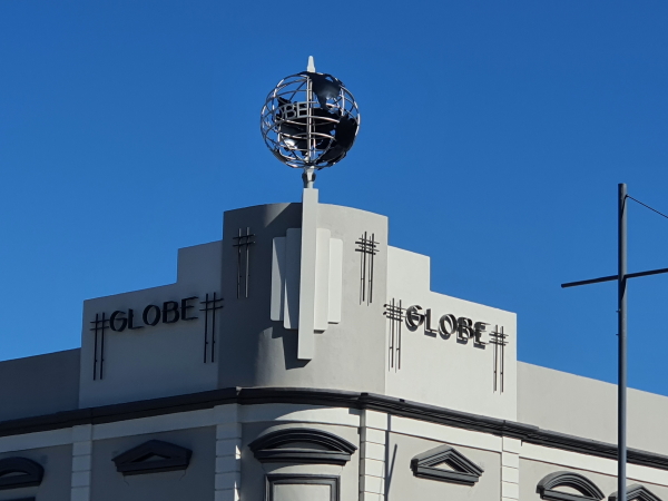
One of the most notable features of the CBD area (apart from the nice ambience) is the amazing art-deco architecture - well worth a visit.
Wagirra Trail and Wonga Wetlands
Overview
Explorers Hume and Hovell first documented the area that we now know as The Twin Cities of Albury-Wodonga in 1824, and their inscribed tree is still standing in Hovell Tree Park (off to the left, about one kilometre north of the Union Bridge over the Murray River) The original plaque has been removed as the tree bark was encroaching on the brass plate, but a replica is on display nearby.
Local aboriginal people knew the river that divides Albury-Wodonga as the Millewa, but the Explorers named it the Hume River, a label that would later be upstaged by explorer Charles Sturt, who gave the river its present name.
Following on from the Hume and Hovell exploration, settlers from the Sydney area gradually moved south, and used the river crossing pioneered by the early explorers to enter what is now Victoria.
Little did they know, but this was not the easiest place to cross the river, particularly with large numbers of cattle and sheep; much easier crossing places can be found not far upstream and downstream.
However, such is history, and a fledgling community started to emerge at ’the crossing’.
In 1838, the New South Wales government decided to formally survey a town at the site, and surveyor Thomas Townsend suggested the aboriginal name for the area Bungambrewatha; this was later changed to Albury (after the village of Albury in Surrey, England).
On the opposite side of the Murray, the small settlement of Woodonga also began to grow (this was prior to the establishment of the separate colony of Victoria, so both settlements were in New South Wales at this time).
Woodonga became Wodonga, was renamed Belvoir and later renamed Wodonga. By this time the colony of Victoria was separated out from New South Wales (this was in 1851), and both towns became a centre for colonial rivalry, a situation that has not entirely subsided.
In the last half of the 19th century, both towns profited from the river boat trade, a trade that was decimated by the arrival of the railway from Melbourne in 1873, and the Sydney railway in 1881.
Such was colonial rivalry that these lines used a different gauge, a situation that would not be remedied until 1962.
However, a rail bridge over the river was opened in 1883, and from then until 1962, passengers would disembark at Albury’s railway station, cross the platform, and board the next train heading north or south as appropriate. Not only was this inefficient, but it denied them the opportunity to admire the exterior of the Albury Station, a colonial masterpiece.
Bonegilla Migrant Museum
After World War II, Australia embarked upon an ambitious immigration program, mainly targeting people from Britain and Ireland, as well as displaced people from all over war-torn Europe. The largest and longest-lasting Migrant Reception Centre was built at the former Bonegilla Army Camp, and ultimately helped over 300,000 people (from 1947 to 1971) with their introduction to Australia.
The Museum at Bonegilla (Block 19, Bonegilla Migrant Experience Heritage Park) is well worth a visit; it celebrates a wave of hard working migrants who helped advance Australia economically, socially and culturally.
Bonegilla is on the shores of Lake Hume, to the east of Wodonga, and details can be found via the link shown below.
Bungambrawatha Creek
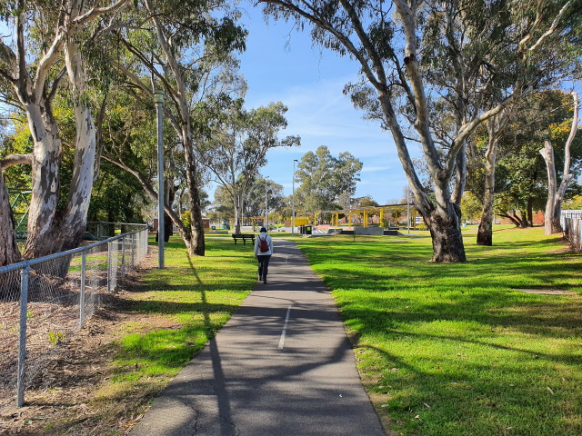
This urbanised waterway swings its way through the western side of Albury's urban area, and is closely followed by an excellent walking track.
Details can be found in the Albury Trails brochure, and this is a popular walking/cycling route, with many different options to choose from
Expectedly, there are many road crossings to be encoutered, and care is required at each of these.
As well, there are short sections of quiet suburban roadways to walk down - take care!
The Albury Trails brochure is available from Visitor Information Centres in the North-east.
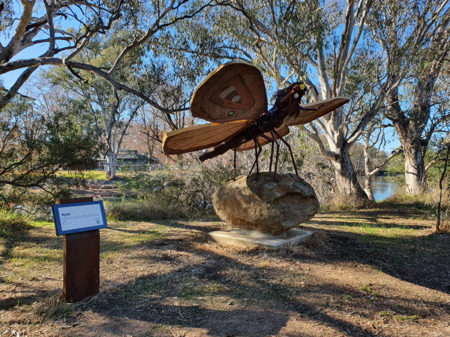
The Crossing Place Trail
The Crossing Place Trail commemorates the original crossing place of the Murray River by early explorers (which was superseded by installation of a punt in 1848, and then the first bridge in 1861).
The trail covers about 5.1km, and is a very enjoyable loop that features several excellent sculptures by local Aboriginal artists.
Making great use of an almost natural environment of riverine vegetation, this is a great place for birdwatching, and to see native wildlife.
Initial access is via Lemke Road, which is accessible via the Lincoln Causeway between the twin cities.
There is a small amount of car parking (on the right) as you swing around the corner, but the official car park is about 200m further along the bitumen.
The walk is signposted at both locations, and it is handy to have a copy of the Crossing Place Map with you (available at Visitor Information Centre in the area).
In either direction this is a very enjoyable walk, taking about 90 minutes to complete.
Federation Hill
Federation Hill is an isolated block of high ground to the south-west of the urban area, and can be accessed via Ballara Drive. The walking tracks are actually vehicular tracks, and these meander through open woodlands, with some nice views of the not too distant urban area.
Gateway Island
This is a group of islands formed by the Murray River and the Wodonga Creek ana-branch, and is easily accessible via the car parking area on the Lincoln Causeway, between Wodonga and the Union Bridge. The Island has some very interesting infrastructure, including walking tracks, bird hides and picnic areas, it is however traversed by the Albury-Wodonga freeway bypass (an above ground structure) and the Melbourne-Sydney Railway (another above ground structure).
If you want another nice wetland walk in the area, then the Wonga Wetlands (just north of the border) has it all laid on for you. The Wetlands can be accessed by taking the Riverina Highway a short distance to the west of Albury’s CBD, and then the signposted turn-off. There's plenty of parking near the Visitor Centre, and from here there is a choice of three documented short walks to choose from. More details via the link shown below.
High Country Rail Trail
The High Country Rail Trail runs along the route that was graded and levelled for the Wodonga-Cudgewa Railway, and currently extends for about 43km from Wodonga, through to Old Tallangatta, with a few other separate sections beyond there. More details via the link shown below.
Huon Hill
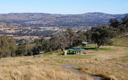
This block of high ground (428m) is located to the east of the urban area, and is accessible via several entry points, notably Whytes Road, which runs north-west off the Murray Valley Highway.
This leads to a t-junction, where you need to turn right, and this is followed by a meandering narrow roadway that subsequently reaches the picnic area near the summit area. The picnic area is well organised, with lots of amenity, and a covered bbq facility.
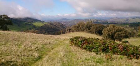
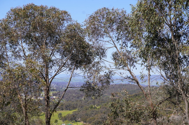
Expectedly, there are extensive views over the Albury-Wodonga urban area, as well as some good vistas of the Victorian high country, and nearby Lake Hume (including the dam wall).
There are several walking tracks [AWTGS-3] that lead up and down the slopes of Huon Hill, and these include the Hidden Valley Track, Stringybark Track, Summit Track and White Box Track.
The most popular walking access to Huon Hill is via the Kiewa River Parklands Track; see the next description, and the maps along that walk.
Kiewa River Parklands
The Kiewa River rises in the heart of Victoria’s Alpine Region, and its catchment area includes much of the Bogong High Plains, as well as parts of Mount Bogong itself. It flows past the townships of Mount Beauty, Kergunyah and Gundowring before joining up with the Murray River just to the east of the Albury-Wodonga urban area.
The Kiewa River Parklands described here extend along the Kiewa River from the Murray Valley Highway to the Kiewa-Murray confluence, about four kilometres away.
There are plans to extend the Parklands much further upstream, notionally as far as the Yackandandah Creek-Kiewa River confluence.
In the meantime the Parklands offer peaceful riverside walking for about 4.5km each way, and the opportunity for bird watching.
Heading out of town, the main car parking area is in Klillara (on the left, just before the Kiewa River Bridge) and offers a reasonable amount of space for cars, as well as some picnic facilities. The walking track heads off downstream from here, and follows the Kiewa quite closely, all the way to the Murray River confluence.
Whilst there is a clearly discernible track to follow, it is not a formed track, and is quite muddy in wet conditions.
At about the 1km mark there is a sign-posted track (to the left) which leads to Huon Hill. Ignore this turn-off, as well as a similar one at about the 3km mark.
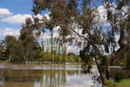
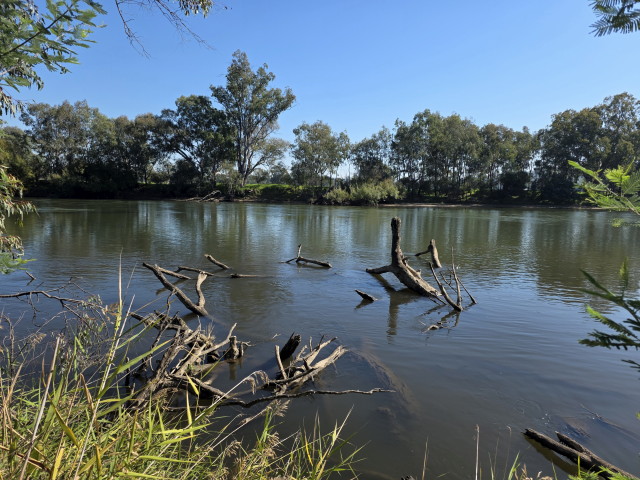
Lake Hume
In 1918, the River Murray Commission unveiled plans for a new ’super-dam’ at the confluence of the Mitta Mitta and Murray Rivers, and part of this initial design included the news that the existing town of Tallangatta would need to be relocated.
Stage 1 of the project (completed in 1936) left Tallangatta untouched, but it was till acknowledged that inundation would come one day.
In the early 1950s, a site near the railway siding of Bolga (on the Wodonga - Cudgewa Rail) was selected as a suitable site for the new town, and the big move began.
One of the best ways to view the Lake, and its dam wall is to take the Murray Valley Highway east from town, and then swing left onto the Bonegilla Road (C541).
Follow this through to a low level bridge over the Murray and turn right at the following t-junction. This leads to a further t-junction, signposted ’Corryong’ to the left, however, continuing on (straight-ahead) towards the Lake will lead to the parklands alongside the dam wall.
Except on really busy days, there is plenty of parking here, with adjoining picnic areas, information boards etc.
McFarlanes Hill
McFarlanes Hill is another block of high ground in the Wodonga area, this one being to the west of the urban area, with an altitude of 442m. Access is via Fell Timber Creek Road (the Pearce Street turn-off from the Beechworth Road) with the less than formal car parking area being encountered just before the bridge over the said Fell Timber Creek.
This is directly opposite the start of Ridge Walking Track (AWTGS-3/4), a popular loop of about four kilometres that provides great views of the Twin Cities.
Climbing up from the roadway, the pathway climbs a short distance, and then swings to the west (left) for an undulating walk on the north side of a ridge.
At the turnaround point, the path swings around to the south (left), and then follows a low level route back to the car parking area.
For even better views, continue along the outgoing ridge track until you intersect Coyles Road (a management vehicles only roadway). Hop over the stile at this point, and walk uphill to a round gateway on your left.
From here, follow a former farm track to the top of the hill. This optional extra adds another three kilometres to the route, as well as a lot more effort. Return to Coyles Road, and the round gateway, turn right, and follow the roadway back to the stile previously mentioned, to pick up the return route to the car park.
Nail Can Hill
Nail Can Hill is part of a large bushland reserve in the north-west of the Albury-Wodonga urban area, and offers a wide variety of bushwalks to choose from, many of them with great views of Albury, and the surrounding riverine countryside.
The best resource for this is the Albury-Wodonga Parklands website (see link below) which offers a downloadable map of the area.
Popular access points include Centaur Road, Gap Road, Pemberton Street and Range Road.
The final part of the Centaur Road access includes an un-sealed section, and is not the best in wet conditions.
Swainsonia Reserve
Swainsonia Reserve adjoins McFarlanes Hill (see above) and its main feature, recreation wise, is the Gully Walking Track.
The Reserve is also home to the endangered Smooth Darling Pea, one of many hundreds of members of the pea family found throughout Australia (including the ubiquitous wattle). Heading out of town, the car parking area is on the right, and is several kilometres after crossing Fell Timber Creek.
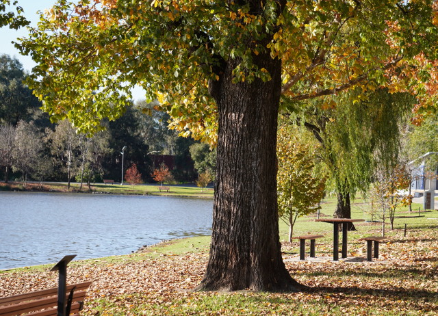
Sumsion Gardens
The pleasing Sumsion Gardens occupy a natural wetland site that has been crafted into a very popular urban area.
Eric Sumsion was a former garden curator for the City of Wodonga in the 1950s, and was a key person in the creation of the gardens as they are today; the gardens were named in memory of Eric in 1961.
See the Wodonga Historical Society website (link below) for more details.
Access is via Huon Street, and this leds to a lakeside car parking area, with amenities, and easy access to the lake, its walking track, and further afield, a range of other urban walks.
There are maps of the area at several points around the lake, and these provide a nice overview of the Gardens, and its linkages with the surrounding area.
Bike Trails
As well as the High Country Rail Trail, Wodonga also has a system of mostly off-road bike trails, and these are detailed in the linked file shown below.
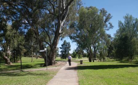
Wagirra Trail and the Wonga Wetlands
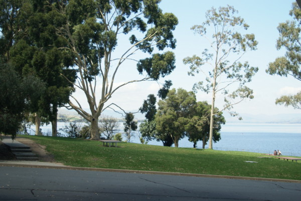
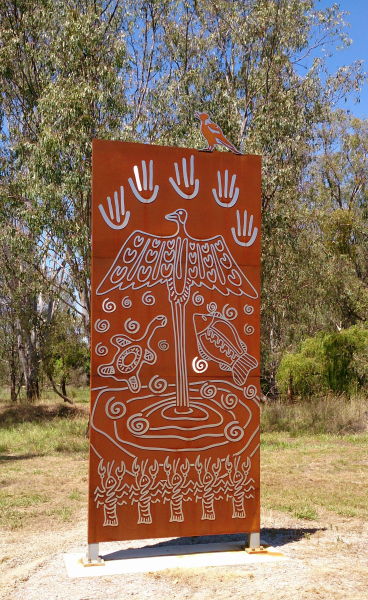
Wagirra Trail is a nine kilometre riverside walking/cycling path that basically follows the Murray River downstream from Albury’s Norieul Park (named after a WW1 battle).
The Trail also incorporates the Yindyamarra Sculpture Walk, and leads to the Horseshoe Lagoons and the Wonga Wetlands.
As a complete loop, this is a 20km+ route, but most walkers pick and choose a few sections to give a very enjoyable outing, whatever combination is decided upon.
See the links below for more information (including maps) on the Trail, and the Wetlands.
Bonegilla Migrant Heritage Park
Wagirra Trail and Yindyamarra Sculpture Walk
Wodonga Visitor Information Centre
Intro Screen on a fresh browser page
COPYRIGHT © 1995-2023, Chris McLaughlin.