MOUNT BEAUTY
(www.northeastvictoria.online)
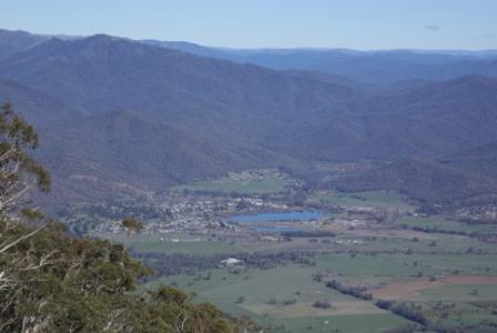
Mount Beauty (population about 2300) is located on the Kiewa River, and is set in a beautiful valley, with excellent views of Mount Bogong, Victoria’s highest peak (1986m).
The alpine streams (the East and West Kiewa Rivers) that form the Kiewa River, rise in the heart of Victoria’s Alpine Region and their catchment areas include much of the Bogong High Plains, as well as parts of Mount Bogong itself.
The Kiewa (the aboriginal word for ’sweet water’) flows past the townships of Mount Beauty, Tawonga, Kergunyah and Gundowring before joining up with the Murray River just to the east of the Albury-Wodonga urban area.
Expectedly, the Kiewa is the main feature of the Kiewa Valley, and the Kiewa Valley itself is one of the most majestic valleys of the North-east.
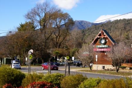
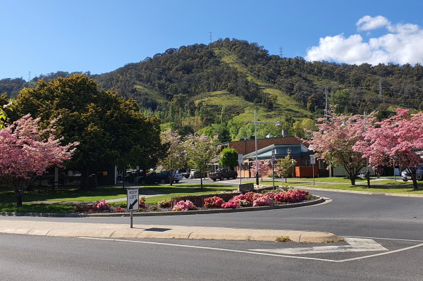
Nestling between the East and West Branch of the Kiewa River, Mount Beauty, with its mix of ’Tyrolia’ and ’construction village’ architecture is an attractive tourist town that is a popular base camp for thousands of visitors every year. The town has a good range of shops and services, as well as some nice coffee shops and restaurants.
The annual Mount Beauty Music Festival is held in April of each year, and is a popular event; see the link shown below for more details.
Accommodation options include motels, a riverside caravan park, and several excellent boutique choices.
The township, like many others in and around the high country was purpose built as part of a hydro-electric scheme, the Kiewa Scheme in the case of Mount Beauty.
The idea of establishing a hydro-electricity scheme in the Upper Kiewa Valley dates back to the early 1900s. However it wasn’t until the 1930s that the actual potential of the Kiewa for hydro-electricity production was first documented. The size of the scheme varied immensely over the years it took to plan and implement; 115 Megawatts (MW) in 1937, 289MW in 1946 (when construction began) and 184MW at completion in the 1960s.
The original design specified major water storages at Rocky Valley, Pretty Valley (Upper East Kiewa) and in the West Kiewa Valley. However, the project as envisaged in 1946 was never completed; of the five planned power stations, only three were ever built (McKay Creek, Clover and Kiewa West). As well, the major storages at Pretty Valley and in the West Kiewa Valley were never built.
In 2002, energy company AGL announced plans for an expansion of the Kiewa System, including the construction of a new power station (Bogong). This was to be an underground station, located adjacent to the village of the same name.
Bogong is open for visitor inspection, however the other Kiewa stations can only be viewed from the outside. Clover Power Station stands close to the Bogong High Plains Road, whereas Kiewa West and McKay Creek involve small detours. Inspection times (and further information) can be obtained from the Visitor Information Centre in Mount Beauty, and from www.agl.com.au.
The initial base camp for the project was Bogong Village; however, the 1946 version of the Scheme made this picturesque mountain village an impossible headquarters, and HQ was moved to the floodplain of the Kiewa River, and a new township called Mount Beauty (after a nearby peak) was created.
If you can find a copy, The Kiewa Story by Graham Napier and Geoff Easdown has a detailed account of the Kiewa Project.
A detailed account of the creation of the township, and its ongoing history, can be found in Diane Edmondson’s excellent book Below Bogong : A History of Mount Beauty.
There are many enjoyable walks in, and around the township, and in the adjoining high country, for example . . .
Mount Beauty bike rides
There are several bike riding venues in the Mount Beauty area, and these are detailed on the Bike Paths, Rail Trails and Cycle Routes selection on the Main Menu.
BOGONG ALPINE WAY (Bright - Mount Beauty - Falls Creek - Omeo - Mount Hotham - Bright)
KIEWA VALLEY HIGHWAY (Albury-Wodonga, Kergunyah, Mount Beauty)
MOUNT BEAUTY to OMEO (via Bogong Village, Falls Creek and Bogong High Plains)
TAWONGA GAP (Bright to Mount Beauty)
Mount Beauty Community website
Mount Beauty Visitor Information Centre
Intro Screen on a fresh browser page
COPYRIGHT © 1995-2023, Chris McLaughlin.